1953 Map of Indian Town
USGS Topo · Published 1977About this map
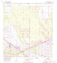
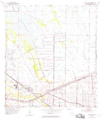
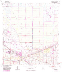
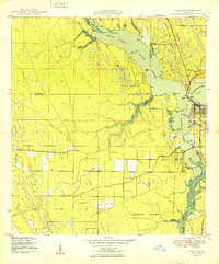
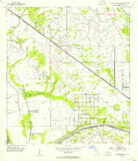
Indian Town serves as the focal point of this 1950s interior Florida landscape, situated at the intersection of critical rail and water infrastructure. The town's grid is defined by the Seaboard Coast Line railroad and its proximity to the St Lucie Canal, which forms a major segment of the Okeechobee Waterway. The surrounding terrain transitions from the vast, gridded expanse of the Allapattah Flats to the marshy lowlands punctuated by a series of Spoil Banks and a protective Levee system. This survey captures a moment of agricultural and logistical development, evidenced by the scattered Windmills and a Landing Field positioned north of the main settlement. A small Trailer Park appears along the waterway, reflecting the era's emerging residential and recreational patterns in Martin County.
Find a feature on this map
18 named features on this map. Tap any name to fly to it.
Don’t see what you’re looking for? This feature index may not catch every label — zoom into the map to look around manually.
Map Details
Editions of this 1953 Indian Town Map
4 editions found
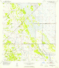
Other maps of this area

1948 · Palm City
USGS Topo · 1:24,000
1950 · Palm City
USGS Topo · 1:24,000
1953 · Okeechobee 4 SE
USGS Topo · 1:24,000
1953 · Okeechobee 4 NE
USGS Topo · 1:24,000
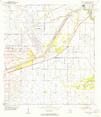
1953 · Indian Town SE
USGS Topo · 1:24,000

1953 · Indian Town NW
USGS Topo · 1:24,000

1953 · Indian Town
USGS Topo · 1:24,000

1956 · West Palm Beach
USGS Topo · 1:250,000

1956 · Fort Pierce
USGS Topo · 1:250,000

1957 · West Palm Beach
USGS Topo · 1:250,000