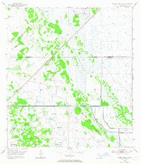
1953 Map of Okeechobee 4 NE
USGS Topo · Published 1965About this map
Allapattah Flats dominates this mid-century landscape on the boundary of St Lucie and Martin Counties. This area represents a critical moment in South Florida's environmental transformation, where the natural drainage of Myrtle Slough and Parker Branch met an emerging network of human engineering. The presence of a Canal, Levee, and multiple instances of a Spoil Bank illustrate the systematic efforts to manage the water of the Florida wetlands for agriculture and settlement.
Find a feature on this map
14 named features on this map. Tap any name to fly to it.
Don’t see what you’re looking for? This feature index may not catch every label — zoom into the map to look around manually.
Map Details
Editions of this 1953 Okeechobee 4 NE Map
4 editions found
Other maps of this area

1953 · Okeechobee 4 SW
USGS Topo · 1:24,000

1953 · Okeechobee 4 SE
USGS Topo · 1:24,000

1953 · Okeechobee 1 SE
USGS Topo · 1:24,000

1953 · Okeechobee 4 NE
USGS Topo · 1:24,000

1953 · Okeechobee 4 NW
USGS Topo · 1:24,000

1953 · Okeechobee 1 SW
USGS Topo · 1:24,000

1953 · Indian Town NW
USGS Topo · 1:24,000

1953 · Fort Pierce SW
USGS Topo · 1:24,000

1953 · Indian Town
USGS Topo · 1:24,000

1956 · Fort Pierce
USGS Topo · 1:250,000