
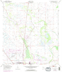
1953 Map of Taylor Creek SE
USGS Topo · Published 1954About this map
Okeechobee and its immediate surroundings are captured here during a period of transition in the early 1950s. The landscape is defined by the marshy lowland drainage of Taylor Creek and Mosquito Creek, which flow toward the southern edge of the survey area. Significant local social history is visible in the residential pockets of Barber Quarters and Cypress Quarters, while the Brown High Sch and Evergreen Cem provide critical points of interest for genealogists and researchers of the community's mid-century infrastructure.
Find a feature on this map
12 named features on this map. Tap any name to fly to it.
Don’t see what you’re looking for? This feature index may not catch every label — zoom into the map to look around manually.
Map Details
Editions of this 1953 Taylor Creek SE Map
3 editions found
Other maps of this area

1952 · Okeechobee NW
USGS Topo · 1:24,000

1952 · Okeechobee
USGS Topo · 1:24,000

1953 · Taylor Creek NW
USGS Topo · 1:24,000

1953 · Okeechobee 4 NW
USGS Topo · 1:24,000

1953 · Taylor Creek SW
USGS Topo · 1:24,000

1953 · Okeechobee 1 SW
USGS Topo · 1:24,000

1953 · Taylor Creek NE
USGS Topo · 1:24,000

1953 · Okeechobee 1 NW
USGS Topo · 1:24,000

1956 · Fort Pierce
USGS Topo · 1:250,000

1958 · Fort Pierce
USGS Topo · 1:250,000
Featured Places
- Okeechobee, FL
- Basswood Estates, FL
- Cypress Quarters, FL
- Barber Quarters, Okeechobee
- Whispering Pines, FL