Old Maps of Palm Beach County, Florida for Hiking & Exploration
Hike through history with 312 historic maps of Palm Beach County. Explore old trails, ghost towns, and forgotten backroads — perfect for outdoor adventurers and local explorers.
- Rediscover forgotten places: Map out old mining camps, roads, and footpaths that no longer exist on modern maps.
- Layer with modern tools: Combine with LiDAR or satellite views to plan hikes through historical terrain.
- Made for exploration: Popular among hikers, overlanders, and local history lovers.
Use these maps to find adventure and explore the hidden past of Palm Beach County.
Palm Beach County, FL maps
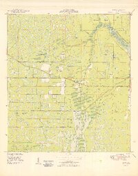
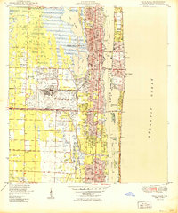
(312)- 1945 Map of Delta, 1961 Print
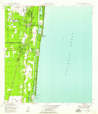
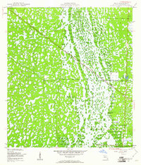 1945 Delta1961 Print · USGSPalm Beach County’s interior wetlands are preserved here as they appeared mid-century, before the spread of coastal development. Genealogists and historians can trace the path of the Seaboard Air Line through the Loxahatchee Slough and locate the early settlement of Delta.6 unique versions available
 - 1945 Map of Greenacres City, 1961 Print
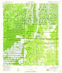
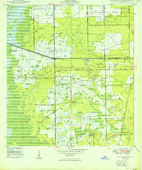
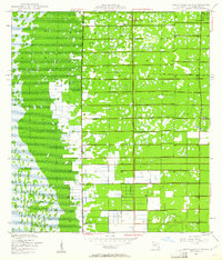 1945 Greenacres City1961 Print · USGSGreenacres City and the surrounding Palm Beach County interior are captured in the mid-1940s during a transformation of the Florida wetlands. Genealogists and researchers can trace early infrastructure like the Sunshine State Parkway and local sites like Convict or various Borrow Pits.4 unique versions available
 - 1945 Map of Lake Worth, 1962 Print
 1945 Lake Worth1962 Print · USGSThe Florida coast near Lake Worth is documented here just after the war, showing the expansion of rail and water infrastructure. Genealogists and local historians can trace early residential footprints in Lantana, Boynton Beach, and across Hypoluxo Island.4 unique versions available
 - 1946 Map of Riviera Beach, 1956 Print
 1946 Riviera Beach1956 Print · USGSPalm Beach County’s coastline in the mid-forties reveals a landscape defined by the Intracoastal Waterway and thriving rail corridors. Trace early development from Monet down to Riviera Beach, and locate coastal landmarks like the Seminole Golf Club and Peanut I.4 unique versions available
 - 1946 Map of West Dixie Bend, 1958 Print
 1946 West Dixie Bend1958 Print · USGSCoastal Broward and Palm Beach counties are shown here just after the war, during an era of significant drainage and early development. Trace the early layout of Deerfield Beach, the course of the Hillsboro Canal, and the tracks of the Seaboard Air Line railroad.
 - 1946 Map of Boca Raton, 1958 Print
 1946 Boca Raton1958 Print · USGSThe South Florida coast at the end of the 1940s reveals a developing network of seaside towns and vital waterways. Genealogists and historians can trace the early footprints of Deerfield Beach and Hillsboro Beach, alongside the iconic Lighthouse and the Boca Raton Inlet.
 - 1946 Map of Palm Beach Farms, 1958 Print
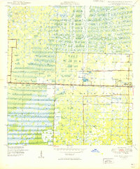
 1946 Palm Beach Farms1958 Print · USGSPalm Beach County's interior wetlands meet early post-war development in the 1940s, showing the struggle to drain and define the landscape. Researchers can trace the early grids of Greenacres City and West Palm Beach Farms alongside the critical West Palm Beach Canal.3 unique versions available
 - 1946 Map of Palm Beach, 1964 Print
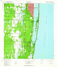
 1946 Palm Beach1964 Print · USGSPalm Beach and its inland neighbors are captured here during a period of rapid post-war growth and military activity. Local historians can trace the footprint of the Morrison Field Air Base or locate family sites near Woodlawn Cem and the Military Trail Sch.6 unique versions available
 - 1947 Map of Delmar Farms, 1961 Print
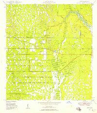
 1947 Delmar Farms1961 Print · USGSPalm Beach County’s agricultural interior and wetlands are captured in the late 1940s as infrastructure began to redefine the landscape. Researchers can trace the early layout of Delmar Farms, the settlement at Dewitt, and the path of the Sunshine State Parkway.
 - 1948 Map of Rood, 1958 Print
 1948 Rood1958 Print · USGSCoastal Florida's interior wetlands meet early development at the mid-century mark in this 1948 survey. Genealogists and historians can trace the local community around Rood, including the Jupiter School and landmarks like the Indian Mound and Trappers Zoo.5 unique versions available
 - 1948 Map of Jupiter, 1962 Print
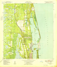
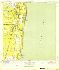
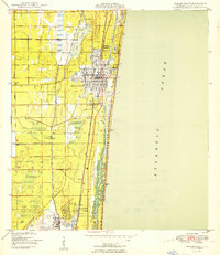
 1948 Jupiter1962 Print · USGSCoastal Palm Beach County comes into focus in the late 1940s, highlighting the strategic maritime and rail corridor of the Loxahatchee River. Researchers can locate historical landmarks including the Jupiter Lighthouse Reservation, the Jupiter Cem, and the local US Navy Marine Base.5 unique versions available
 - 1949 Map of Rood
 1949 Rood1949 Print · USGSThe Florida wetlands of Palm Beach and Martin counties are captured here just after the war, showing a landscape defined by cypress creeks and early water management. Researchers can locate the settlement of Rood, the Trappers Zoo, and the Jupiter Sch.2 unique versions available
 - 1949 Map of Lake Worth
 1949 Lake Worth1949 Print · USGSPalm Beach County’s shoreline and inland rail corridors are documented in the late 1940s during a pivotal era of South Florida development. Genealogists and historians can trace the early footprints of Lantana and Boynton Beach, or locate landmarks like Hypoluxo Island and the Palm Beach County Airport.
 - 1949 Map of West Dixie Bend
 1949 West Dixie Bend1949 Print · USGSCoastal Broward County and the edge of the Everglades are shown here in the late 1940s as infrastructure began to reshape the wetlands. Researchers can trace the early layout of Deerfield Beach and the inland settlement of West Dixie Bend near the Hillsboro Canal.2 unique versions available
 - 1949 Map of Palm Beach Farms
 1949 Palm Beach Farms1949 Print · USGSThe Palm Beach interior in the late 1940s reveals a landscape of massive wetlands and early agricultural expansion. Researchers can trace the development of Greenacres City, identify the Military Reservation, and follow the West Palm Beach Canal.2 unique versions available
 - 1949 Map of Riviera Beach
 1949 Riviera Beach1949 Print · USGSThe Florida coast near Lake Park and Riviera Beach is shown here just after the war as the resort economy expanded. Trace the historic rail lines of the Florida East Coast, find the Seminole Golf Club, and locate the U S Coast Guard Reservation.
 - 1949 Map of Delmar Farms
 1949 Delmar Farms1949 Print · USGSPalm Beach County's agricultural frontier is captured here in the late 1940s, showcasing the massive drainage projects at the edge of the Everglades. Researchers can trace the early layout of Delmar Farms, the small settlement of Dewitt, and the path of Atlantic Avenue.2 unique versions available
 - 1950 Map of Boca Raton
 1950 Boca Raton1950 Print · USGSSoutheast Florida’s coastline shows its mid-century character before the peak of modern development, centered on the growing resorts and transit hubs. Genealogists and historians can trace the early footprints of Boca Raton and Deerfield Beach, locating landmarks like the Lighthouse and the original Florida East Coast rail line.
 - 1950 Map of Delray Beach
 1950 Delray Beach1950 Print · USGSThe Florida coast near Delray Beach and Boca Raton is captured here during its post-war transition. You can trace the competing paths of the Florida East Coast and Seaboard Air Line railroads or locate local landmarks like Christ Ch and the Rifle Range.2 unique versions available
 - 1950 Map of Jupiter
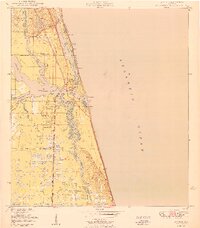 1950 Jupiter1950 Print · USGSCoastal Florida is mapped in the early postwar years as the town of Jupiter begins to expand around its famous lighthouse. Genealogists and local historians can trace landmarks like the Jupiter Cem, the US Navy Marine Base, and the old Jupiter Sch.
 - 1950 Map of Greenacres City
 1950 Greenacres City1950 Print · USGSPalm Beach County was undergoing significant drainage and transformation in the mid-1940s as agriculture moved west. Researchers can trace the grid of (Palm Beach Farms) and find early landmarks like Greenacres City and Convict.
 - 1950 Map of Delta
 1950 Delta1950 Print · USGSPalm Beach County's interior appears as a complex wetland mosaic just after the war, dominated by the sprawling Loxahatchee Slough. Follow the diagonal route of the Seaboard Air Line railroad to the small settlement at Delta.
 - 1950 Map of Palm Beach
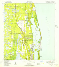
 1950 Palm Beach1950 Print · USGSCoastal Florida is seen here in the postwar years, before the modern skyline fully transformed the shoreline. Genealogists and researchers can trace the development of West Palm Beach, the grounds of Morrison Field Air Base, and local landmarks like Woodlawn Cem.
 - 1956 Map of West Palm Beach, 1964 Print
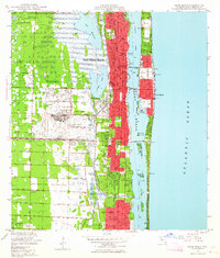
 1956 West Palm Beach1964 Print · USGSSouth Florida during the mid-fifties exhibits a fascinating balance between expanding coastal cities and the vast interior wetlands. Researchers can trace the development of inland settlements like Immokalee and Okeelanta or locate vanished landmarks like Chosen and Buckingham Cem.2 unique versions available
 - 1957 Map of West Palm Beach
 1957 West Palm Beach1957 Print · USGSSouthern Florida in the mid-fifties reveals a landscape defined by massive drainage canals and the early expansion of the Gold Coast. Genealogists and historians can trace industrial outposts like the Sugar plant and Everglades Labor Center, or locate the Jupiter Auxiliary Air Force Base.
Showing maps 1-25 of 312
Top cities of Palm Beach County
- West Palm Beach historical maps
- Boca Raton historical maps
- Boynton Beach historical maps
- Delray Beach historical maps
- Wellington historical maps
- Palm Beach Gardens historical maps
See more
Frequently asked questions
- What are the different types of historical maps available for Palm Beach County?
- What is the oldest map of Palm Beach County?
- Where can I purchase historical maps of Palm Beach County for my home or office?
- Where can I download high-res historical maps of Palm Beach County?
- Are there historical topographic maps available for Palm Beach County?
- Is there historical aerial imagery available for Palm Beach County?
- Where are historical maps of Palm Beach County sourced from?