Old Maps of Wesley Chapel, Florida for Hiking & Exploration
Hike through history with 12 historic maps of Wesley Chapel. Explore old trails, ghost towns, and forgotten backroads — perfect for outdoor adventurers and local explorers.
- Rediscover forgotten places: Map out old mining camps, roads, and footpaths that no longer exist on modern maps.
- Layer with modern tools: Combine with LiDAR or satellite views to plan hikes through historical terrain.
- Made for exploration: Popular among hikers, overlanders, and local history lovers.
Use these maps to find adventure and explore the hidden past of Wesley Chapel.
Wesley Chapel, FL maps
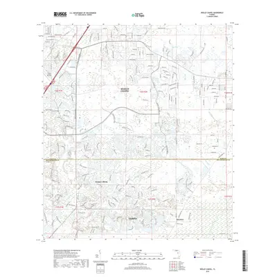
(12)- 1944 Map of Wesley Chapel
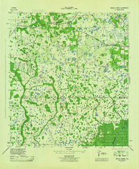 1944 Wesley Chapel1944 Print · USGSPasco and Hillsborough counties are shown during the mid-forties, characterized by scattered rural settlements and a dense network of creeks and cypress swamps. Researchers can trace the original locations of Wesley Chapel, Double Branch Church, and the Sulphur Works along the river banks.3 unique versions available
 - 1955 Map of Plant City, 1966 Print
 1955 Plant City1966 Print · USGSMid-century Central Florida comes to life in this survey of the Nature Coast and the inland citrus and rail belt. Genealogists and historians can trace the paths of the Atlantic Coast Line, locate the Anclote Keys Lighthouse, or find old communities like Masaryktown and Lacoochee.6 unique versions available
 - 1958 Map of Plant City
 1958 Plant City1958 Print · USGSFlorida's Gulf Coast and inland ridge country are captured here in the mid-fifties, showing the region before modern sprawl. Genealogists and historians can trace rail-era towns like Richland and Trilby or locate coastal landmarks such as the Anclote Keys Lighthouse.
 - 1959 Map of Plant City
 1959 Plant City1959 Print · USGSThe West Florida coast and inland timberlands are captured here in the late fifties, from the bend of the Gulf to the rail hubs of the interior. Trace the paths of the Atlantic Coast Line through Inverness and find landmarks like the Anclote Keys Lighthouse.
 - 1964 Map of Plant City
 1964 Plant City1964 Print · USGSThe West Florida coast and its interior rail corridors come alive in this mid-sixties survey, spanning from the gulf marshes to the agricultural heartland. Researchers can trace the routes of the Atlantic Coast Line through settlements like Bushnell, Inverness, and Plant City.
 - 1973 Map of Wesley Chapel, 1976 Print
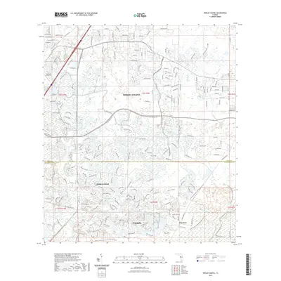
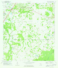 1973 Wesley Chapel1976 Print · USGSThe transition from citrus groves and ranch land to suburban communities in the 1970s is visible across the Wesley Chapel corridor. Genealogists and local historians can trace the early layout of Branchton, the grounds of Angus Valley Chapel, and the reaches of Cabbage Swamp.3 unique versions available
 - 1978 Map of Tarpon Springs, 1982 Print
 1978 Tarpon Springs1982 Print · USGSCoastal Florida is shown during its late-century period of rapid growth, from the Gulf shores to the deep inland swamps. Researchers can trace the development of the Intracoastal Waterway and locate regional landmarks like the Anclote Missile Tracking Annex and Lake Tarpon.
 - 2012 Map of Wesley Chapel, 2012 Print
 2012 Wesley Chapel2012 Print · USGSCovers Wesley Chapel, including Tampa, Pebble Creek, and other nearby areas
 - 2015 Map of Wesley Chapel, 2015 Print
 2015 Wesley Chapel2015 Print · USGSCovers Wesley Chapel, including Tampa, Pebble Creek, and other nearby areas
 - 2018 Map of Wesley Chapel, 2018 Print
 2018 Wesley Chapel2018 Print · USGSCovers Wesley Chapel, including Tampa, Pebble Creek, and other nearby areas
 - 2021 Map of Wesley Chapel, 2021 Print
 2021 Wesley Chapel2021 Print · USGSCovers Wesley Chapel, including Tampa, Pebble Creek, and other nearby areas
 - 2024 Map of Wesley Chapel, 2024 Print
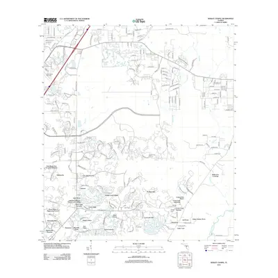
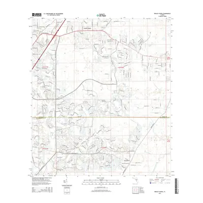
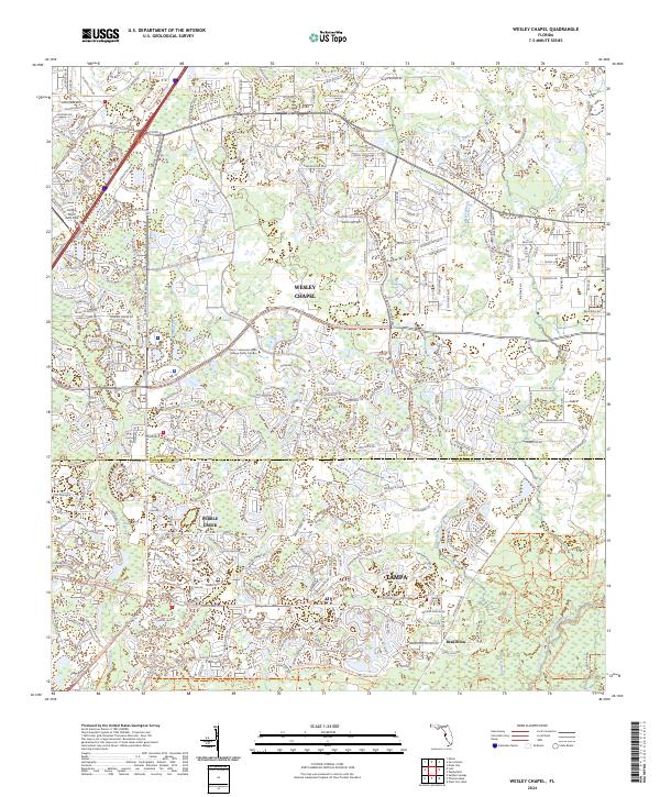 2024 Wesley Chapel2024 Print · USGSThe northern edge of the Tampa metropolitan area is captured here during its modern phase of development and suburban growth. Researchers can trace the waterways of the Hillsborough River and New River alongside major thoroughfares like Bruce B Downs Blvd and the community of Wesley Chapel.
End of results
Showing maps 1-12 of 12
Top cities near Wesley Chapel
- Tampa historical maps
- Spring Hill historical maps
- Plant City historical maps
- Temple Terrace historical maps
- Lutz historical maps
- Zephyrhills historical maps
See more
Frequently asked questions
- What are the different types of historical maps available for Wesley Chapel?
- What is the oldest map of Wesley Chapel?
- Where can I purchase historical maps of Wesley Chapel for my home or office?
- Where can I download high-res historical maps of Wesley Chapel?
- Are there historical topographic maps available for Wesley Chapel?
- Is there historical aerial imagery available for Wesley Chapel?
- Where are historical maps of Wesley Chapel sourced from?