Old Maps of Dunedin Cove, Pinellas County for Hiking & Exploration
Hike through history with 30 historic maps of Dunedin Cove. Explore old trails, ghost towns, and forgotten backroads — perfect for outdoor adventurers and local explorers.
- Rediscover forgotten places: Map out old mining camps, roads, and footpaths that no longer exist on modern maps.
- Layer with modern tools: Combine with LiDAR or satellite views to plan hikes through historical terrain.
- Made for exploration: Popular among hikers, overlanders, and local history lovers.
Use these maps to find adventure and explore the hidden past of Dunedin Cove.
Dunedin Cove, Pinellas County maps
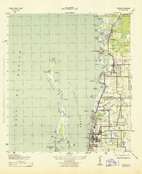
(30)- 1921 Map of Sand Key
 1921 Sand Key1921 Print · USGSThe Pinellas peninsula comes alive in this early tactical survey of the gulf coast at the dawn of the Roaring Twenties. Genealogists and historians can trace early settlement patterns in Largo, Clearwater, and Anona before the post-war building boom.
 - 1943 Map of Dunedin
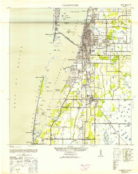
 1943 Dunedin1943 Print · USGSCoastal Pinellas County comes into focus during the early 1940s, documenting the shoreline from Dunedin north to Palm Harbor. Genealogists and historians can trace the Atlantic Coast Line railroad through small communities like Ozona, Wall Springs, and Crystal Beach.3 unique versions available
 - 1943 Map of Clearwater, 1952 Print
 1943 Clearwater1952 Print · USGSCoastal Pinellas County comes alive in the mid-1940s, showing the early footprints of coastal resorts and citrus-era rail towns. Trace the old rail lines of the Seaboard Air Line or locate landmarks like the Biltmore Hotel and the Pinellas Co Fair Grounds.3 unique versions available
 - 1955 Map of Plant City, 1966 Print
 1955 Plant City1966 Print · USGSMid-century Central Florida comes to life in this survey of the Nature Coast and the inland citrus and rail belt. Genealogists and historians can trace the paths of the Atlantic Coast Line, locate the Anclote Keys Lighthouse, or find old communities like Masaryktown and Lacoochee.6 unique versions available
 - 1956 Map of Tampa, 1964 Print
 1956 Tampa1964 Print · USGSThe Florida Gulf Coast thrived in the mid-fifties, from the bustling docks of Tampa to the quiet shores of Sanibel. Genealogists and historians can trace old rail lines like the Atlantic Coast Line or find early layouts of Port Charlotte and Bokeelia.2 unique versions available
 - 1958 Map of Plant City
 1958 Plant City1958 Print · USGSFlorida's Gulf Coast and inland ridge country are captured here in the mid-fifties, showing the region before modern sprawl. Genealogists and historians can trace rail-era towns like Richland and Trilby or locate coastal landmarks such as the Anclote Keys Lighthouse.
 - 1959 Map of Plant City
 1959 Plant City1959 Print · USGSThe West Florida coast and inland timberlands are captured here in the late fifties, from the bend of the Gulf to the rail hubs of the interior. Trace the paths of the Atlantic Coast Line through Inverness and find landmarks like the Anclote Keys Lighthouse.
 - 1959 Map of Tampa
 1959 Tampa1959 Print · USGSThe Florida Gulf Coast appears in this late fifties survey during a period of steady coastal growth and established rail commerce. Researchers can trace historic neighborhoods and transit lines from Tampa to St Petersburg, or locate landmarks like Mac Dill AFB and Boca Grande.
 - 1960 Map of Tampa
 1960 Tampa1960 Print · USGSThe Florida Gulf Coast was undergoing a major transformation at the start of the sixties, with new bridges linking burgeoning cities across the bays. Researchers can trace the mid-century footprints of St Petersburg and Tampa, or locate coastal landmarks like Mac Dill AFB and the Sunshine Skyway.2 unique versions available
 - 1964 Map of Plant City
 1964 Plant City1964 Print · USGSThe West Florida coast and its interior rail corridors come alive in this mid-sixties survey, spanning from the gulf marshes to the agricultural heartland. Researchers can trace the routes of the Atlantic Coast Line through settlements like Bushnell, Inverness, and Plant City.
 - 1972 Map of Tampa, 1974 Print
 1972 Tampa1974 Print · USGSThe Florida Gulf Coast appears in a period of significant growth during the early seventies, from the urban centers of the bay to the quiet southern keys. Researchers can trace the expansion of St Petersburg or locate family sites near Safety Harbor, Valrico, and Boca Ciega.
 - 1974 Map of Clearwater, 1976 Print
 1974 Clearwater1976 Print · USGSThe Pinellas County coastline shows extensive mid-century development and dredging just before the mid-seventies. Trace local history through landmarks like the Rousseau Pioneer Cem, the Seaboard Coast Line tracks, and the Pinellas Plant.2 unique versions available
 - 1974 Map of Dunedin, 1977 Print
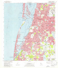
 1974 Dunedin1977 Print · USGSCoastal Pinellas County comes into focus in the mid-seventies, showing a landscape defined by barrier islands and rapid residential growth. Genealogists and local historians can trace family sites near Dunedin Cem, the Seaboard Coast Line tracks, and early churches like Berea Ch.3 unique versions available
 - 1978 Map of Tarpon Springs, 1982 Print
 1978 Tarpon Springs1982 Print · USGSCoastal Florida is shown during its late-century period of rapid growth, from the Gulf shores to the deep inland swamps. Researchers can trace the development of the Intracoastal Waterway and locate regional landmarks like the Anclote Missile Tracking Annex and Lake Tarpon.
 - 1981 Map of St Petersburg, 1983 Print
 1981 St Petersburg1983 Print · USGSThe Tampa Bay region is shown here in the early eighties as the urban centers of St Petersburg and Tampa expanded along the coastline. Genealogists and historians can trace rail lines like the Seaboard Coast Line and landmarks from Mac Dill Air Force Base to the Sunshine Skyway.
 - 1988 Map of St Petersburg
 1988 St Petersburg1988 Print · USGSThe Florida Gulf Coast reached a peak of late-twentieth-century development as seen in this late-1980s look at the growing corridor from St Petersburg to Port Charlotte. Researchers can trace the expansion of coastal infrastructure, including MacDill Air Force Base, the Seaboard System RR, and regional parks like Fort De Soto Park.
 - 1995 Map of Clearwater, 2000 Print
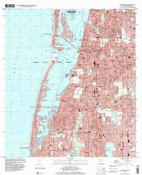 1995 Clearwater2000 Print · USGSPinellas County's Gulf coast appears at a peak of late-century development, showing the dense suburban expansion of Clearwater and Largo. Genealogists and historians can locate neighborhood landmarks like Anona Sch, St Pauls Ch, and the St Petersburg NW Base.
 - 1998 Map of Dunedin, 2001 Print
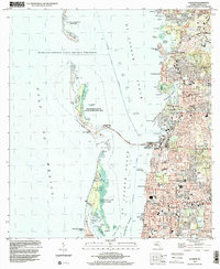 1998 Dunedin2001 Print · USGSCoastal Pinellas County comes into focus at the end of the century, showing the established communities of Dunedin and Palm Harbor. Genealogists and local historians can trace the layouts of Ozona, find the Dunedin Cem, or locate landmarks like Wall Springs.
 - 2012 Map of Clearwater, 2012 Print
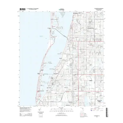
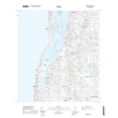
 2012 Clearwater2012 Print · USGSCovers Dunedin Cove, including Clearwater, Largo, and other nearby areas
 - 2012 Map of Dunedin, 2012 Print
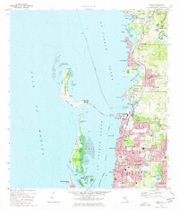
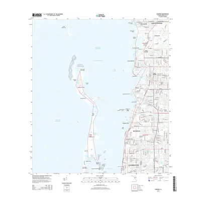
 2012 Dunedin2012 Print · USGSCovers Dunedin Cove, including Clearwater, Palm Harbor, and other nearby areas
 - 2015 Map of Dunedin, 2015 Print
 2015 Dunedin2015 Print · USGSCovers Dunedin Cove, including Clearwater, Palm Harbor, and other nearby areas
 - 2015 Map of Clearwater, 2015 Print
 2015 Clearwater2015 Print · USGSCovers Dunedin Cove, including Clearwater, Largo, and other nearby areas
 - 2018 Map of Dunedin, 2018 Print
 2018 Dunedin2018 Print · USGSCovers Dunedin Cove, including Clearwater, Palm Harbor, and other nearby areas
 - 2018 Map of Clearwater, 2018 Print
 2018 Clearwater2018 Print · USGSCovers Dunedin Cove, including Clearwater, Largo, and other nearby areas
 - 2021 Map of Clearwater, 2021 Print
 2021 Clearwater2021 Print · USGSCovers Dunedin Cove, including Clearwater, Largo, and other nearby areas
Showing maps 1-25 of 30
Frequently asked questions
- What are the different types of historical maps available for Dunedin Cove?
- What is the oldest map of Dunedin Cove?
- Where can I purchase historical maps of Dunedin Cove for my home or office?
- Where can I download high-res historical maps of Dunedin Cove?
- Are there historical topographic maps available for Dunedin Cove?
- Is there historical aerial imagery available for Dunedin Cove?
- Where are historical maps of Dunedin Cove sourced from?