Old Maps of Bartow, Polk County for Genealogy
Trace your family roots with 13 historic maps of Bartow. These high-res maps reveal old neighborhoods, homesites, landmarks, and streets — helping you uncover where your ancestors lived and how the area evolved over time.
- Explore historic neighborhoods: Identify where your relatives may have lived in the 1800s or 1900s.
- Compare maps over time: Trace the changes in streets, buildings, and landmarks for multi-generational research.
- Perfect for genealogy & ancestry research: Used by family historians and researchers to map out lineage and migration.
These maps are an incredible resource for exploring your personal connection to Bartow's past.
Bartow, Polk County maps
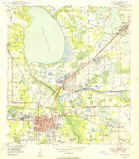
(13)- 1949 Map of Mulberry, 1964 Print
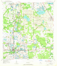 1949 Mulberry1964 Print · USGSCovers Bartow, including Lakeland, Mulberry, and other nearby areas5 unique versions available
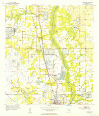
 - 1949 Map of Bartow, 1964 Print
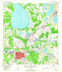 1949 Bartow1964 Print · USGSCovers Bartow, including Winter Haven, Eagle Lake, and other nearby areas5 unique versions available
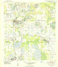
 - 1949 Map of Bradley Junction, 1966 Print
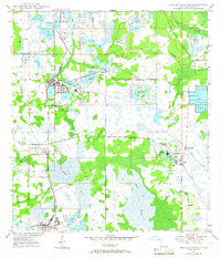 1949 Bradley Junction1966 Print · USGSCovers Bartow, including Achan, Bonnie, and other nearby areas3 unique versions available
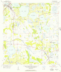
 - 1950 Map of Mulberry
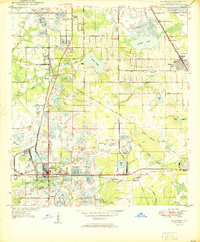 1950 Mulberry1950 Print · USGSCovers Bartow, including Lakeland, Mulberry, and other nearby areas
 - 1950 Map of Bartow
 1950 Bartow1950 Print · USGSCovers Bartow, including Winter Haven, Eagle Lake, and other nearby areas
 - 1950 Map of Bradley Junction
 1950 Bradley Junction1950 Print · USGSCovers Bartow, including Achan, Bonnie, and other nearby areas
 - 1952 Map of Homeland, 1953 Print
 1952 Homeland1953 Print · USGSCovers Bartow, including Fort Meade, Tiger Bay, and other nearby areas6 unique versions available
 - 1955 Map of Eloise, 1956 Print
 1955 Eloise1956 Print · USGSCovers Bartow, including Winter Haven, Lake Wales, and other nearby areas6 unique versions available
 - 1956 Map of Fort Pierce, 1965 Print
 1956 Fort Pierce1965 Print · USGSCovers Bartow, including Port Saint Lucie, Palm Bay, and other nearby areas4 unique versions available
 - 1958 Map of Fort Pierce
 1958 Fort Pierce1958 Print · USGSCovers Bartow, including Port Saint Lucie, Palm Bay, and other nearby areas
 - 1959 Map of Fort Pierce
 1959 Fort Pierce1959 Print · USGSCovers Bartow, including Port Saint Lucie, Palm Bay, and other nearby areas3 unique versions available
 - 1978 Map of Bartow, 1980 Print
 1978 Bartow1980 Print · USGSCovers Bartow, including Lakeland, Winter Haven, and other nearby areas2 unique versions available
 - 1988 Map of Fort Pierce
 1988 Fort Pierce1988 Print · USGSCovers Bartow, including Port Saint Lucie, Palm Bay, and other nearby areas
End of results
Showing maps 1-13 of 13
Frequently asked questions
- What are the different types of historical maps available for Bartow?
- What is the oldest map of Bartow?
- Where can I purchase historical maps of Bartow for my home or office?
- Where can I download high-res historical maps of Bartow?
- Are there historical topographic maps available for Bartow?
- Is there historical aerial imagery available for Bartow?
- Where are historical maps of Bartow sourced from?