Old Maps of Bridgeport, Florida for Academic Research
Study the evolution of Bridgeport with 13 high-resolution historic maps. Whether you're teaching, researching, or modeling changes in land use, these maps provide essential visual documentation of urban, environmental, and geographic change.
- Analyze long-term change: Track patterns in development, transportation, and natural features.
- Ideal for environmental or urban studies: Support academic projects with primary historical map data.
- Use in the classroom or lab: Educators and researchers rely on these maps to bring historical context to life.
These maps are a powerful tool for teaching, research, and visualizing how Bridgeport has changed over the decades.
Bridgeport, FL maps
(13)- 1947 Map of Bostwick
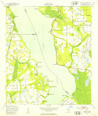
 1947 Bostwick1947 Print · USGSThe Saint Johns River valley in the late 1940s reveals a landscape defined by its waterways and timber-era rail lines. Researchers can trace historic river access at Clay Landing and Picolata, or follow the Atlantic Coast Line through Bostwick.
 - 1949 Map of Riverdale, 1953 Print
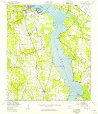
 1949 Riverdale1953 Print · USGSThe St. Johns River corridor comes alive in the late 1940s, showing the intersection of three counties and the riverfront communities that thrived there. Genealogists and historians can trace old landings and rail stops like West Tocoi, Federal Point, and the station at Riverdale.4 unique versions available
 - 1949 Map of Bostwick, 1955 Print
 1949 Bostwick1955 Print · USGSThe St. Johns River corridor comes to life in the late 1940s, showing a landscape of military installations and quiet river landings. Researchers can trace family roots at Shiloh Ch or Bostwick, and locate vanished river hubs like Picolata and Tocoi.
 - 1954 Map of Daytona Beach, 1974 Print
 1954 Daytona Beach1974 Print · USGSNortheast Florida is captured in the mid-1950s, showing the transition from river-based commerce to coastal tourism. Researchers can trace the Florida East Coast rail lines and find historic sites like Castillo de San Marcos Nat Mon and Palatka.
 - 1958 Map of Daytona Beach
 1958 Daytona Beach1958 Print · USGSThe Florida coast and St. Johns River valley are captured in the late 1950s, showing a landscape defined by citrus-belt rail towns and Atlantic shorelines. Genealogists can trace family roots through riverside settlements like Palatka and Welaka or coastal hubs like Daytona Beach.2 unique versions available
 - 1964 Map of Daytona Beach
 1964 Daytona Beach1964 Print · USGSCoastal Florida in the mid-1960s shows a fascinating balance between burgeoning beach tourism and the deep interior wilderness of the Ocala National Forest. Researchers can trace the path of the Florida East Coast railway through historic settlements like St. Augustine, Marineland, and Palatka.
 - 1981 Map of Saint Augustine, 1982 Print
 1981 Saint Augustine1982 Print · USGSNortheast Florida in the early eighties shows a landscape of deep river commerce and coastal growth. Genealogists and historians can trace the inland rail network of the Seaboard Coast Line through rural Hastings or explore the military footprint of Camp Blanding.2 unique versions available
 - 1991 Map of Riverdale
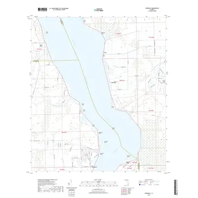
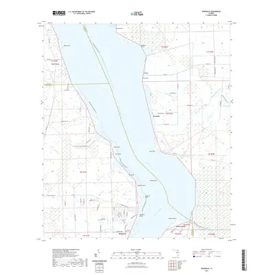
 1991 Riverdale1991 Print · USGSThe St. Johns River corridor comes alive in the early nineties, documenting the riverside landings and crossings that shaped this region. Researchers can trace family sites near Riverdale, Federal Point, and St Johns Ch, or follow the Old Railroad Grade.
 - 2012 Map of Riverdale, 2012 Print
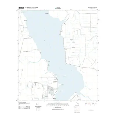 2012 Riverdale2012 Print · USGSCovers Bridgeport, including Lane Landing, Tocoi, and other nearby areas
 - 2015 Map of Riverdale, 2015 Print
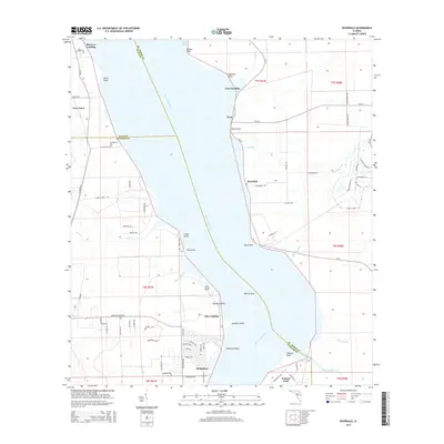 2015 Riverdale2015 Print · USGSCovers Bridgeport, including Lane Landing, Tocoi, and other nearby areas
 - 2018 Map of Riverdale, 2018 Print
 2018 Riverdale2018 Print · USGSCovers Bridgeport, including Lane Landing, Tocoi, and other nearby areas
 - 2021 Map of Riverdale, 2021 Print
 2021 Riverdale2021 Print · USGSCovers Bridgeport, including Lane Landing, Tocoi, and other nearby areas
 - 2024 Map of Riverdale, 2024 Print
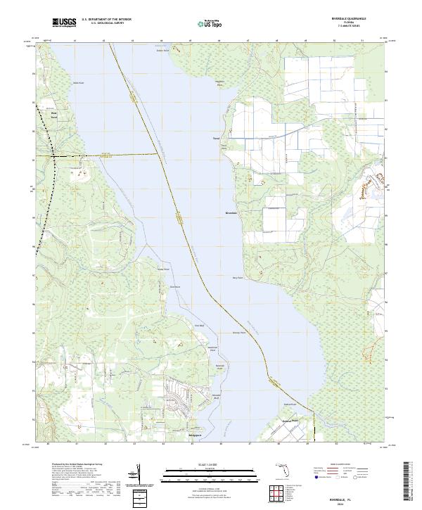 2024 Riverdale2024 Print · USGSThe Saint Johns River corridor south of Green Cove Springs comes to life in this survey of the riverfront and its interior marshes. Researchers can trace the waterfront footprints of Riverdale, Tocoi, and Federal Point alongside landmarks like Deadman Point and Palmetto Bluff.
End of results
Showing maps 1-13 of 13
Top cities near Bridgeport
- Palm Coast historical maps
- Palatka historical maps
- Green Cove Springs historical maps
- Bunnell historical maps
- Hastings historical maps
- Penney Farms historical maps
Frequently asked questions
- What are the different types of historical maps available for Bridgeport?
- What is the oldest map of Bridgeport?
- Where can I purchase historical maps of Bridgeport for my home or office?
- Where can I download high-res historical maps of Bridgeport?
- Are there historical topographic maps available for Bridgeport?
- Is there historical aerial imagery available for Bridgeport?
- Where are historical maps of Bridgeport sourced from?