Old Maps of Fort Gates, Florida for Hiking & Exploration
Hike through history with 11 historic maps of Fort Gates. Explore old trails, ghost towns, and forgotten backroads — perfect for outdoor adventurers and local explorers.
- Rediscover forgotten places: Map out old mining camps, roads, and footpaths that no longer exist on modern maps.
- Layer with modern tools: Combine with LiDAR or satellite views to plan hikes through historical terrain.
- Made for exploration: Popular among hikers, overlanders, and local history lovers.
Use these maps to find adventure and explore the hidden past of Fort Gates.
Fort Gates, FL maps
(11)- 1954 Map of Daytona Beach, 1974 Print
 1954 Daytona Beach1974 Print · USGSNortheast Florida is captured in the mid-1950s, showing the transition from river-based commerce to coastal tourism. Researchers can trace the Florida East Coast rail lines and find historic sites like Castillo de San Marcos Nat Mon and Palatka.
 - 1958 Map of Daytona Beach
 1958 Daytona Beach1958 Print · USGSThe Florida coast and St. Johns River valley are captured in the late 1950s, showing a landscape defined by citrus-belt rail towns and Atlantic shorelines. Genealogists can trace family roots through riverside settlements like Palatka and Welaka or coastal hubs like Daytona Beach.2 unique versions available
 - 1964 Map of Daytona Beach
 1964 Daytona Beach1964 Print · USGSCoastal Florida in the mid-1960s shows a fascinating balance between burgeoning beach tourism and the deep interior wilderness of the Ocala National Forest. Researchers can trace the path of the Florida East Coast railway through historic settlements like St. Augustine, Marineland, and Palatka.
 - 1970 Map of Welaka, 1973 Print
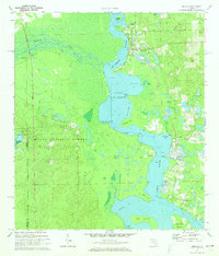 1970 Welaka1973 Print · USGSThe St. Johns River corridor and Ocala National Forest are shown here in the 1970s, during a period of quiet riverside growth. Genealogists and historians can trace old settlements and landings like Welaka, Fruitland, and Norwalk Landing.4 unique versions available
 - 1978 Map of Daytona Beach, 1980 Print
 1978 Daytona Beach1980 Print · USGSCoastal development meets the wild Florida interior in the late seventies, spanning from the Atlantic beaches to the St. Johns River. Trace the growth of Daytona Beach or find inland outposts like Salt Springs, De Leon Springs, and the U S Naval Reservation.2 unique versions available
 - 1994 Map of Welaka, 1998 Print
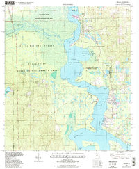 1994 Welaka1998 Print · USGSThe St. Johns riverfront and the northern reaches of Lake George come into focus in this late-twentieth-century study of Putnam County. Genealogists and local researchers can trace old river landings and settlements like Welaka, Norwalk, and the expansive Drayton Island.
 - 2012 Map of Welaka, 2012 Print
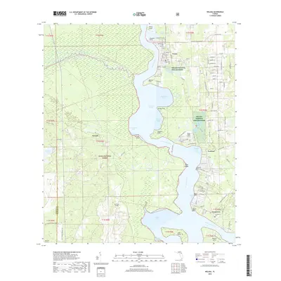
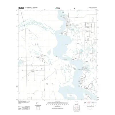 2012 Welaka2012 Print · USGSCovers Fort Gates, including Welaka, Johns Ferry, and other nearby areas
 - 2015 Map of Welaka, 2015 Print
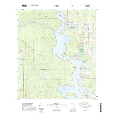
 2015 Welaka2015 Print · USGSCovers Fort Gates, including Welaka, Johns Ferry, and other nearby areas
 - 2018 Map of Welaka, 2018 Print
 2018 Welaka2018 Print · USGSCovers Fort Gates, including Welaka, Johns Ferry, and other nearby areas
 - 2021 Map of Welaka, 2021 Print
 2021 Welaka2021 Print · USGSCovers Fort Gates, including Welaka, Johns Ferry, and other nearby areas
 - 2024 Map of Welaka, 2024 Print
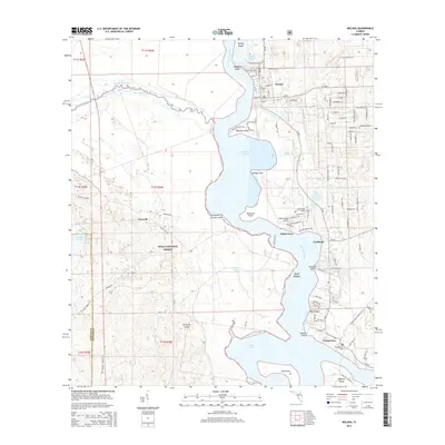
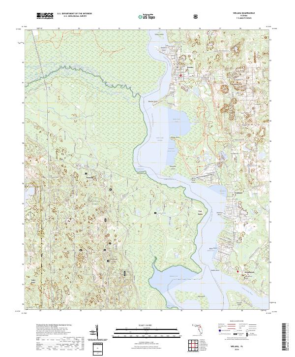 2024 Welaka2024 Print · USGSThe Saint Johns River corridor remains a lush landscape of national forests and riverfront settlements in this recent Florida survey. Researchers can locate Georgetown Cem, the historic site of Fort Gates, and the expansive Welaka National Fish Hatchery.
End of results
Showing maps 1-11 of 11
Top cities near Fort Gates
- Palatka historical maps
- Bunnell historical maps
- Pierson historical maps
- Crescent City historical maps
- Interlachen historical maps
- Pomona Park historical maps
See more
Frequently asked questions
- What are the different types of historical maps available for Fort Gates?
- What is the oldest map of Fort Gates?
- Where can I purchase historical maps of Fort Gates for my home or office?
- Where can I download high-res historical maps of Fort Gates?
- Are there historical topographic maps available for Fort Gates?
- Is there historical aerial imagery available for Fort Gates?
- Where are historical maps of Fort Gates sourced from?