1970s Maps of Santa Rosa County, Florida
Explore 28 historic maps of Santa Rosa County from the 1970s. These maps offer a rare glimpse into what life looked like during the 1970s — showing old roads, neighborhoods, homes, and landmarks that have changed or disappeared over time.
Whether you're researching your family's past, planning a metal detecting trip, or studying how Santa Rosa County's landscape evolved across the 1970s, these high-resolution maps are a powerful tool for exploring the history of this region.
- Focus on a specific era: All maps on this page are from the 1970s, giving you a focused view of this time period.
- See what’s changed: Compare century-old streets, trails, and buildings to today's modern landscape using overlays and satellite layers.
- Research with precision: Use these maps for genealogy, historical research, land use analysis, or educational projects.
- View, download, or print: Maps are fully viewable online in high resolution, and can be downloaded or printed for your own records.
Start exploring Santa Rosa County's history through authentic maps from the 1970s. This is your window into the past.
Santa Rosa County, FL maps
(28)- 1970 Map of Garcon Point, 1971 Print
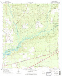
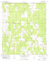
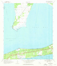 1970 Garcon Point1971 Print · USGSThe Santa Rosa coastline appears in the early seventies as residential pockets began to expand along the sound. Researchers can trace local landmarks like Black Hammock Cem, St Pauls Ch, and the Midway Landing Strip.4 unique versions available
 - 1970 Map of South Of Holley, 1972 Print
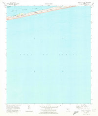 1970 South Of Holley1972 Print · USGSThe Florida Panhandle coast is captured in the early 1970s, focusing on the slender profile of Santa Rosa Island. Local historians and researchers can trace the natural shoreline of Santa Rosa Sound and locate specific sand dunes and tidal flats of the era.3 unique versions available
 - 1970 Map of Ward Basin, 1972 Print
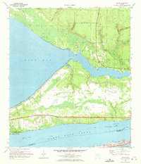
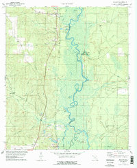
 1970 Ward Basin1972 Print · USGSCoastal Santa Rosa County is seen here during the early seventies, where military airfields meet the cypress-lined bends of the Yellow River. Researchers can trace local heritage at Welcome Cem or locate old river points like Faulks Ferry Landing and Broxson Landing.4 unique versions available
 - 1970 Map of Navarre, 1972 Print
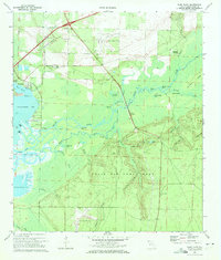
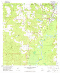
 1970 Navarre1972 Print · USGSThe Florida Panhandle coast near the turn of the 1970s shows a landscape defined by military range lands and emerging beach communities. Researchers can trace the mid-century layout of Navarre, Wynnehaven Beach, and the installations within Eglin Air Force Base.3 unique versions available
 - 1970 Map of Pensacola, 1972 Print
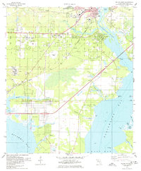
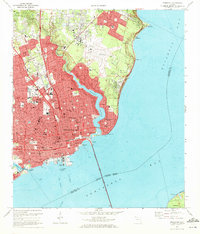 1970 Pensacola1972 Print · USGSPensacola's waterfront and growing suburbs are captured here just as the city's modern footprint was solidifying. Genealogists and historians can trace neighborhood development through numerous local schools and cemeteries like St Johns Cem and Holy Cross Cemetery.3 unique versions available
 - 1970 Map of Holley, 1972 Print
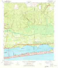
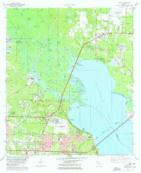
 1970 Holley1972 Print · USGSCoastal life and military operations meet on this Florida peninsula in the early seventies. Genealogists and local historians can trace family-named points like Tom King Bayou and Dean Creek or locate the quiet settlements of Holley and Harper.5 unique versions available
 - 1970 Map of Harold SE, 1973 Print
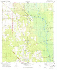
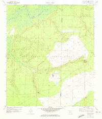 1970 Harold SE1973 Print · USGSThe Yellow River corridor in the Florida Panhandle is captured here during the early 1970s, showing a mix of rural river life and military expansion. Genealogists and historians can locate Parkerville, the Flowers Field Cem, and the aircraft facilities at Aux Field No 7.2 unique versions available
 - 1973 Map of Hurricane Lake, 1976 Print
 1973 Hurricane Lake1976 Print · USGSThe Florida-Alabama borderlands appear as a dense network of timberlands and creek basins in the early seventies. Researchers can trace rural landmarks like Bullard Ch, Hobbs Cem, and the waters of Hurricane Lake.
 - 1973 Map of Mc Lellan, 1976 Print
 1973 Mc Lellan1976 Print · USGSSanta Rosa County's pine forests and river forks are captured here in the early seventies, just north of the Alabama state line. Researchers can trace the legacy of timber and rural life through an Old Railroad Grade, Sellersville Cem, and McLellan Ch.2 unique versions available
 - 1973 Map of Floridale, 1976 Print
 1973 Floridale1976 Print · USGSSanta Rosa and Okaloosa counties in the early 1970s show a landscape shaped by the Blackwater and Yellow Rivers. Researchers can trace the Louisville and Nashville railroad through Floridale or find family history at New Canoe Cem and Canoe Cem.3 unique versions available
 - 1973 Map of Munson, 1976 Print
 1973 Munson1976 Print · USGSThe Florida Panhandle in the early 1970s reveals a landscape defined by the deep woods of the Blackwater River State Forest. Researchers can trace old family sites like the Ates Cem and rural congregations at Good Hope Ch.3 unique versions available
 - 1973 Map of Spring Hill, 1976 Print
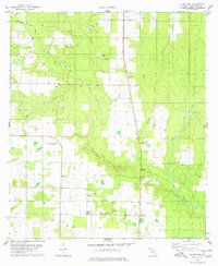
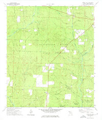 1973 Spring Hill1976 Print · USGSSanta Rosa County in the early seventies shows a landscape defined by timber management and small rural outposts. Researchers can find old family cemeteries like Sullivan Cem, the Old Railroad Grade, and the forest-rimmed Munson High Sch.2 unique versions available
 - 1973 Map of Harold, 1976 Print
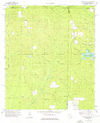
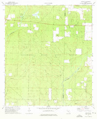
 1973 Harold1976 Print · USGSIn the early 1970s, this portion of Santa Rosa County was a landscape defined by the winding Blackwater River and the operations of the Whiting Field U S Naval Air Sta. Researchers can trace old routes along the Louisville and Nashville tracks and locate community sites like Harold and Pleasant Home Ch.2 unique versions available
 - 1978 Map of Wallace
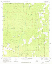
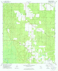 1978 Wallace1978 Print · USGSSanta Rosa County's rural interior comes into focus during the late seventies, showing the area as it transitioned between traditional agriculture and modern aviation support. Trace family roots at Elizabeth Chapel or map the waterways of Tenmile Creek and the White River.2 unique versions available
 - 1978 Map of Jay
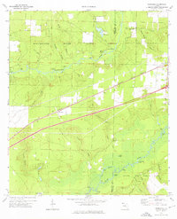
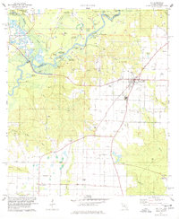 1978 Jay1978 Print · USGSThe Jay area of Santa Rosa County was a bustling center of energy production and river-bottom agriculture in the late seventies. Researchers can trace rural family roots through landmarks like McCostill Cem, Ebenezer Ch, and the extensive Oil Field.4 unique versions available
 - 1978 Map of Milton North
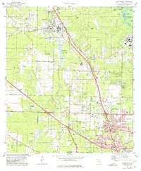
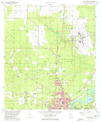 1978 Milton North1978 Print · USGSMilton and the surrounding Florida panhandle are shown here during a period of significant military and residential expansion in the late seventies. Genealogists and researchers can trace local landmarks like Allen Cem, the Government Railroad, and King Middle Sch.3 unique versions available
 - 1978 Map of McDavid
 1978 McDavid1978 Print · USGSThe Florida panhandle's river-and-rail corridor is documented here in the late seventies, showing the settlements that grew along the Escambia River. Researchers can locate family sites at Coon Hill Cem, trace the Louisville and Nashville line through Bogia, or find Wiggins Bridge.2 unique versions available
 - 1978 Map of Pace
 1978 Pace1978 Print · USGSCoastal development and river industry converge near Escambia Bay during the late seventies. Family historians can trace local roots at Whitmire Cem or follow the growth of Pace and the University of West Florida campus.3 unique versions available
 - 1978 Map of Milton South
 1978 Milton South1978 Print · USGSThe Florida Panhandle waterfront in the late seventies reveals the intersection of river commerce and suburban growth. Genealogists and historians can trace the foundations of Bagdad and Milton, locating family sites at Strickland Cem and Wilson Mem Ch.2 unique versions available
 - 1978 Map of Allentown
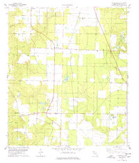
 1978 Allentown1978 Print · USGSAllentown and northern Santa Rosa County are shown in the late seventies as a landscape of rural homesteads and active oil exploration. Genealogists and local historians can locate many country landmarks, from the Allentown Sch to family sites like Chavers Cem and Hopewell Ch.2 unique versions available
 - 1978 Map of Fidelis
 1978 Fidelis1978 Print · USGSThe Florida-Alabama borderlands in the late 1970s reveal a landscape of experimental forests and scattered rural hamlets. Researchers can trace family history through the numerous country churches and cemeteries, including Fidelis Ch, Old Fidelis Cem, and Dixonville Ch.2 unique versions available
 - 1978 Map of Molino
 1978 Molino1978 Print · USGSThe Escambia River valley in the late 1970s shows a landscape of upland settlements and dense river bottomlands. Researchers can trace family history through sites like Barrineau Cem, the Molino Sch, and landings such as Webb Landing.3 unique versions available
 - 1978 Map of Cantonment
 1978 Cantonment1978 Print · USGSNorth of Pensacola in the late seventies, this area shows a mix of industrial utility and established rural communities. Researchers can trace family sites at Santa Marie Cem or follow the rails of the Louisville and Nashville through Cantonment.3 unique versions available
 - 1978 Map of Chumuckla
 1978 Chumuckla1978 Print · USGSSanta Rosa County's rural communities are documented in detail in the late seventies, showing the area's agricultural and social foundations. Genealogists and local historians can trace the locations of family landmarks like Chumuckla Cem, New Bethel Ch, and the settlement of Brownsdale.
 - 1978 Map of Century
 1978 Century1978 Print · USGSThe Florida-Alabama state line and the winding Escambia River define this region in the late seventies. Researchers can trace family history through sites like Carney Cem, Byrneville Ch, and the old Louisville and Nashville rail lines.
Showing maps 1-25 of 28
Top cities of Santa Rosa County
Frequently asked questions
- What are the different types of historical maps available for Santa Rosa County?
- What is the oldest map of Santa Rosa County?
- Where can I purchase historical maps of Santa Rosa County for my home or office?
- Where can I download high-res historical maps of Santa Rosa County?
- Are there historical topographic maps available for Santa Rosa County?
- Is there historical aerial imagery available for Santa Rosa County?
- Where are historical maps of Santa Rosa County sourced from?