Old Maps of Santa Rosa County, Florida for Genealogy
Trace your family roots with 214 historic maps of Santa Rosa County. These high-res maps reveal old neighborhoods, homesites, landmarks, and streets — helping you uncover where your ancestors lived and how the area evolved over time.
- Explore historic neighborhoods: Identify where your relatives may have lived in the 1800s or 1900s.
- Compare maps over time: Trace the changes in streets, buildings, and landmarks for multi-generational research.
- Perfect for genealogy & ancestry research: Used by family historians and researchers to map out lineage and migration.
These maps are an incredible resource for exploring your personal connection to Santa Rosa County's past.
Santa Rosa County, FL maps
(214)- 1920 Map of Milton
 1920 Milton1920 Print · USGSSanta Rosa County's timber and rail economy is captured here just after the first World War. Genealogists and historians can trace the lumber industry through the Manu'g. and Land Co. R.R. and old coastal sites like Bagdad, Floridatown, and Roeville Sta.
 - 1921 Map of Holley
 1921 Holley1921 Print · USGSThe Florida panhandle coastline near Holley appears here as it was in the early 1920s, a landscape of quiet sounds and barrier islands. Genealogists and researchers can trace old settlements and coastal landmarks like Harper, Hiawatha, and Manatee Pt.
 - 1921 Map of Pensacola
 1921 Pensacola1921 Print · USGSCoastal Florida in the early twentieth century reveals a landscape of maritime industry and military reserves. Map collectors and genealogists can trace the waterfront piers of Muscogee Wharf, the historic U. S. Live Oak Plantation, and early settlements like Bohemia.
 - 1921 Map of Muscogee
 1921 Muscogee1921 Print · USGSThe Alabama-Florida borderlands come to life in the early 1920s, showing the river-and-rail network that sustained the region. Trace old ferry crossings like Billy Malone Ferry and landmarks such as Lathams Chapel and Seminola P.O.
 - 1934 Map of Harold
 1934 Harold1934 Print · USGSSanta Rosa County and the Florida Panhandle are shown here in the 1930s, defined by the winding paths of the Blackwater and Yellow Rivers. Researchers can locate family landmarks like the Old Whitmier Place, Kellys Mill, and several river access points including Faulks Ferry Landing.3 unique versions available
 - 1936 Map of Holley
 1936 Holley1936 Print · USGSThe Florida Panhandle coast near Santa Rosa County appears here during the mid-1930s, showing a quiet landscape of timber and wetlands. Genealogists and historians can trace early settlements at Holley and Navarre or locate landmarks like the Indian Head Fire Tower and Holley Ch.3 unique versions available
 - 1937 Map of Harold, 1942 Print
 1937 Harold1942 Print · USGSSanta Rosa County's river-and-rail landscape is captured here in the mid-1930s, showing a world of timber landings and rural parishes. Trace family history through Pleasant Home Ch, find the Old Whitmier Place, or locate Faulks Ferry Landing along the Yellow River.
 - 1938 Map of Holley
 1938 Holley1938 Print · USGSThe Florida Panhandle's coastline and interior forests appear here in the mid-thirties, before modern development transformed the shore. Researchers can trace early settlements at Holley and Navarre or locate landmarks like the East Bay Ch and East Bay Ranger Station.3 unique versions available
 - 1938 Map of Harold
 1938 Harold1938 Print · USGSThe Florida panhandle comes alive in the late 1930s, showing a timber-and-rail landscape shaped by the Blackwater River. Genealogists and historians can trace family roots at Old Whitmier Place, Flowers Field Cemetery, and several rural churches like Welcome Ch.4 unique versions available
 - 1941 Map of Muscogee, 1956 Print
 1941 Muscogee1956 Print · USGSThe Florida-Alabama borderlands come alive in the early 1940s as the Perdido River and major rail lines dictate the rhythm of local commerce. Researchers can trace family roots through numerous rural landmarks like Barrineau Park, the Mission Cem, and Quintette Sch.2 unique versions available
 - 1941 Map of Pensacola, 1956 Print
 1941 Pensacola1956 Print · USGSPensacola and its surrounding bays are seen here just before the mid-century boom, detailing a landscape defined by naval aviation and maritime rail. Trace the historic city grid, explore the U S Naval Reservation, or locate Oakland Ch and Black Hammock Cem.
 - 1941 Map of Milton, 1956 Print
 1941 Milton1956 Print · USGSSanta Rosa County at the start of the 1940s is shown here as a landscape of timber-towns and tidewater rail junctions. Genealogists can trace family names at Allen Cem, Robinson Sch, and the riverside settlements of Bagdad and Floridatown.2 unique versions available
 - 1941 Map of Century, 1962 Print
 1941 Century1962 Print · USGSThe Florida-Alabama borderlands come alive in the early 1940s as a landscape of river-bottom wetlands and upland rail towns. Genealogists can trace family roots at Coon Hill Cem, Kays Chapel, and long-standing schools like Pine Barren Sch.2 unique versions available
 - 1942 Map of Pensacola
 1942 Pensacola1942 Print · USGSCoastal Florida is captured here in the early years of the war, showing the maritime and rail infrastructure that shaped the Panhandle. Genealogists and historians can trace family locations near Oakland Ch, the Black Hammock Cem, and the busy Muscogee Wharf.2 unique versions available
 - 1943 Map of Muscogee
 1943 Muscogee1943 Print · USGSThe Florida-Alabama borderlands come alive in the early 1940s as the river-and-rail economy pulses through Muscogee and Cantonment. Genealogists can trace family footprints at Mission Cem, Sunnyhill Sch, and rural stops along the Louisville and Nashville RR.2 unique versions available
 - 1943 Map of Century
 1943 Century1943 Print · USGSThe Florida-Alabama borderlands in the 1940s are defined by the winding Escambia River and a thriving rail-and-timber network. Researchers can trace rural life through family-named landmarks like Coon Hill Cem, Ward Sch, and Chumuckla Springs.2 unique versions available
 - 1943 Map of Milton
 1943 Milton1943 Print · USGSSanta Rosa and Escambia counties are captured here in the early 1940s at the confluence of the Blackwater and Escambia rivers. Researchers can trace the waterfront history of MILTON and Bagdad or locate rural landmarks like Union Valley Ch and Conners Still.2 unique versions available
 - 1943 Map of Jay
 1943 Jay1943 Print · USGSSanta Rosa County's agricultural and riverine heartland is captured here during the early years of the Second World War. Researchers can locate vanished landmarks like Catawba Fidelis Sch and Old Fidelis Cem or trace family roots in Jay and Chumuckla.4 unique versions available
 - 1944 Map of Floridatown
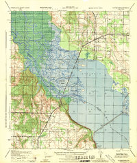 1944 Floridatown1944 Print · USGSCoastal Santa Rosa County is captured here during the mid-forties, showing the vital river-and-rail hub where the Escambia delta meets the bay. Trace the wartime footprint of Ellyson Field and the historic streets of Floridatown and Pace.
 - 1944 Map of Oriole Beach
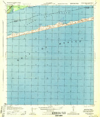 1944 Oriole Beach1944 Print · USGSThe Florida Panhandle's barrier islands remain largely undeveloped during the mid-1940s, dominated by the Santa Rosa National Monument. Local historians can trace early maritime markers and coastal settlements like Oriole Beach and the U S Naval Res.
 - 1944 Map of Gonzalez
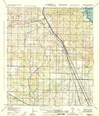 1944 Gonzalez1944 Print · USGSNorth of Pensacola in the mid-1940s, this area centers on the rail hub of Cantonment and the surrounding rural communities. Genealogists can locate family landmarks like Jordan Cemetery, the Tate School, and the historic Farm Hill Church.
 - 1944 Map of Gulf Breeze
 1944 Gulf Breeze1944 Print · USGSCoastal Florida and its military defenses are surveyed here during the mid-forties, showing the transition from naval outposts to early recreation. Researchers can trace the layout of the U S Naval Reservation and find the location of the Pensacola Quarantine Station (Abandoned) or the old Casino.
 - 1944 Map of Garcon Point
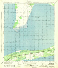 1944 Garcon Point1944 Print · USGSThe Santa Rosa County coastline and the Garcon Point peninsula are captured here during the mid-forties. Genealogists and local historians can trace the early development of Woodlawn Beach or locate the northern Black Hammock Cem and several 1930s benchmarks.
 - 1944 Map of Pensacola
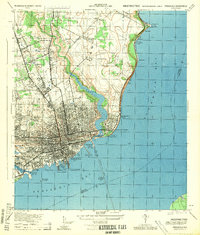 1944 Pensacola1944 Print · USGSWorld War II era Pensacola reveals a bustling harbor defined by industrial piers and emerging suburbs. Trace the waterfront rail terminals like L & N Railroad Piers and follow the bluffs past Magnolia Bluff to the Bohemia Brick Chimney.
 - 1948 Map of Munson, 1958 Print
 1948 Munson1958 Print · USGSSanta Rosa County's timberlands are captured here in the late 1940s, just as modern forest management was taking root. Researchers can locate family sites and early community landmarks like Sellersville, Black Cem, and the Munson High School.2 unique versions available
Showing maps 1-25 of 214
Top cities of Santa Rosa County
Frequently asked questions
- What are the different types of historical maps available for Santa Rosa County?
- What is the oldest map of Santa Rosa County?
- Where can I purchase historical maps of Santa Rosa County for my home or office?
- Where can I download high-res historical maps of Santa Rosa County?
- Are there historical topographic maps available for Santa Rosa County?
- Is there historical aerial imagery available for Santa Rosa County?
- Where are historical maps of Santa Rosa County sourced from?