Old Maps of Sarasota, Florida for Metal Detecting
Plan your next treasure hunt with 30 historic maps of Sarasota. Find old homesites, ghost towns, trails, and gathering spots that may be lost to time — perfect for identifying promising metal detecting locations.
- Locate forgotten sites: Uncover places like long-lost settlements, abandoned rail lines, or gathering spots.
- Plan better hunts: Use map overlays combined with LiDAR or satellite views to narrow in on historically rich areas.
- Made for detectorists: Thousands of hobbyists use these maps to discover relics, coins, and hidden history.
Use these historic maps to boost your research and find new opportunities beneath the surface of Sarasota.
Sarasota, FL maps
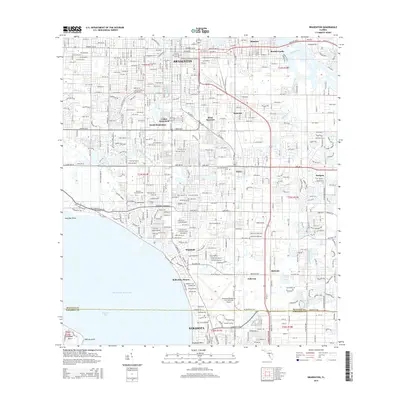
(30)- 1944 Map of Sarasota
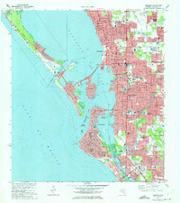
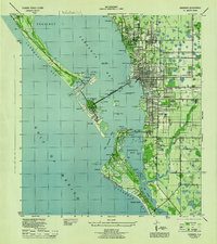 1944 Sarasota1944 Print · USGSSarasota and its neighboring keys are shown here during the mid-1940s, a period of significant coastal development and wartime infrastructure. Researchers can trace the layout of early neighborhoods like Beverly Terrace or locate local landmarks such as the Booker Schools and the Primitive Church.2 unique versions available
 - 1947 Map of Bradenton
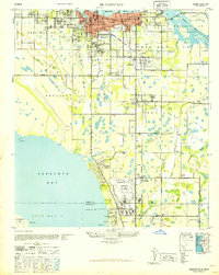 1947 Bradenton1947 Print · USGSCoastal Florida is shown in transition during the late 1940s, from the city streets of Bradenton to the large military installation at the Sarasota US Army Air Base. Researchers can trace the early layout of Whitfield Estates, locate the Manasota Cem, or find the original Prospect School site.
 - 1947 Map of Bee Ridge
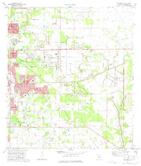
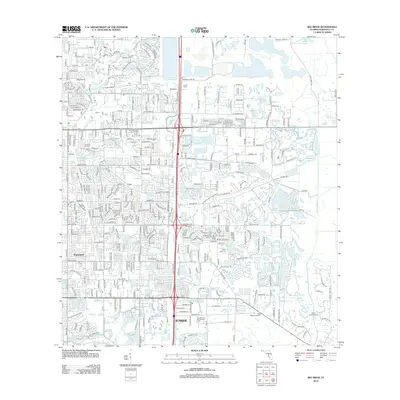
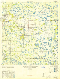 1947 Bee Ridge1947 Print · USGSSarasota's inland prairie and citrus lands are captured here just after the war, showing a region balanced between agriculture and emerging industry. Genealogists and historians can locate the Ringling Bros Circus Winter Quarters, the Bee Ridge Sch, and the Friendship Ch.2 unique versions available
 - 1956 Map of Tampa, 1964 Print
 1956 Tampa1964 Print · USGSThe Florida Gulf Coast thrived in the mid-fifties, from the bustling docks of Tampa to the quiet shores of Sanibel. Genealogists and historians can trace old rail lines like the Atlantic Coast Line or find early layouts of Port Charlotte and Bokeelia.2 unique versions available
 - 1959 Map of Tampa
 1959 Tampa1959 Print · USGSThe Florida Gulf Coast appears in this late fifties survey during a period of steady coastal growth and established rail commerce. Researchers can trace historic neighborhoods and transit lines from Tampa to St Petersburg, or locate landmarks like Mac Dill AFB and Boca Grande.
 - 1960 Map of Tampa
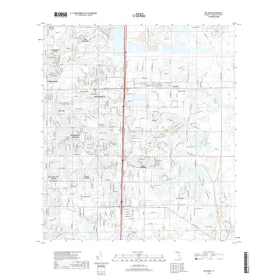
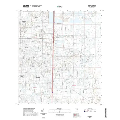
 1960 Tampa1960 Print · USGSThe Florida Gulf Coast was undergoing a major transformation at the start of the sixties, with new bridges linking burgeoning cities across the bays. Researchers can trace the mid-century footprints of St Petersburg and Tampa, or locate coastal landmarks like Mac Dill AFB and the Sunshine Skyway.2 unique versions available
 - 1964 Map of Bradenton, 1966 Print
 1964 Bradenton1966 Print · USGSBradenton and the Sarasota Bay shoreline are shown here during a mid-century period of rapid coastal growth. Genealogists and local historians can locate early landmarks like Braden Castle, Manatee Jr College, and Oneco.4 unique versions available
 - 1972 Map of Tampa, 1974 Print
 1972 Tampa1974 Print · USGSThe Florida Gulf Coast appears in a period of significant growth during the early seventies, from the urban centers of the bay to the quiet southern keys. Researchers can trace the expansion of St Petersburg or locate family sites near Safety Harbor, Valrico, and Boca Ciega.
 - 1973 Map of Sarasota, 1975 Print
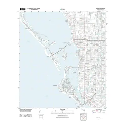
 1973 Sarasota1975 Print · USGSSarasota and its barrier islands are shown in the early seventies as the coastal landscape was rapidly urbanizing. Trace family roots at Pioneer Park Cem or study the unique development of St Armands Key and Longboat Key.3 unique versions available
 - 1973 Map of Bee Ridge, 1975 Print
 1973 Bee Ridge1975 Print · USGSSarasota and its eastern suburbs are caught in a period of steady growth during the early seventies. Genealogists and local historians can trace the foundations of Bee Ridge and Fruitville, or locate family sites near Palms Memorial Park Gardens and Lake Marae.3 unique versions available
 - 1979 Map of Sarasota, 1980 Print
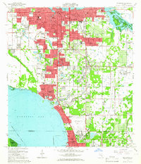
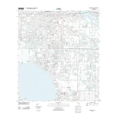
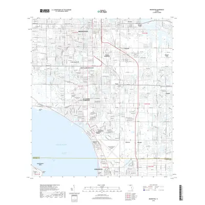
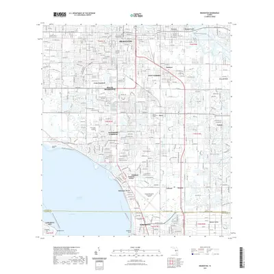
 1979 Sarasota1980 Print · USGSCoastal Florida in the late seventies reveals the rapid growth of the Gulf shoreline from Bradenton down to Port Charlotte. Trace the expansion of coastal communities like Bayshore Gardens, find long-standing landmarks like Trailer Estates, or explore the vast preserve of Myakka River State Park.
 - 1988 Map of St Petersburg
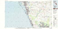
 1988 St Petersburg1988 Print · USGSThe Florida Gulf Coast reached a peak of late-twentieth-century development as seen in this late-1980s look at the growing corridor from St Petersburg to Port Charlotte. Researchers can trace the expansion of coastal infrastructure, including MacDill Air Force Base, the Seaboard System RR, and regional parks like Fort De Soto Park.
 - 1994 Map of Bradenton, 2000 Print
 1994 Bradenton2000 Print · USGSCoastal Manatee County at the end of the twentieth century shows a landscape of rapid suburban growth between the rivers and the bay. Researchers can find long-standing community landmarks like Braden Castle, Trailer Estates, and the Ringling Museum of Art.
 - 1994 Map of Sarasota, 2000 Print
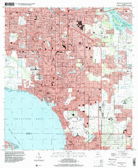
 1994 Sarasota2000 Print · USGSThe Florida Gulf Coast comes alive in the mid-nineties as the shoreline development of Sarasota and its barrier islands is documented in fine detail. Researchers can trace the layout of waterfront neighborhoods from Siesta Key to Beverley Terrace and locate landmarks like the County Fairgrounds.
 - 2012 Map of Bee Ridge, 2012 Print
 2012 Bee Ridge2012 Print · USGSCovers Sarasota, including Fruitville, Desoto Lakes, and other nearby areas
 - 2012 Map of Bradenton, 2012 Print
 2012 Bradenton2012 Print · USGSCovers Sarasota, including Bradenton, Longboat Key, and other nearby areas
 - 2012 Map of Sarasota, 2012 Print
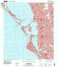
 2012 Sarasota2012 Print · USGSCovers Sarasota, including Longboat Key, Siesta Key, and other nearby areas
 - 2015 Map of Bradenton, 2015 Print
 2015 Bradenton2015 Print · USGSCovers Sarasota, including Bradenton, Longboat Key, and other nearby areas
 - 2015 Map of Bee Ridge, 2015 Print
 2015 Bee Ridge2015 Print · USGSCovers Sarasota, including Fruitville, Desoto Lakes, and other nearby areas
 - 2015 Map of Sarasota, 2015 Print
 2015 Sarasota2015 Print · USGSCovers Sarasota, including Longboat Key, Siesta Key, and other nearby areas
 - 2018 Map of Sarasota, 2018 Print
 2018 Sarasota2018 Print · USGSCovers Sarasota, including Longboat Key, Siesta Key, and other nearby areas
 - 2018 Map of Bee Ridge, 2018 Print
 2018 Bee Ridge2018 Print · USGSCovers Sarasota, including Fruitville, Desoto Lakes, and other nearby areas
 - 2018 Map of Bradenton, 2018 Print
 2018 Bradenton2018 Print · USGSCovers Sarasota, including Bradenton, Longboat Key, and other nearby areas
 - 2021 Map of Bee Ridge, 2021 Print
 2021 Bee Ridge2021 Print · USGSCovers Sarasota, including Fruitville, Desoto Lakes, and other nearby areas
 - 2021 Map of Bradenton, 2021 Print
 2021 Bradenton2021 Print · USGSCovers Sarasota, including Bradenton, Longboat Key, and other nearby areas
Showing maps 1-25 of 30
Top cities near Sarasota
- North Port historical maps
- Bradenton historical maps
- Venice historical maps
- Palmetto historical maps
- Laurel historical maps
- Longboat Key historical maps
See more
Top neighborhoods of Sarasota
- Sarasota Heights historical maps
- South Trail historical maps
- Downtown historical maps
- Southside historical maps
- Lido Key historical maps
- Granada historical maps
See more
Frequently asked questions
- What are the different types of historical maps available for Sarasota?
- What is the oldest map of Sarasota?
- Where can I purchase historical maps of Sarasota for my home or office?
- Where can I download high-res historical maps of Sarasota?
- Are there historical topographic maps available for Sarasota?
- Is there historical aerial imagery available for Sarasota?
- Where are historical maps of Sarasota sourced from?