Old Maps of Ebro, Florida for Academic Research
Study the evolution of Ebro with 21 high-resolution historic maps. Whether you're teaching, researching, or modeling changes in land use, these maps provide essential visual documentation of urban, environmental, and geographic change.
- Analyze long-term change: Track patterns in development, transportation, and natural features.
- Ideal for environmental or urban studies: Support academic projects with primary historical map data.
- Use in the classroom or lab: Educators and researchers rely on these maps to bring historical context to life.
These maps are a powerful tool for teaching, research, and visualizing how Ebro has changed over the decades.
Ebro, FL maps
(21)- 1944 Map of Bruce, 1969 Print
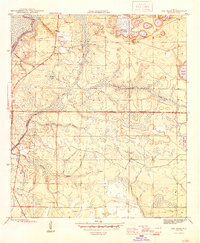
 1944 Bruce1969 Print · USGSThe Choctawhatchee River bottomlands in the 1940s reveal a landscape of remote river camps and timber landings. Trace the early footprints of Bruce and Ebro, and locate riverfront sites like Cedar Tree Landing and the Ebro Sch.
 - 1945 Map of Red Head
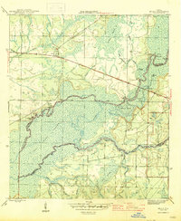
 1945 Red Head1945 Print · USGSThe Choctawhatchee River lowlands and the southern pine forests come into focus during the mid-1940s. Genealogists and local historians can locate early community hubs like Red Head and the Oak Grove Ch, or trace landmarks like the Moody Fire Tower and Ebro Cem.4 unique versions available
 - 1945 Map of Bruce
 1945 Bruce1945 Print · USGSFlorida's Panhandle river country is captured here in the mid-1940s, showing the complex wetlands where Walton and Washington Counties meet. Researchers can trace the riverfront economy through sites like Cowford Ferry, Miller Landing, and the Ebro school.3 unique versions available
 - 1954 Map of Tallahassee, 1967 Print
 1954 Tallahassee1967 Print · USGSThe Florida Panhandle and South Georgia are captured here during a period of mid-century growth and military expansion. Researchers can trace the development of Panama City, the footprint of Tyndall Air Force Base, and the rail lines of the Atlantic Coast Line.4 unique versions available
 - 1959 Map of Tallahassee
 1959 Tallahassee1959 Print · USGSFlorida's Panhandle and the Big Bend region appear here in the mid-fifties, showing a landscape defined by its great river systems and developing coast. Trace the early layout of Panama City, the expansive Apalachicola National Forest, and the coastal St Marks Lighthouse.
 - 1960 Map of Tallahassee
 1960 Tallahassee1960 Print · USGSThe Florida Panhandle and southern Georgia are captured here in the mid-twentieth century, showing a region defined by its rivers and military installations. Genealogists and historians can trace the growth of Tallahassee or locate coastal landmarks like the St Marks Lighthouse and Tyndall Air Force Base.
 - 1981 Map of Panama City
 1981 Panama City1981 Print · USGSPanama City and the Florida Panhandle coast are captured here in the early eighties, showing the region's balance of military installations and maritime industry. Researchers can trace the Atlanta and St Andrews Bay RR or locate coastal sites like Tyndall Air Force Base and Dead Lake.2 unique versions available
 - 1982 Map of Bruce, 1983 Print
 1982 Bruce1983 Print · USGSThe Choctawhatchee River floodplain in the early eighties reveals a complex landscape of wetlands and timberland at the meeting of Walton, Washington, and Bay counties. Genealogists and local historians can trace family-named sites like Gunlock Cem, Miller Landing, and the settlement of Bruce.2 unique versions available
 - 1982 Map of Red Head, 1983 Print
 1982 Red Head1983 Print · USGSThe Florida Panhandle's tri-county borderlands are revealed in the early 1980s, showcasing the intersection of river, forest, and small-town life. Researchers can locate family landmarks like Oak Grove Ch, the Red Head settlement, and various backcountry water bodies such as Court Martial Lake.
 - 1988 Map of Tallahassee
 1988 Tallahassee1988 Print · USGSThe Florida Panhandle and South Georgia are captured here in the late eighties, showing the expansion of the regional highway network and coastal growth. Genealogists and historians can trace rail lines like the Seaboard System Railroad or locate family roots in Blountstown, Graceville, or Crawfordville.2 unique versions available
 - 1994 Map of Red Head, 1998 Print
 1994 Red Head1998 Print · USGSThe Florida panhandle comes into focus during the mid-1990s, showcasing the rural landscapes of Bay County. Genealogists and researchers can trace the vicinity of Red Head and the winding course of the Choctawhatchee River.
 - 2012 Map of Bruce, 2012 Print
 2012 Bruce2012 Print · USGSCovers Ebro, including Miller Bend, Bruce, and other nearby areas
 - 2012 Map of Red Head, 2012 Print
 2012 Red Head2012 Print · USGSCovers Ebro, including Red Head, Bay County, and other nearby areas
 - 2015 Map of Bruce, 2015 Print
 2015 Bruce2015 Print · USGSCovers Ebro, including Miller Bend, Bruce, and other nearby areas
 - 2015 Map of Red Head, 2015 Print
 2015 Red Head2015 Print · USGSCovers Ebro, including Red Head, Bay County, and other nearby areas
 - 2018 Map of Red Head, 2018 Print
 2018 Red Head2018 Print · USGSCovers Ebro, including Red Head, Bay County, and other nearby areas
 - 2018 Map of Bruce, 2018 Print
 2018 Bruce2018 Print · USGSCovers Ebro, including Miller Bend, Bruce, and other nearby areas
 - 2021 Map of Bruce, 2021 Print
 2021 Bruce2021 Print · USGSCovers Ebro, including Miller Bend, Bruce, and other nearby areas
 - 2021 Map of Red Head, 2021 Print
 2021 Red Head2021 Print · USGSCovers Ebro, including Red Head, Bay County, and other nearby areas
 - 2024 Map of Red Head, 2024 Print
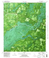
 2024 Red Head2024 Print · USGSThe Choctawhatchee River lowlands and Pine Log State Forest are documented here in the early 2020s. Genealogists and historians can trace the rural layout of Red Head and Ebro, or locate the Community Cem and Redhead Airport amidst the wetlands.
 - 2024 Map of Bruce, 2024 Print
 2024 Bruce2024 Print · USGSWalton and Washington counties meet at the winding Choctawhatchee River in this modern survey of the Florida Panhandle. Researchers can locate family landmarks like Morrell Cemetery, trace the Florida National Scenic Trl, and explore old routes such as Old Gristmill Rd.
End of results
Showing maps 1-21 of 21
Top cities near Ebro
- Panama City historical maps
- Lynn Haven historical maps
- Panama City Beach historical maps
- DeFuniak Springs historical maps
- Freeport historical maps
- Vernon historical maps
Frequently asked questions
- What are the different types of historical maps available for Ebro?
- What is the oldest map of Ebro?
- Where can I purchase historical maps of Ebro for my home or office?
- Where can I download high-res historical maps of Ebro?
- Are there historical topographic maps available for Ebro?
- Is there historical aerial imagery available for Ebro?
- Where are historical maps of Ebro sourced from?