Old Maps of Brantley County, Georgia for Genealogy
Trace your family roots with 109 historic maps of Brantley County. These high-res maps reveal old neighborhoods, homesites, landmarks, and streets — helping you uncover where your ancestors lived and how the area evolved over time.
- Explore historic neighborhoods: Identify where your relatives may have lived in the 1800s or 1900s.
- Compare maps over time: Trace the changes in streets, buildings, and landmarks for multi-generational research.
- Perfect for genealogy & ancestry research: Used by family historians and researchers to map out lineage and migration.
These maps are an incredible resource for exploring your personal connection to Brantley County's past.
Brantley County, GA maps
(109)- 1917 Map of Nahunta, 1958 Print
 1917 Nahunta1958 Print · USGSSoutheast Georgia's riverine and rail networks are preserved here during the early twentieth century. Researchers can trace the legacy of rural education and transport through Ammons Ferry Bridge, the Jacksonville Post Road, and community anchors like Bixley Chapel.2 unique versions available
 - 1918 Map of Hortense
 1918 Hortense1918 Print · USGSSoutheast Georgia during the Great War era reveals a landscape shaped by river systems and steam-age railroads. Genealogists can trace family roots through numerous rural landmarks like Pendarvis School, Mt Zion Church, and the river crossing at Rosin Landing.2 unique versions available
 - 1918 Map of Everett City
 1918 Everett City1918 Print · USGSCoastal Georgia at the end of the Great War was a world of vast river swamps and emerging rail junctions. Genealogists and historians can trace family locations through isolated landmarks like Bull Island School, the Ft Barrington Ferry, and the timber-driven siding at Thalmann.2 unique versions available
 - 1918 Map of Nahunta
 1918 Nahunta1918 Print · USGSSoutheastern Georgia at the end of the Great War reveals a landscape defined by the winding Satilla River and its vast swamps. Researchers can locate early schools and river crossings like Ammons Ferry Bridge, Oak Grove School, and Bixley Chapel.2 unique versions available
 - 1920 Map of Everett City, 1944 Print
 1920 Everett City1944 Print · USGSCoastal Glynn County was a hub of railroad and river activity during the early twentieth century. Researchers can trace family-named landings and vanished rail stops like Thalmann, the Union Industrial School, and the historic Ft Barrington Ferry.
 - 1944 Map of Everett City
 1944 Everett City1944 Print · USGSCoastal Georgia during the mid-forties was a world of rail junctions and river landings tied to the Altamaha. Genealogists and historians can trace rail-side communities like Everett City, rural schoolhouses including Bull Island Sch, and the site of the Fort Barrington Ferry.
 - 1944 Map of Hortense
 1944 Hortense1944 Print · USGSCoastal Georgia during the mid-forties reveals a landscape defined by the Satilla River and a strategic intersection of two major railroads. Genealogists can trace family roots through rural landmarks like Manningtown, Oak Grove Ch, and Menor Sch.
 - 1946 Map of Brunswick, 1948 Print
 1946 Brunswick1948 Print · USGSCoastal Georgia in the mid-forties reveals a landscape defined by the Camp Stewart Military Reservation and the sprawling barrier islands. Genealogists and historians can trace the rail-and-river network through inland towns like Ludowici and Jesup, or locate coastal landmarks like the St Simon Light.
 - 1948 Map of Brunswick
 1948 Brunswick1948 Print · USGSCoastal Georgia in the late 1940s is defined here by its labyrinthine barrier islands and the massive footprint of Camp Stewart. Genealogists and historians can trace the rail-tied growth of Jesup and Hinesville or locate coastal landmarks like St Simon Light.
 - 1953 Map of Waycross, 1967 Print
 1953 Waycross1967 Print · USGSSouth Georgia's agricultural and rail heartland is captured here in the mid-1950s, showing a vast network of timber and farming towns. Researchers can trace the rail lines connecting Waycross and Tifton or locate landmarks like Jefferson Davis State Park and Lake Blackshear.2 unique versions available
 - 1956 Map of Brunswick, 1968 Print
 1956 Brunswick1968 Print · USGSThe Georgia coast in the mid-twentieth century is a wild expanse of barrier islands and massive river deltas. You can trace the development of the maritime economy and military presence at Brunswick, or locate historic sites like Fort Frederica National Monument and Harris Neck National Wildlife Refuge.2 unique versions available
 - 1958 Map of Waycross
 1958 Waycross1958 Print · USGSSoutheast Georgia in the late fifties remains a landscape of deep river basins and vital rail junctions. Genealogists and historians can trace family-named landmarks and rural hubs like Union Church, South Georgia College, and the sprawling Okefenokee Swamp.2 unique versions available
 - 1961 Map of Brunswick
 1961 Brunswick1961 Print · USGSThe Georgia coast at the start of the 1960s was a landscape of deep tidal marshes and growing military installations. Genealogists and historians can trace rail-linked towns like Limerick Station or explore coastal landmarks from Fort Frederica National Monument to Sapelo Island.
 - 1966 Map of Winokur, 1967 Print
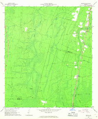 1966 Winokur1967 Print · USGSThe Brantley and Charlton County line emerges from the Okefenokee Swamp in the mid-1960s, showing a landscape defined by railroads and wetlands. Researchers can trace the Seaboard Coast Line through Winokur or find rural landmarks like Bachlott Ch and White Oak Hammock.2 unique versions available
 - 1966 Map of Hoboken East, 1967 Print
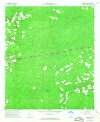 1966 Hoboken East1967 Print · USGSBrantley County at the midpoint of the sixties is a landscape of vast wetlands and rising timberlands bisected by heavy rail. Genealogists and local historians can trace the straight-line path of the Atlantic Coast Line connecting Hoboken and Hickox near landmarks like Trail Ridge.2 unique versions available
 - 1967 Map of Fort Mudge, 1968 Print
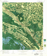 1967 Fort Mudge1968 Print · USGSThe Okefenokee wilderness in the late sixties reveals a landscape shaped by timber interests and conservation. Researchers can trace the Seaboard Coast Line through Fort Mudge and locate the Indian Mounds near Billy Landing Island.
 - 1967 Map of Hoboken West, 1969 Print
 1967 Hoboken West1969 Print · USGSBrantley and Ware counties are shown in the late 1960s, a period defined by the timber industry and the railroad's path through the pine flatwoods. Genealogists can trace family names through numerous rural landmarks like Thrift Cem, St Johns Ch, and the community of Schlatterville.2 unique versions available
 - 1967 Map of Waycross East, 1969 Print
 1967 Waycross East1969 Print · USGSWaycross during the late sixties was a thriving railway and educational center at the edge of the Georgia wetlands. Genealogists and historians can trace neighborhood growth through dozens of named schools and cemeteries like Hazzard Hill Cem and Oakland Cemetery.
 - 1971 Map of Blackshear East, 1974 Print
 1971 Blackshear East1974 Print · USGSPierce County in the early seventies remains a landscape of rural family settlements and small country churches. Genealogists can trace local roots at the Jot 'Em Down Store, Homestead Ch, and the Seaboard Coast Line rail corridor.2 unique versions available
 - 1971 Map of Patterson SE, 1974 Print
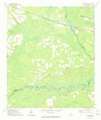 1971 Patterson SE1974 Print · USGSSoutheast of Patterson in the early 1970s, this rural Georgia landscape is defined by the winding Satilla River and its expansive wetlands. Genealogists and local historians can trace family roots through landmarks like Raulerson Cem, Laura Chapel, and the Raulerson Community Center.2 unique versions available
 - 1975 Map of Tarboro, 1987 Print
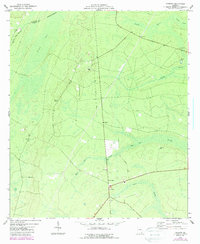 1975 Tarboro1987 Print · USGSIn the Georgia lowcountry during the mid-seventies, the community of Tarboro sat at the heart of a wetland landscape. Researchers can trace rural lineages at Bickley Chapel Cem and Harrell Cem, or follow the path of the Old Railroad Grade.
 - 1975 Map of Waynesville, 1987 Print
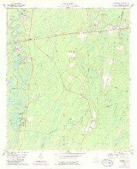 1975 Waynesville1987 Print · USGSCoastal Georgia's riverine landscape is captured here in the 1970s, showcasing the winding Satilla River and the settlements of Waynesville and Atkinson. Genealogists can locate family-named sites like Linda Plantation, Ammons Cem, and Wiggins Cem among the swampy lowlands.
 - 1978 Map of Nahunta
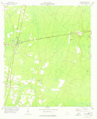 1978 Nahunta1978 Print · USGSThe rail-and-river landscape of Brantley County is captured here in the late seventies as the timber and swamp country surrounded growing towns. Local researchers can trace family landmarks like Little Buffalo Cem, Raybon Ch, and the rural community of Hickox.2 unique versions available
 - 1978 Map of Waynesville
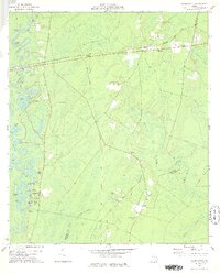 1978 Waynesville1978 Print · USGSCoastal Georgia in the late 1970s reveals a landscape of river-fed swamps and old rail corridors. Genealogists can trace family names through numerous burial sites like Highsmith Cem or locate historic crossings at Ammons Ferry and Atkinson.
 - 1978 Map of Boons Lake
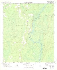 1978 Boons Lake1978 Print · USGSThe Satilla River's complex oxbows and the expansive Big Bay wetlands defined this rural landscape in the late seventies. Family historians can trace local landmarks like Bethlehem Cem or the settlements at Big Oak and Lime Rock.2 unique versions available
Showing maps 1-25 of 109
Top cities of Brantley County
Frequently asked questions
- What are the different types of historical maps available for Brantley County?
- What is the oldest map of Brantley County?
- Where can I purchase historical maps of Brantley County for my home or office?
- Where can I download high-res historical maps of Brantley County?
- Are there historical topographic maps available for Brantley County?
- Is there historical aerial imagery available for Brantley County?
- Where are historical maps of Brantley County sourced from?