Old Maps of Popwellville, Georgia for Hiking & Exploration
Hike through history with 16 historic maps of Popwellville. Explore old trails, ghost towns, and forgotten backroads — perfect for outdoor adventurers and local explorers.
- Rediscover forgotten places: Map out old mining camps, roads, and footpaths that no longer exist on modern maps.
- Layer with modern tools: Combine with LiDAR or satellite views to plan hikes through historical terrain.
- Made for exploration: Popular among hikers, overlanders, and local history lovers.
Use these maps to find adventure and explore the hidden past of Popwellville.
Popwellville, GA maps
(16)- 1918 Map of Everett City
 1918 Everett City1918 Print · USGSCoastal Georgia at the end of the Great War was a world of vast river swamps and emerging rail junctions. Genealogists and historians can trace family locations through isolated landmarks like Bull Island School, the Ft Barrington Ferry, and the timber-driven siding at Thalmann.2 unique versions available
 - 1920 Map of Everett City, 1944 Print
 1920 Everett City1944 Print · USGSCoastal Glynn County was a hub of railroad and river activity during the early twentieth century. Researchers can trace family-named landings and vanished rail stops like Thalmann, the Union Industrial School, and the historic Ft Barrington Ferry.
 - 1944 Map of Everett City
 1944 Everett City1944 Print · USGSCoastal Georgia during the mid-forties was a world of rail junctions and river landings tied to the Altamaha. Genealogists and historians can trace rail-side communities like Everett City, rural schoolhouses including Bull Island Sch, and the site of the Fort Barrington Ferry.
 - 1946 Map of Brunswick, 1948 Print
 1946 Brunswick1948 Print · USGSCoastal Georgia in the mid-forties reveals a landscape defined by the Camp Stewart Military Reservation and the sprawling barrier islands. Genealogists and historians can trace the rail-and-river network through inland towns like Ludowici and Jesup, or locate coastal landmarks like the St Simon Light.
 - 1948 Map of Brunswick
 1948 Brunswick1948 Print · USGSCoastal Georgia in the late 1940s is defined here by its labyrinthine barrier islands and the massive footprint of Camp Stewart. Genealogists and historians can trace the rail-tied growth of Jesup and Hinesville or locate coastal landmarks like St Simon Light.
 - 1956 Map of Brunswick, 1968 Print
 1956 Brunswick1968 Print · USGSThe Georgia coast in the mid-twentieth century is a wild expanse of barrier islands and massive river deltas. You can trace the development of the maritime economy and military presence at Brunswick, or locate historic sites like Fort Frederica National Monument and Harris Neck National Wildlife Refuge.2 unique versions available
 - 1961 Map of Brunswick
 1961 Brunswick1961 Print · USGSThe Georgia coast at the start of the 1960s was a landscape of deep tidal marshes and growing military installations. Genealogists and historians can trace rail-linked towns like Limerick Station or explore coastal landmarks from Fort Frederica National Monument to Sapelo Island.
 - 1978 Map of Brunswick
 1978 Brunswick1978 Print · USGSThe Georgia coast and its barrier islands are captured in the late 1970s, as I-95 and the rail lines shaped the growth of coastal towns. Genealogists and historians can trace family locations across the islands or locate sites near Fort Stewart, Darien, and Ludowici.2 unique versions available
 - 1978 Map of Thalmann
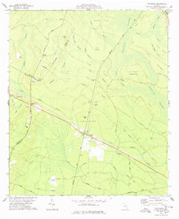 1978 Thalmann1978 Print · USGSCoastal Georgia's rail junctions and swamp islands are detailed in the late seventies. Genealogists can trace family landmarks across Thalmann, Popwellville, and numerous burial sites like Popwell Cem and Blount Crossing Cem.
 - 1981 Map of Brunswick, 1982 Print
 1981 Brunswick1982 Print · USGSThe Georgia coast at the start of the eighties reveals a complex landscape of tidal estuaries, deep-water sounds, and growing island communities. Trace local history through the protected grounds of Fort Frederica National Monument and the old rail stops at Thalmann and Nahunta.3 unique versions available
 - 1993 Map of Thalmann, 1995 Print
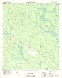 1993 Thalmann1995 Print · USGSCoastal Georgia's lowlands come into focus in the mid-1990s as the intersection of Glynn, Wayne, and Brantley counties reveals a landscape of hammocks and swamps. Researchers can trace family roots at Whitaker Hill Cem and Popwell Cem or locate the small rail-side communities of Thalmann and Jamaica.
 - 2011 Map of Thalmann, 2011 Print
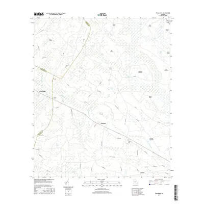
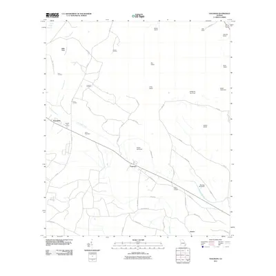 2011 Thalmann2011 Print · USGSCovers Popwellville, including Jamaica, Belle Vista, and other nearby areas
 - 2014 Map of Thalmann, 2014 Print
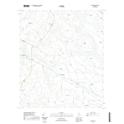
 2014 Thalmann2014 Print · USGSCovers Popwellville, including Jamaica, Belle Vista, and other nearby areas
 - 2017 Map of Thalmann, 2017 Print
 2017 Thalmann2017 Print · USGSCovers Popwellville, including Jamaica, Belle Vista, and other nearby areas
 - 2020 Map of Thalmann, 2020 Print
 2020 Thalmann2020 Print · USGSCovers Popwellville, including Jamaica, Belle Vista, and other nearby areas
 - 2024 Map of Thalmann, 2024 Print
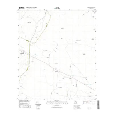
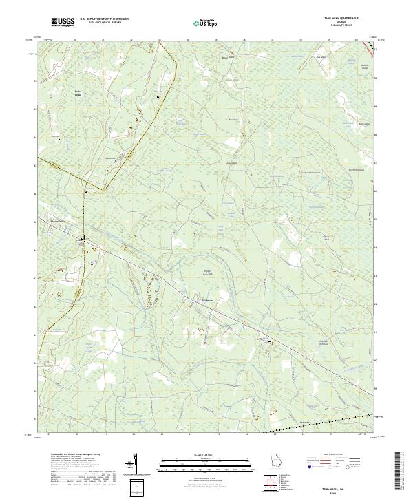 2024 Thalmann2024 Print · USGSCoastal Georgia's lowlands come into focus in the early 2020s, revealing a landscape where family history is etched into the hammocks and swamps. Researchers can trace ancestral roots at Blount Crossing Cem, explore the area around Thalmann, or locate the site of Popwellville.
End of results
Showing maps 1-16 of 16
Top cities near Popwellville
Frequently asked questions
- What are the different types of historical maps available for Popwellville?
- What is the oldest map of Popwellville?
- Where can I purchase historical maps of Popwellville for my home or office?
- Where can I download high-res historical maps of Popwellville?
- Are there historical topographic maps available for Popwellville?
- Is there historical aerial imagery available for Popwellville?
- Where are historical maps of Popwellville sourced from?