Old Maps of Richmond Hill, Georgia for Genealogy
Trace your family roots with 25 historic maps of Richmond Hill. These high-res maps reveal old neighborhoods, homesites, landmarks, and streets — helping you uncover where your ancestors lived and how the area evolved over time.
- Explore historic neighborhoods: Identify where your relatives may have lived in the 1800s or 1900s.
- Compare maps over time: Trace the changes in streets, buildings, and landmarks for multi-generational research.
- Perfect for genealogy & ancestry research: Used by family historians and researchers to map out lineage and migration.
These maps are an incredible resource for exploring your personal connection to Richmond Hill's past.
Richmond Hill, GA maps
(25)- 1920 Map of Limerick, 1928 Print
 1920 Limerick1928 Print · USGSThe Georgia coast at the end of the Great War reveals a landscape shaped by tidal rivers and burgeoning timber railroads. Genealogists and local historians can trace family roots through the settlements of Limerick, Sunbury, and Riceboro, or locate the historic Midway Ch. and the coastal defenses of Fort Morris.
 - 1944 Map of Limerick, 1945 Print
 1944 Limerick1945 Print · USGSCoastal Georgia during the mid-forties reveals a landscape transitioning between established agricultural settlements and expanding military grounds. Genealogists and researchers can trace local families through many Art Well locations and historic community centers like Midway Ch, Limerick, and Riceboro.
 - 1946 Map of Brunswick, 1948 Print
 1946 Brunswick1948 Print · USGSCoastal Georgia in the mid-forties reveals a landscape defined by the Camp Stewart Military Reservation and the sprawling barrier islands. Genealogists and historians can trace the rail-and-river network through inland towns like Ludowici and Jesup, or locate coastal landmarks like the St Simon Light.
 - 1948 Map of Brunswick
 1948 Brunswick1948 Print · USGSCoastal Georgia in the late 1940s is defined here by its labyrinthine barrier islands and the massive footprint of Camp Stewart. Genealogists and historians can trace the rail-tied growth of Jesup and Hinesville or locate coastal landmarks like St Simon Light.
 - 1948 Map of Limerick, 1964 Print
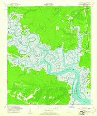
 1948 Limerick1964 Print · USGSCoastal Georgia's river-fed landscapes are captured here just after the war, showing the deep-rooted settlements of Liberty and Bryan counties. Genealogists can locate family sites among numerous landmarks like Dorchester Academy, Fort Morris, and the Old Dorchester Cem.
 - 1950 Map of Limerick
 1950 Limerick1950 Print · USGSThe Georgia lowcountry at the mid-century mark shows a transition from coastal plantations to military and industrial expansion. Genealogists and historians can trace family roots through numerous sites like Dorchester Academy, Sunbury, and Scratchy Hall Cem.2 unique versions available
 - 1956 Map of Brunswick, 1968 Print
 1956 Brunswick1968 Print · USGSThe Georgia coast in the mid-twentieth century is a wild expanse of barrier islands and massive river deltas. You can trace the development of the maritime economy and military presence at Brunswick, or locate historic sites like Fort Frederica National Monument and Harris Neck National Wildlife Refuge.2 unique versions available
 - 1958 Map of Limerick SE, 1961 Print
 1958 Limerick SE1961 Print · USGSThe Georgia coast near Sunbury was a network of tidal rivers and rail sidings in the late fifties. You can locate family landmarks like the George Washington Carver Sch, the Fort Morris (Site), and Old Dorchester Cem among the marshlands.2 unique versions available
 - 1958 Map of Richmond Hill, 1961 Print
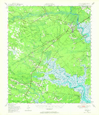
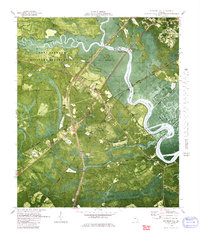
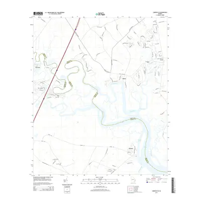
 1958 Richmond Hill1961 Print · USGSCoastal Georgia in the late fifties is defined here by the winding Ogeechee and the rise of the town of Richmond Hill. Researchers can trace family history through numerous rural cemeteries and church sites, including Strathy Hall Cem, Bryan Neck Ch, and Rabbit Hill.3 unique versions available
 - 1961 Map of Brunswick
 1961 Brunswick1961 Print · USGSThe Georgia coast at the start of the 1960s was a landscape of deep tidal marshes and growing military installations. Genealogists and historians can trace rail-linked towns like Limerick Station or explore coastal landmarks from Fort Frederica National Monument to Sapelo Island.
 - 1978 Map of Brunswick
 1978 Brunswick1978 Print · USGSThe Georgia coast and its barrier islands are captured in the late 1970s, as I-95 and the rail lines shaped the growth of coastal towns. Genealogists and historians can trace family locations across the islands or locate sites near Fort Stewart, Darien, and Ludowici.2 unique versions available
 - 1979 Map of Limerick SE
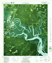 1979 Limerick SE1979 Print · USGSCoastal Georgia's tidal rivers and marshlands are captured in detail during the late 1970s, showing the intersection of Belfast industry and historic settlements. Researchers can trace family roots at Corinth Ch Cem or locate the historic Fort Morris (Site) along the Medway River.2 unique versions available
 - 1980 Map of Richmond Hill
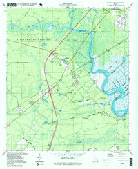
 1980 Richmond Hill1980 Print · USGSThe Ogeechee River corridor is shown here as it transitioned into the 1980s, revealing a landscape of military reserves and old coastal canals. Trace family roots and local history at Byran Neck Ch, Strathy Hall Cem, and the old settlement at Burroughs.
 - 1981 Map of Jesup, 1982 Print
 1981 Jesup1982 Print · USGSCoastal Georgia in the early eighties shows a landscape of expansive river deltas and military reservations stretching from the interior to the Atlantic. Genealogists and local historians can trace family locations near Jesup, the old port of Sunbury, or the tidal reaches of the Altamaha River.
 - 1997 Map of Richmond Hill, 1999 Print
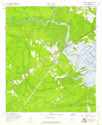
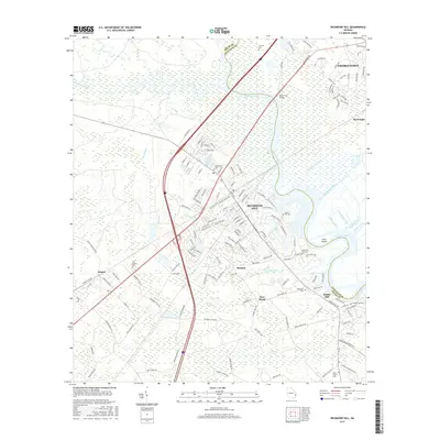
 1997 Richmond Hill1999 Print · USGSCoastal Georgia at the close of the twentieth century remains defined by its deep river basins and legacy of waterway engineering. Genealogists can trace family roots through numerous sites like Burnt Church Cem, St Annes Ch, and the settlement at Richmond Hill.
 - 2011 Map of Limerick SE, 2011 Print
 2011 Limerick SE2011 Print · USGSCovers Richmond Hill, including Midway, Keller, and other nearby areas
 - 2011 Map of Richmond Hill, 2011 Print
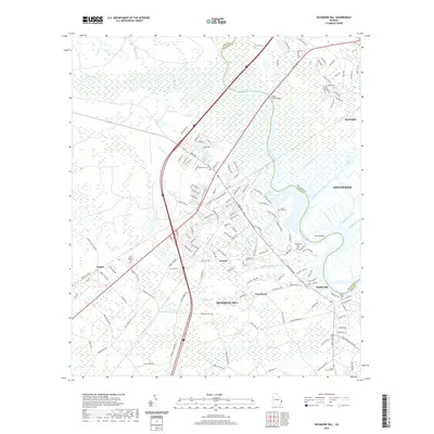
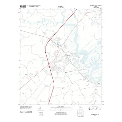 2011 Richmond Hill2011 Print · USGSCovers Richmond Hill, including Savannah, Port Royal, and other nearby areas
 - 2014 Map of Richmond Hill, 2014 Print
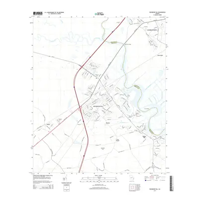 2014 Richmond Hill2014 Print · USGSCovers Richmond Hill, including Savannah, Port Royal, and other nearby areas
 - 2014 Map of Limerick SE, 2014 Print
 2014 Limerick SE2014 Print · USGSCovers Richmond Hill, including Midway, Keller, and other nearby areas
 - 2017 Map of Limerick SE, 2017 Print
 2017 Limerick SE2017 Print · USGSCovers Richmond Hill, including Midway, Keller, and other nearby areas
 - 2017 Map of Richmond Hill, 2017 Print
 2017 Richmond Hill2017 Print · USGSCovers Richmond Hill, including Savannah, Port Royal, and other nearby areas
 - 2020 Map of Richmond Hill, 2020 Print
 2020 Richmond Hill2020 Print · USGSCovers Richmond Hill, including Savannah, Port Royal, and other nearby areas
 - 2020 Map of Limerick SE, 2020 Print
 2020 Limerick SE2020 Print · USGSCovers Richmond Hill, including Midway, Keller, and other nearby areas
 - 2024 Map of Limerick SE, 2024 Print
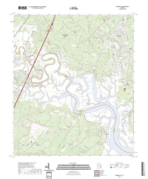 2024 Limerick SE2024 Print · USGSCoastal Georgia at the current moment reveals a landscape of tidal marshes and historical settlements along the Bryan and Liberty County line. Trace family sites at Bryan Neck Cem and the twin Old Dorchester Cem locations near Sunbury and Belfast.
 - 2024 Map of Richmond Hill, 2024 Print
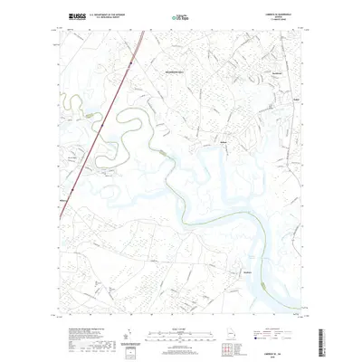
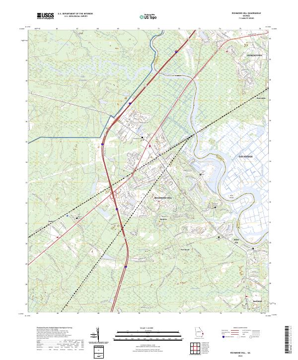 2024 Richmond Hill2024 Print · USGSCoastal Georgia's riverine borderlands come to life in this current-era survey of the growing communities south of Savannah. Genealogists can locate numerous local burial sites like Cherry Hill Cem and Burnt Church Cem among the wetlands of Poplar Swamp.
End of results
Showing maps 1-25 of 25
Top cities near Richmond Hill
- Savannah historical maps
- Pooler historical maps
- Georgetown historical maps
- Garden City historical maps
- Montgomery historical maps
- Bloomingdale historical maps
See more
Frequently asked questions
- What are the different types of historical maps available for Richmond Hill?
- What is the oldest map of Richmond Hill?
- Where can I purchase historical maps of Richmond Hill for my home or office?
- Where can I download high-res historical maps of Richmond Hill?
- Are there historical topographic maps available for Richmond Hill?
- Is there historical aerial imagery available for Richmond Hill?
- Where are historical maps of Richmond Hill sourced from?