1970s Maps of Temple, Georgia
Explore 3 historic maps of Temple from the 1970s. These maps offer a rare glimpse into what life looked like during the 1970s — showing old roads, neighborhoods, homes, and landmarks that have changed or disappeared over time.
Whether you're researching your family's past, planning a metal detecting trip, or studying how Temple's landscape evolved across the 1970s, these high-resolution maps are a powerful tool for exploring the history of this region.
- Focus on a specific era: All maps on this page are from the 1970s, giving you a focused view of this time period.
- See what’s changed: Compare century-old streets, trails, and buildings to today's modern landscape using overlays and satellite layers.
- Research with precision: Use these maps for genealogy, historical research, land use analysis, or educational projects.
- View, download, or print: Maps are fully viewable online in high resolution, and can be downloaded or printed for your own records.
Start exploring Temple's history through authentic maps from the 1970s. This is your window into the past.
Temple, GA maps
(3)- 1973 Map of Draketown, 1975 Print
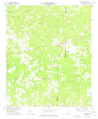 1973 Draketown1975 Print · USGSHaralson and Carroll counties are shown in the early seventies, centered on a rural network of churches and creek-side homesteads. Genealogists and historians can locate family burial sites at Haney Cem and Union Hill Cem, or trace long-standing congregations like District Line Ch.2 unique versions available
 - 1973 Map of Temple, 1975 Print
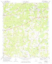 1973 Temple1975 Print · USGSTemple and Bremen were regional hubs in the early 1970s as the rail and road networks expanded through Georgia. Local historians can trace family roots through numerous landmark churches and schools like Miller Academy, Old Concord Ch, and Liberty Cem.2 unique versions available
 - 1973 Map of Villa Rica, 1975 Print
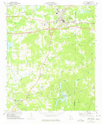 1973 Villa Rica1975 Print · USGSVilla Rica and its rural surroundings are captured here in the early seventies, showing a period of modern transit growth along the Southern rail line. Genealogists and local historians can trace family locations near Old Carrollton, Ithaca, and churches like Macedonia Ch and Ephesus Church.3 unique versions available
End of results
Showing maps 1-3 of 3
Top cities near Temple
- Carrollton historical maps
- Villa Rica historical maps
- Dallas historical maps
- Bremen historical maps
- Hiram historical maps
- Tallapoosa historical maps
See more
Frequently asked questions
- What are the different types of historical maps available for Temple?
- What is the oldest map of Temple?
- Where can I purchase historical maps of Temple for my home or office?
- Where can I download high-res historical maps of Temple?
- Are there historical topographic maps available for Temple?
- Is there historical aerial imagery available for Temple?
- Where are historical maps of Temple sourced from?