Old Maps of McLeods Mill, Georgia for Genealogy
Trace your family roots with 11 historic maps of McLeods Mill. These high-res maps reveal old neighborhoods, homesites, landmarks, and streets — helping you uncover where your ancestors lived and how the area evolved over time.
- Explore historic neighborhoods: Identify where your relatives may have lived in the 1800s or 1900s.
- Compare maps over time: Trace the changes in streets, buildings, and landmarks for multi-generational research.
- Perfect for genealogy & ancestry research: Used by family historians and researchers to map out lineage and migration.
These maps are an incredible resource for exploring your personal connection to McLeods Mill's past.
McLeods Mill, GA maps
(11)- 1954 Map of Valdosta, 1967 Print
 1954 Valdosta1967 Print · USGSThe South Georgia and North Florida borderlands are captured here in the mid-fifties, showing the deep timber and wetland networks of the coastal plain. Researchers can trace the path of the Atlantic Coast Line through Valdosta or explore the interior of the Okefenokee Swamp.2 unique versions available
 - 1958 Map of Valdosta
 1958 Valdosta1958 Print · USGSSouth Georgia and North Florida are captured here in the mid-fifties, showing the vast Okefenokee Swamp and the vital timber and rail corridors connecting the two states. Researchers can locate the footprint of Moody Air Force Base, trace the Live Oak Perry and Gulf railroad, or find early community sites like Bakers Mill and Paradise Church.
 - 1959 Map of Valdosta
 1959 Valdosta1959 Print · USGSThe Georgia-Florida borderlands in the mid-fifties reveal a landscape of massive blackwater swamps and emerging military aviation hubs. Genealogists and historians can trace rail-stop towns like Fargo and Stockton or explore the interior reaches of the Okefenokee Swamp and Billys Island.
 - 1966 Map of Cravens Island, 1968 Print
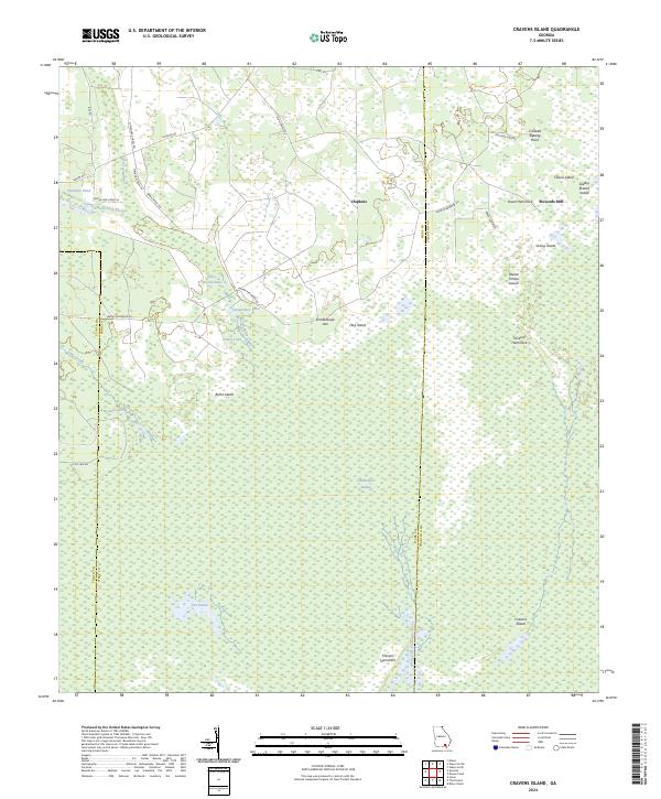
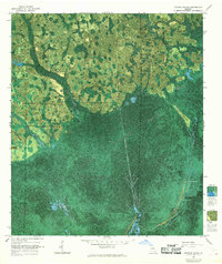 1966 Cravens Island1968 Print · USGSWare County and the Okefenokee Swamp are captured in this mid-century photomap during an era of experimental cartography. Researchers can trace the heritage of the timber industry through a Dismantled Logging Tram and local landmarks like Mc Leods Mill.
 - 1980 Map of Okefenokee Swamp, 1981 Print
 1980 Okefenokee Swamp1981 Print · USGSThe Georgia-Florida borderlands come to life in the early 1980s, centered on the immense wilderness of the Okefenokee Swamp. Genealogists and historians can trace rail-stop settlements like Fargo and Fruitland or explore the interior geography of Billys Island and Trail Ridge.
 - 1994 Map of Cravens Island
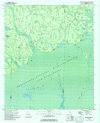 1994 Cravens Island1994 Print · USGSThe Okefenokee swamp interior in the mid-1990s reveals a complex world of island hammocks and historical timber transport. Researchers can trace the Old Railroad Grade past Hopkins and locate old landmarks like McLeods Mill and Cravens Island.
 - 2011 Map of Cravens Island, 2011 Print
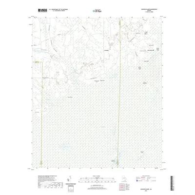
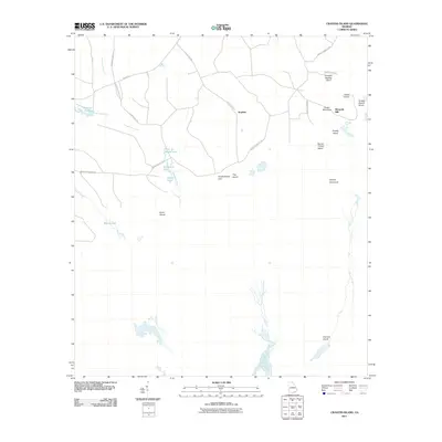 2011 Cravens Island2011 Print · USGSCovers McLeods Mill, including Hopkins, Ware County, and other nearby areas
 - 2014 Map of Cravens Island, 2014 Print
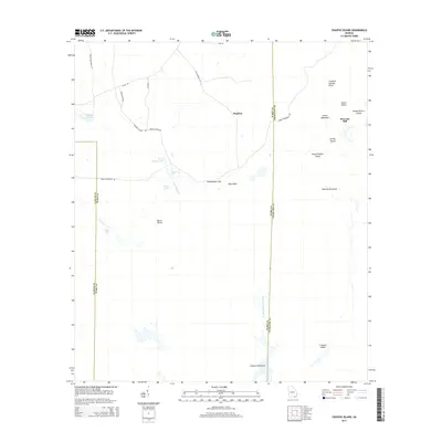 2014 Cravens Island2014 Print · USGSCovers McLeods Mill, including Hopkins, Ware County, and other nearby areas
 - 2017 Map of Cravens Island, 2017 Print
 2017 Cravens Island2017 Print · USGSCovers McLeods Mill, including Hopkins, Ware County, and other nearby areas
 - 2020 Map of Cravens Island, 2020 Print
 2020 Cravens Island2020 Print · USGSCovers McLeods Mill, including Hopkins, Ware County, and other nearby areas
 - 2024 Map of Cravens Island, 2024 Print
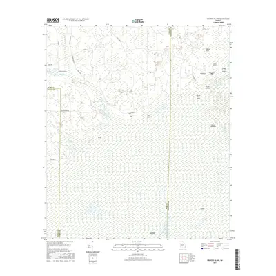
 2024 Cravens Island2024 Print · USGSWare County's deep southern wetlands are surveyed here, showing the interface between local timber roads and the protected swamp. Genealogists and historians can trace routes near Hopkins and locate family-named landmarks like McLeods Mill and Cravens Island.
End of results
Showing maps 1-11 of 11
Top cities near McLeods Mill
Frequently asked questions
- What are the different types of historical maps available for McLeods Mill?
- What is the oldest map of McLeods Mill?
- Where can I purchase historical maps of McLeods Mill for my home or office?
- Where can I download high-res historical maps of McLeods Mill?
- Are there historical topographic maps available for McLeods Mill?
- Is there historical aerial imagery available for McLeods Mill?
- Where are historical maps of McLeods Mill sourced from?