Old Maps of Talahi Island, Georgia for Academic Research
Study the evolution of Talahi Island with 15 high-resolution historic maps. Whether you're teaching, researching, or modeling changes in land use, these maps provide essential visual documentation of urban, environmental, and geographic change.
- Analyze long-term change: Track patterns in development, transportation, and natural features.
- Ideal for environmental or urban studies: Support academic projects with primary historical map data.
- Use in the classroom or lab: Educators and researchers rely on these maps to bring historical context to life.
These maps are a powerful tool for teaching, research, and visualizing how Talahi Island has changed over the decades.
Talahi Island, GA maps
(15)- 1920 Map of Bluffton
 1920 Bluffton1920 Print · USGSThe Georgia and South Carolina coastlines meet here in the early twentieth century, showing a world defined by tidal rivers and island outposts. Researchers can trace historic maritime landmarks like Ft. Pulaski, the Long Island Ferry, and family settlements at Spanish Wells or Hickory Bluff.
 - 1945 Map of Bluffton
 1945 Bluffton1945 Print · USGSThe Carolina Lowcountry and Georgia's sea islands appear here in the mid-forties, before modern bridges transformed the coast. Trace the early footprints of Bluffton and Spanish Wells, or locate maritime landmarks like Buckingham Ferry and the Oyster Packing Plant.
 - 1947 Map of Savannah
 1947 Savannah1947 Print · USGSCoastal Georgia and South Carolina are captured here in the mid-forties, showing the rail-and-river networks of the Lowcountry. Genealogists and researchers can trace old crossroads and river towns from Statesboro to Beaufort, alongside military sites like Camp Stewart and Parris Island.
 - 1948 Map of Savannah
 1948 Savannah1948 Print · USGSThe Georgia and South Carolina Lowcountry comes alive in this post-war survey of the coast and its river-fed hinterlands. Genealogists and historians can trace rail lines like the Central of Georgia RR and find established settlements such as Isle of Hope and Sylvania.
 - 1955 Map of Fort Pulaski, 1957 Print
 1955 Fort Pulaski1957 Print · USGSCoastal South Carolina and Georgia meet at the mouth of the Savannah River in the mid-fifties, where salt marshes and tidal islands define the border. Researchers can trace historic family sites on Daufuskie Island like Mary Field Cem or locate the Lighthouse (Abandoned) near Fort Pulaski.2 unique versions available
 - 1957 Map of Savannah, 1967 Print
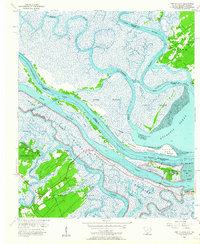
 1957 Savannah1967 Print · USGSThe Lowcountry and Georgia coastal plain are shown here in the late fifties, prior to modern expansion. Researchers can trace the rail-and-river economy through the Central of Georgia lines and the Ogeechee River wetlands.4 unique versions available
 - 1960 Map of Savannah
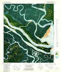
 1960 Savannah1960 Print · USGSCoastal Georgia and the South Carolina Lowcountry are captured in the late fifties, showcasing the intricate web of islands and tidal rivers before modern expansion. Researchers can trace the rail lines of the Atlantic Coast Line or locate sites like Parris Island, Beaufort, and the Tybee Lighthouse.
 - 1961 Map of Savannah
 1961 Savannah1961 Print · USGSThe Georgia and South Carolina Lowcountry comes alive in this mid-century survey of coastal marshes, barrier islands, and river networks. Genealogists and historians can trace the paths of the Seaboard Air Line RR, locate family sites near Isle of Hope, or study the grounds of Fort Stewart Military Reservation.2 unique versions available
 - 1978 Map of Fort Pulaski
 1978 Fort Pulaski1978 Print · USGSThe coastal borderlands of Georgia and South Carolina are captured here in the late seventies, showing the tidal marshes where the Savannah River meets the sea. Researchers can trace the Old Railroad Grade and locate historic markers like Daufuskie Landing and Fort Pulaski National Monument.2 unique versions available
 - 1978 Map of Beaufort
 1978 Beaufort1978 Print · USGSCoastal South Carolina and Georgia come to life in this detailed bathymetric study from the late seventies, featuring the intricate Sea Islands and the Savannah River mouth. Researchers can trace military history at Parris Island or locate inland settlements like Switzerland and Old Sheldon.2 unique versions available
 - 2011 Map of Fort Pulaski, 2011 Print
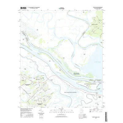
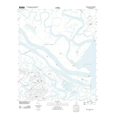 2011 Fort Pulaski2011 Print · USGSCovers Talahi Island, including Wilmington Island, Tybee Island, and other nearby areas
 - 2014 Map of Fort Pulaski, 2014 Print
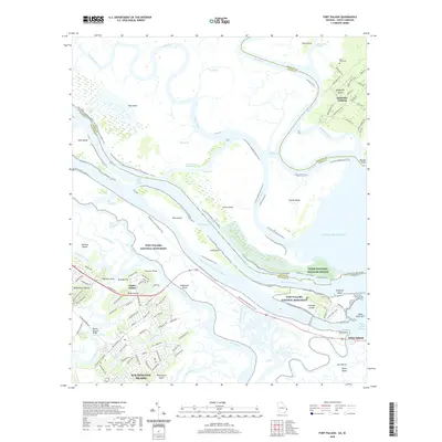
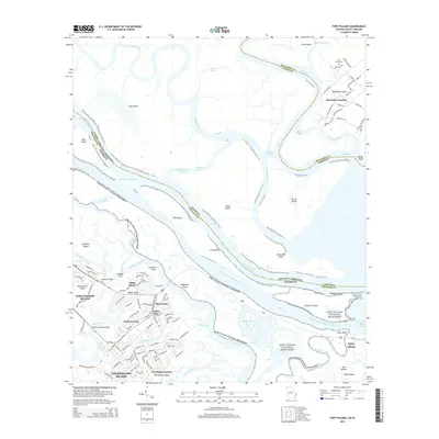 2014 Fort Pulaski2014 Print · USGSCovers Talahi Island, including Wilmington Island, Tybee Island, and other nearby areas
 - 2017 Map of Fort Pulaski, 2017 Print
 2017 Fort Pulaski2017 Print · USGSCovers Talahi Island, including Wilmington Island, Tybee Island, and other nearby areas
 - 2020 Map of Fort Pulaski, 2020 Print
 2020 Fort Pulaski2020 Print · USGSCovers Talahi Island, including Wilmington Island, Tybee Island, and other nearby areas
 - 2024 Map of Fort Pulaski, 2024 Print
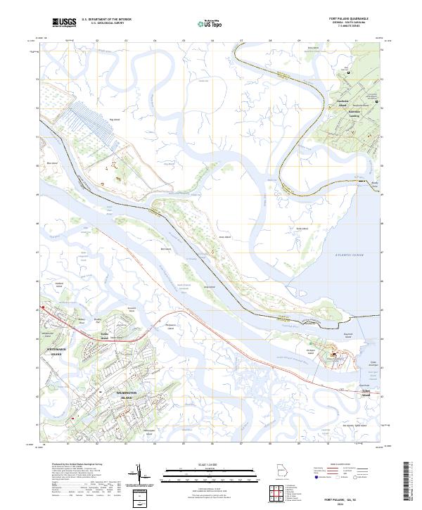 2024 Fort Pulaski2024 Print · USGSThe coastal marshes of the Georgia and South Carolina border are mapped here in the early twenty-first century. Researchers can trace the grounds of Fort Pulaski National Monument or locate family sites like the First Union African Baptist Church Cem on Daufuskie Island.
End of results
Showing maps 1-15 of 15
Top cities near Talahi Island
- Savannah historical maps
- Hilton Head Island historical maps
- Pooler historical maps
- Wilmington Island historical maps
- Garden City historical maps
- Port Wentworth historical maps
See more
Frequently asked questions
- What are the different types of historical maps available for Talahi Island?
- What is the oldest map of Talahi Island?
- Where can I purchase historical maps of Talahi Island for my home or office?
- Where can I download high-res historical maps of Talahi Island?
- Are there historical topographic maps available for Talahi Island?
- Is there historical aerial imagery available for Talahi Island?
- Where are historical maps of Talahi Island sourced from?