1960s Maps of Chattooga County, Georgia
Explore 11 historic maps of Chattooga County from the 1960s. These maps offer a rare glimpse into what life looked like during the 1960s — showing old roads, neighborhoods, homes, and landmarks that have changed or disappeared over time.
Whether you're researching your family's past, planning a metal detecting trip, or studying how Chattooga County's landscape evolved across the 1960s, these high-resolution maps are a powerful tool for exploring the history of this region.
- Focus on a specific era: All maps on this page are from the 1960s, giving you a focused view of this time period.
- See what’s changed: Compare century-old streets, trails, and buildings to today's modern landscape using overlays and satellite layers.
- Research with precision: Use these maps for genealogy, historical research, land use analysis, or educational projects.
- View, download, or print: Maps are fully viewable online in high resolution, and can be downloaded or printed for your own records.
Start exploring Chattooga County's history through authentic maps from the 1960s. This is your window into the past.
Chattooga County, GA maps
(11)- 1961 Map of Rome
 1961 Rome1961 Print · USGSNorthwest Georgia and neighboring Tennessee and Alabama are shown here at a moment of significant mid-century growth. Researchers can trace the rail networks of the Central of Georgia or locate landmarks within Chickamauga and Chattanooga Nat Military Park.
 - 1963 Map of Rome
 1963 Rome1963 Print · USGSThe tri-state corner of Georgia, Alabama, and Tennessee is captured here during a period of massive reservoir expansion and post-war growth. Genealogists and historians can trace the rail corridors of the Southern Ry or locate landmarks like Fort Oglethorpe and Cloudland Canyon State Park.
 - 1966 Map of Lyerly, 1969 Print
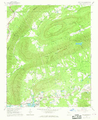
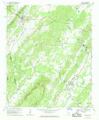 1966 Lyerly1969 Print · USGSThe Chattooga River valley in the mid-sixties reveals a landscape of ridge-and-valley agriculture and small rail-side settlements. Genealogists and local historians can trace family locations near Lyerly, Menlo, and Alpine Ch, or locate the Summerville State Fish Hatchery and the Central of Georgia rail line.2 unique versions available
 - 1967 Map of Trion, 1968 Print
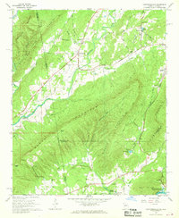
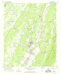 1967 Trion1968 Print · USGSNorthwest Georgia's industrial and rural character is preserved here in the late sixties as the Central of Georgia railroad threads through Trion. Genealogists can locate family landmarks like West Hill Cem, Lookout Hall Ch, and the County Home.
 - 1967 Map of Summerville, 1968 Print
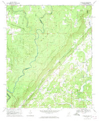
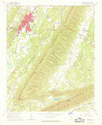 1967 Summerville1968 Print · USGSSummerville and the surrounding Chattooga Valley are captured here in the late sixties as the town expanded alongside the Central of Georgia railroad. Trace family history through rural landmarks like Gore Sch, Midway Ch, and Oak Hill Cem.
 - 1967 Map of Subligna, 1968 Print
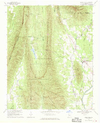
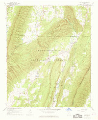 1967 Subligna1968 Print · USGSNorth Georgia's ridge-and-valley country is captured here in the late sixties, showing the rural communities of Chattooga and Walker counties. Researchers can trace local history through sites like Suttles Mill, Bethlehem Ch, and family landmarks such as Salmon Cem.2 unique versions available
 - 1967 Map of Rock Mountain, 1968 Print
 1967 Rock Mountain1968 Print · USGSFloyd County, Georgia, at the edge of the Chattooga County line shows a landscape of ridges and rail-side settlements in the late sixties. Genealogists and historians can locate rural landmarks like Possum Trot Sch, Antioch Ch, and the stop at Oreburg.2 unique versions available
 - 1967 Map of Chattoogaville, 1968 Print
 1967 Chattoogaville1968 Print · USGSThe Georgia-Alabama state line and the Chattooga River valley are captured here in the late sixties as the region's rural character remained intact. Genealogists and local historians can trace family-named sites like Johnson Cem, visit Rock Hill Ch, or locate the old Fullerton School.
 - 1967 Map of Jamestown, 1969 Print
 1967 Jamestown1969 Print · USGSNortheast Alabama and the Georgia borderlands appear here in the late sixties as a landscape of dramatic ridges and quiet valley settlements. Genealogists and hikers can trace family sites like Smith Cem and Alexander Cem or explore the wilder reaches of Little River Canyon.2 unique versions available
 - 1967 Map of Sugar Valley, 1970 Print
 1967 Sugar Valley1970 Print · USGSNorthwest Georgia's ridges and valleys are shown here in the late sixties, where timber and rail lines defined the local economy. Genealogists and historians can locate family sites like Herington Cemetery, the Sugar Valley School, and Camp Sidney Dew.2 unique versions available
 - 1968 Map of Armuchee, 1970 Print
 1968 Armuchee1970 Print · USGSFloyd and Chattooga counties are shown here in the late sixties, where the ridges of Johns Mountain meet fertile valley settlements. Researchers can trace family sites at Farmersville Cem or locate local landmarks like the Fish Hatchery and Bethel Ch.
End of results
Showing maps 1-11 of 11
Top cities of Chattooga County
Frequently asked questions
- What are the different types of historical maps available for Chattooga County?
- What is the oldest map of Chattooga County?
- Where can I purchase historical maps of Chattooga County for my home or office?
- Where can I download high-res historical maps of Chattooga County?
- Are there historical topographic maps available for Chattooga County?
- Is there historical aerial imagery available for Chattooga County?
- Where are historical maps of Chattooga County sourced from?