1960s Maps of Clay County, Georgia
Explore 5 historic maps of Clay County from the 1960s. These maps offer a rare glimpse into what life looked like during the 1960s — showing old roads, neighborhoods, homes, and landmarks that have changed or disappeared over time.
Whether you're researching your family's past, planning a metal detecting trip, or studying how Clay County's landscape evolved across the 1960s, these high-resolution maps are a powerful tool for exploring the history of this region.
- Focus on a specific era: All maps on this page are from the 1960s, giving you a focused view of this time period.
- See what’s changed: Compare century-old streets, trails, and buildings to today's modern landscape using overlays and satellite layers.
- Research with precision: Use these maps for genealogy, historical research, land use analysis, or educational projects.
- View, download, or print: Maps are fully viewable online in high resolution, and can be downloaded or printed for your own records.
Start exploring Clay County's history through authentic maps from the 1960s. This is your window into the past.
Clay County, GA maps
(5)- 1967 Map of Hatcher, 1970 Print
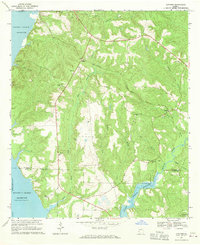 1967 Hatcher1970 Print · USGSCoastal Quitman and Clay Counties appear here in the late sixties as the reservoir reshaped the riverfront landscape. Researchers can locate family landmarks like Ricks Place and Old Pataula Cem, or trace the path of the Central of Georgia railroad.
 - 1968 Map of Eufaula South, 1970 Print
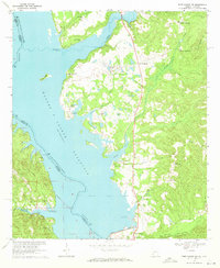
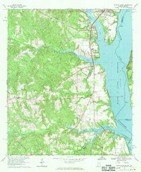 1968 Eufaula South1970 Print · USGSNear the Alabama-Georgia border in the late sixties, the landscape around the reservoir reveals a mix of river industry and deep-rooted rural life. Genealogists and local historians can trace the Old Indian Treaty Bdy and locate landmarks like Bluff City Sch and Epworth Ch.2 unique versions available
 - 1969 Map of Fort Gaines, 1970 Print
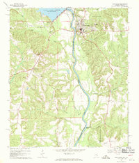 1969 Fort Gaines1970 Print · USGSThe river valley at the Alabama-Georgia line was undergoing significant change in the late sixties as the new reservoir reached its normal pool. Genealogists can trace numerous rural landmarks, from the crossroads at Shorterville to old burial grounds like Poplar Springs Cem and New Bethel Cem.2 unique versions available
 - 1969 Map of Fort Gaines NW, 1970 Print
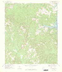 1969 Fort Gaines NW1970 Print · USGSHenry and Barbour Counties are captured here in the late sixties as the rising Walter F George Res meets the rural uplands. Researchers can trace the Indian Treaty Boundary past rural crossroads like Screamer and find old family landmarks such as Old Judson Cem.2 unique versions available
 - 1969 Map of Fort Gaines NE, 1971 Print
 1969 Fort Gaines NE1971 Print · USGSThe Chattahoochee River border between Georgia and Alabama appears here just as the reservoir era reshaped the valley. Genealogists and local historians can locate rural landmarks like New Hope Ch, Standleys Store, and Days Crossroads.
End of results
Showing maps 1-5 of 5
Top cities of Clay County
Frequently asked questions
- What are the different types of historical maps available for Clay County?
- What is the oldest map of Clay County?
- Where can I purchase historical maps of Clay County for my home or office?
- Where can I download high-res historical maps of Clay County?
- Are there historical topographic maps available for Clay County?
- Is there historical aerial imagery available for Clay County?
- Where are historical maps of Clay County sourced from?