Old Maps of Colquitt County, Georgia for Metal Detecting
Plan your next treasure hunt with 100 historic maps of Colquitt County. Find old homesites, ghost towns, trails, and gathering spots that may be lost to time — perfect for identifying promising metal detecting locations.
- Locate forgotten sites: Uncover places like long-lost settlements, abandoned rail lines, or gathering spots.
- Plan better hunts: Use map overlays combined with LiDAR or satellite views to narrow in on historically rich areas.
- Made for detectorists: Thousands of hobbyists use these maps to discover relics, coins, and hidden history.
Use these historic maps to boost your research and find new opportunities beneath the surface of Colquitt County.
Colquitt County, GA maps
(100)- 1953 Map of Dothan, 1966 Print
 1953 Dothan1966 Print · USGSSoutheast Alabama and Southwest Georgia are captured during a period of massive hydraulic and military expansion in the mid-fifties. Genealogists and historians can trace rural landmarks like Antioch Church and School, the Andrew Jackson Monument, and the early footprint of Fort Rucker Military Reservation.3 unique versions available
 - 1953 Map of Waycross, 1967 Print
 1953 Waycross1967 Print · USGSSouth Georgia's agricultural and rail heartland is captured here in the mid-1950s, showing a vast network of timber and farming towns. Researchers can trace the rail lines connecting Waycross and Tifton or locate landmarks like Jefferson Davis State Park and Lake Blackshear.2 unique versions available
 - 1954 Map of Dothan
 1954 Dothan1954 Print · USGSSoutheast Alabama and Southwest Georgia are seen here in the mid-fifties, during a decade of military expansion and rural transition. Genealogists can trace the location of country schools like Little Zion School or the grounds of Kolomoki Mounds State Park.
 - 1955 Map of Dothan
 1955 Dothan1955 Print · USGSSoutheast Alabama and Southwest Georgia are captured here in the mid-fifties, showing a landscape of river-port history and growing military bases. Researchers can trace rural life via the Andrew Jackson Monument, Bauxite mines, and the Central of Georgia RR.
 - 1956 Map of Baconton, 1957 Print
 1956 Baconton1957 Print · USGSMitchell and Dougherty counties in the mid-fifties are defined by the winding Flint River and a dense network of rural rail lines. Researchers can trace genealogical roots through dozens of local landmarks like Noahs Ark Ch, Hard Up Cem, and Sale City.2 unique versions available
 - 1956 Map of Doerun, 1958 Print
 1956 Doerun1958 Print · USGSIn the mid-1950s, the rural borderlands of Colquitt, Worth, and Mitchell counties were connected by a dense rail-and-river network. Genealogists and local historians can trace family landmarks and vanished schools from Doerun to Bridgeboro, including Parkerville Sch and the Evergreen Cem.
 - 1958 Map of Waycross
 1958 Waycross1958 Print · USGSSoutheast Georgia in the late fifties remains a landscape of deep river basins and vital rail junctions. Genealogists and historians can trace family-named landmarks and rural hubs like Union Church, South Georgia College, and the sprawling Okefenokee Swamp.2 unique versions available
 - 1971 Map of Meigs, 1972 Print
 1971 Meigs1972 Print · USGSMeigs and the surrounding Georgia countryside are mapped here in the early seventies, capturing the intersection of four counties. Genealogists can trace family landmarks like Sunset Cem, Ravenwood Sch, and the quiet community of Quality along the Seaboard Coast Line.
 - 1971 Map of Cotton, 1974 Print
 1971 Cotton1974 Print · USGSMitchell County farmland is depicted in the early 1970s, showcasing a landscape of small crossroads and rural parishes. Family historians can locate specific sites like Zion Hill Cem, the waters of Mims Millpond, and community hubs like Pebble City.
 - 1973 Map of Norman Park, 1975 Print
 1973 Norman Park1975 Print · USGSThe rural corridor of Norman Park and Crosland comes into focus in the early 1970s at the intersection of three Georgia counties. Researchers can trace the Old Railroad Grade, locate historic congregations like New Hope Ch, and find family resting places at Paulls Cem.2 unique versions available
 - 1973 Map of Omega, 1976 Print
 1973 Omega1976 Print · USGSOmega and the surrounding South Georgia countryside are shown in the early seventies as a network of rural churches and winding creeks. Genealogists and local historians can trace family ties at Mt Vernon Cem and locate community centers like Antioch Ch and Leila Ch.
 - 1974 Map of Berlin East, 1976 Print
 1974 Berlin East1976 Print · USGSThe rural borderlands of Colquitt, Cook, and Brooks counties come into focus in the mid-1970s as agricultural life centers on the LITTLE RIVER. Genealogists and local historians can trace the foundations of these communities through landmarks like China Grove Ch, the settlement of Berlin, and the OLD RAILROAD GRADE.2 unique versions available
 - 1974 Map of Doerun, 1976 Print
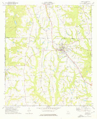 1974 Doerun1976 Print · USGSThe rural agricultural landscapes of Colquitt and Worth counties are captured here in the mid-1970s. Genealogists and historians can trace family roots through sites like Hillcrest Sch, the community at Minnesota, and cemeteries including Smith Cem.
 - 1974 Map of Sigsbee, 1976 Print
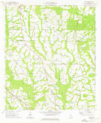 1974 Sigsbee1976 Print · USGSColquitt County in the mid-seventies remained a landscape of creek-bottom forests and dispersed agricultural communities connected by rail. Genealogists can trace family roots through the many local landmarks like Sigsbee, Minton Sch, and Kimball Ch.2 unique versions available
 - 1974 Map of Sale City, 1976 Print
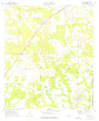 1974 Sale City1976 Print · USGSMitchell County farmland and the community of Sale City are captured here in the mid-seventies. Genealogists and local historians can trace old homesteads and family landmarks like Jackson Grove Ch, Shady Grove Cem, and the historic Stagecoach Road.
 - 1974 Map of Pineboro, 1977 Print
 1974 Pineboro1977 Print · USGSColquitt County is captured here in the mid-seventies, showing a landscape of rural schoolhouses and family-named churches. Researchers can trace the legacy of Spence Field or find old community centers like Barbers and the Reedy Creek Sch.2 unique versions available
 - 1974 Map of Hartsfield, 1977 Print
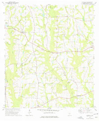 1974 Hartsfield1977 Print · USGSColquitt County, Georgia, is captured here in the mid-1970s, showcasing a landscape of established farmsteads and rural congregations. Researchers can trace local genealogy through numerous landmarks like Sinners Friend Ch, Hamilton Sch, and Mims Millpond.
 - 1974 Map of Ellenton, 1977 Print
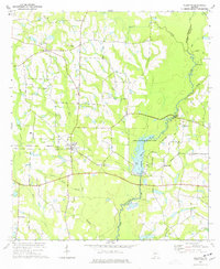 1974 Ellenton1977 Print · USGSThe agricultural and riverine landscape of South Georgia is captured here during the mid-seventies. Researchers can trace the Georgia Northern rail line and locate rural community hubs like Weeks Chapel, Cool Springs, and Buck Creek Ch.
 - 1977 Map of Chastain
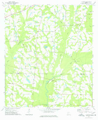 1977 Chastain1977 Print · USGSThe borderlands of Colquitt and Thomas County come into focus during the 1970s, showcasing a landscape of river-bottom farms and rural crossroads. Genealogists and local historians can trace family-named landmarks like White Cem and country steeples including New Bethel Ch and Zion Grove Ch.
 - 1978 Map of Coolidge
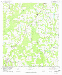 1978 Coolidge1978 Print · USGSSouthern Georgia’s agricultural heartland is captured here in the late seventies, showing the rural communities along the Colquitt and Thomas county line. Genealogists and local historians can trace family-named sites like Murphy Cem and County Line Cem or locate the Jr Academy in Coolidge.2 unique versions available
 - 1978 Map of Moultrie
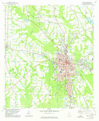 1978 Moultrie1978 Print · USGSMoultrie and its surrounding Colquitt County farmlands are captured in the late seventies as the region's rail and river networks evolved. Trace local history through sites like Strong Cem, the Old Railroad Grade, and Giles Millpond.2 unique versions available
 - 1978 Map of Berlin West
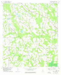 1978 Berlin West1978 Print · USGSSouth Georgia's rural landscape at the edge of the Colquitt and Brooks county line reveals a network of farming communities and rail lines in the late seventies. Researchers can trace family roots at Sardis Ch Cem, visit the settlement of Berlin, or follow the Georgia Northern Railroad.2 unique versions available
 - 1979 Map of Moultrie, 1980 Print
 1979 Moultrie1980 Print · USGSSouth Georgia’s agricultural heartland is documented here in the late 1970s, showcasing the intricate rail and river networks of Colquitt and Tift Counties. Researchers can trace historic settlements along the Georgia Northern railroad or locate landmarks like Spence Air Force Auxiliary Field and Banks Lake.2 unique versions available
 - 1981 Map of Camilla, 1982 Print
 1981 Camilla1982 Print · USGSSouthwest Georgia in the early 1980s is defined by the winding Flint River and the ancient legacy of Kolomoki Mounds State Park. Researchers can trace the agricultural and rail economy through junctions like Blakely, Pelham, and the rail lines of the Central of Georgia.2 unique versions available
 - 1988 Map of Waycross
 1988 Waycross1988 Print · USGSSouth Georgia's wiregrass and timber country is documented here in the late eighties, centered on the vital rail junction of Waycross. Genealogists and historians can trace the rural landscape from Okefenokee up to the Ocmulgee, finding sites like Lumber City and Jefferson Davis Memorial State Park.
Showing maps 1-25 of 100
Top cities of Colquitt County
- Moultrie historical maps
- Norman Park historical maps
- Doerun historical maps
- Berlin historical maps
- Funston historical maps
- Ellenton historical maps
See more
Frequently asked questions
- What are the different types of historical maps available for Colquitt County?
- What is the oldest map of Colquitt County?
- Where can I purchase historical maps of Colquitt County for my home or office?
- Where can I download high-res historical maps of Colquitt County?
- Are there historical topographic maps available for Colquitt County?
- Is there historical aerial imagery available for Colquitt County?
- Where are historical maps of Colquitt County sourced from?