1970s Maps of Cook County, Georgia
Explore 10 historic maps of Cook County from the 1970s. These maps offer a rare glimpse into what life looked like during the 1970s — showing old roads, neighborhoods, homes, and landmarks that have changed or disappeared over time.
Whether you're researching your family's past, planning a metal detecting trip, or studying how Cook County's landscape evolved across the 1970s, these high-resolution maps are a powerful tool for exploring the history of this region.
- Focus on a specific era: All maps on this page are from the 1970s, giving you a focused view of this time period.
- See what’s changed: Compare century-old streets, trails, and buildings to today's modern landscape using overlays and satellite layers.
- Research with precision: Use these maps for genealogy, historical research, land use analysis, or educational projects.
- View, download, or print: Maps are fully viewable online in high resolution, and can be downloaded or printed for your own records.
Start exploring Cook County's history through authentic maps from the 1970s. This is your window into the past.
Cook County, GA maps
(10)- 1973 Map of Adel, 1975 Print
 1973 Adel1975 Print · USGSCentral Cook County comes alive in the 1970s as the rail corridor shapes the growth of Adel and Sparks. Genealogists can locate family landmarks like Baker Cem or trace rural life through Wagon Wheel and Brushy Creek Ch.
 - 1973 Map of New Lois, 1975 Print
 1973 New Lois1975 Print · USGSThe tri-county border of Cook, Berrien, and Lowndes Counties comes alive in the mid-seventies along the banks of the Withlacoochee River. Genealogists and historians can trace rural community life through landmarks like New Lois, Money Cem, and Shady Grove Ch.
 - 1973 Map of Sapps Lake, 1975 Print
 1973 Sapps Lake1975 Print · USGSBerrien and Cook counties are shown here in the early seventies, a landscape shaped by the winding Withlacoochee River. Researchers can locate rural landmarks such as West Berrien School, Sapps Lake, and churches like Liberty Church.
 - 1973 Map of Cecil, 1975 Print
 1973 Cecil1975 Print · USGSThe rural landscape of Cook and Lowndes counties comes into focus in the early 1970s, dominated by the Georgia South and Florida rail line. Researchers can trace the history of local congregations at Jerusalem Missionary Ch and Salem Ch, or locate family sites near Cecil Bay.
 - 1973 Map of Nashville West, 1975 Print
 1973 Nashville West1975 Print · USGSBerrien and Cook counties appear in the early seventies, defined by the winding swamp systems of the New and Withlacoochee rivers. Researchers can locate the Old Railroad Grade and historic churches like Beulah Ch and Community Ch.
 - 1973 Map of Lenox, 1976 Print
 1973 Lenox1976 Print · USGSCoastal plain settlements in Tift, Cook, and Berrien counties are captured here in the early 1970s as agricultural life centered on the rail line and river basins. Researchers can trace the Georgia Southern and Florida rail through Lenox and Staunton, or locate rural landmarks like Bethlehem Ch and the Landing Strip near the New River.
 - 1973 Map of Omega, 1976 Print
 1973 Omega1976 Print · USGSOmega and the surrounding South Georgia countryside are shown in the early seventies as a network of rural churches and winding creeks. Genealogists and local historians can trace family ties at Mt Vernon Cem and locate community centers like Antioch Ch and Leila Ch.
 - 1974 Map of Berlin East, 1976 Print
 1974 Berlin East1976 Print · USGSThe rural borderlands of Colquitt, Cook, and Brooks counties come into focus in the mid-1970s as agricultural life centers on the LITTLE RIVER. Genealogists and local historians can trace the foundations of these communities through landmarks like China Grove Ch, the settlement of Berlin, and the OLD RAILROAD GRADE.2 unique versions available
 - 1974 Map of Ellenton, 1977 Print
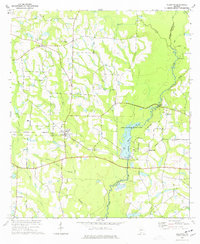 1974 Ellenton1977 Print · USGSThe agricultural and riverine landscape of South Georgia is captured here during the mid-seventies. Researchers can trace the Georgia Northern rail line and locate rural community hubs like Weeks Chapel, Cool Springs, and Buck Creek Ch.
 - 1979 Map of Moultrie, 1980 Print
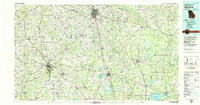 1979 Moultrie1980 Print · USGSSouth Georgia’s agricultural heartland is documented here in the late 1970s, showcasing the intricate rail and river networks of Colquitt and Tift Counties. Researchers can trace historic settlements along the Georgia Northern railroad or locate landmarks like Spence Air Force Auxiliary Field and Banks Lake.2 unique versions available
End of results
Showing maps 1-10 of 10
Top cities of Cook County
Frequently asked questions
- What are the different types of historical maps available for Cook County?
- What is the oldest map of Cook County?
- Where can I purchase historical maps of Cook County for my home or office?
- Where can I download high-res historical maps of Cook County?
- Are there historical topographic maps available for Cook County?
- Is there historical aerial imagery available for Cook County?
- Where are historical maps of Cook County sourced from?