1990s Maps of Dawson County, Georgia
Explore 9 historic maps of Dawson County from the 1990s. These maps offer a rare glimpse into what life looked like during the 1990s — showing old roads, neighborhoods, homes, and landmarks that have changed or disappeared over time.
Whether you're researching your family's past, planning a metal detecting trip, or studying how Dawson County's landscape evolved across the 1990s, these high-resolution maps are a powerful tool for exploring the history of this region.
- Focus on a specific era: All maps on this page are from the 1990s, giving you a focused view of this time period.
- See what’s changed: Compare century-old streets, trails, and buildings to today's modern landscape using overlays and satellite layers.
- Research with precision: Use these maps for genealogy, historical research, land use analysis, or educational projects.
- View, download, or print: Maps are fully viewable online in high resolution, and can be downloaded or printed for your own records.
Start exploring Dawson County's history through authentic maps from the 1990s. This is your window into the past.
Dawson County, GA maps
(9)- 1993 Map of Ball Ground East, 1999 Print
 1993 Ball Ground East1999 Print · USGSCherokee County in the 1990s remained a landscape of deep river valleys and quiet country crossroads. Genealogists and historians can trace family roots through numerous local landmarks like Mica Ch, Ophir, and the cemeteries near Cane Creek Cem.
 - 1993 Map of Matt, 1999 Print
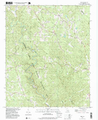
 1993 Matt1999 Print · USGSUpper Forsyth and Dawson Counties appear in the 1990s as a landscape of rural settlements and forested river bends. Genealogists and local historians can trace the Etowah River past the Covered Bridge or locate landmarks like Lebanon Ch and Heardville.
 - 1997 Map of Dawsonville, 1999 Print
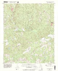
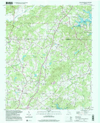
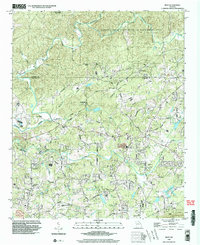
 1997 Dawsonville1999 Print · USGSDawsonville and the surrounding foothills appear in detail during the late nineties, showing a landscape defined by the winding Etowah River. Local historians can trace old community centers like Auraria and Landrum, alongside genealogical markers such as New Bethel Cem and Antioch Ch.
 - 1997 Map of Nelson, 1999 Print
 1997 Nelson1999 Print · USGSThe foothills of North Georgia appear in the late nineties, documenting the rural settlements and mountain ridges of the Pickens and Cherokee county lines. Researchers can find old congregations like Yellow Creek Ch and trace the industrial landscape of Marblehill and its nearby Quarry sites.
 - 1997 Map of Juno, 1999 Print
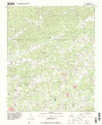
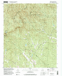
 1997 Juno1999 Print · USGSDawson County in the late nineties is documented here as the local landscape transitioned between protected forest and developing rural hubs. Researchers can locate community centers like Juno, the landmark Covered Bridge, and various historic sites including McKees Chapel and West Side Sch.
 - 1997 Map of Coal Mountain, 2000 Print
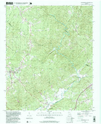
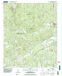
 1997 Coal Mountain2000 Print · USGSUpper Forsyth County in the late nineties shows a landscape defined by the encroaching waters of the reservoir and long-standing rural crossroads. Researchers can trace historic family landmarks and community hubs like Silver City, Coal Mountain, and the Byrd Cem.
 - 1997 Map of Nimblewill, 2000 Print
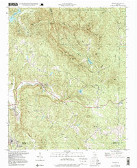
 1997 Nimblewill2000 Print · USGSDawson and Lumpkin Counties come alive in this late-nineties survey of the southern Blue Ridge peaks and forest lands. Researchers can trace rural lineages through Wesley Chapel Cem, locate the Lookout Tower on Frosty Mountain, or find the small community of Emma.
 - 1999 Map of Ball Ground East, 2003 Print
 1999 Ball Ground East2003 Print · USGSCherokee County at the close of the twentieth century remains a landscape of river valleys and rural crossroads. Genealogists and local researchers can trace family landmarks and community anchors like Liberty Ch, Cane Creek Cem, and the old settlement at Ophir.
 - 1999 Map of Matt, 2003 Print
 1999 Matt2003 Print · USGSNorth of Cumming at the turn of the millennium, this area shows the rural character of the Dawson and Forsyth borderlands before rapid suburban expansion. Researchers can trace family roots at Mt Lebanon Ch, Heard Cem, and the old crossroads of Matt.
End of results
Showing maps 1-9 of 9
Top cities of Dawson County
Frequently asked questions
- What are the different types of historical maps available for Dawson County?
- What is the oldest map of Dawson County?
- Where can I purchase historical maps of Dawson County for my home or office?
- Where can I download high-res historical maps of Dawson County?
- Are there historical topographic maps available for Dawson County?
- Is there historical aerial imagery available for Dawson County?
- Where are historical maps of Dawson County sourced from?