1970s Maps of Douglas County, Georgia
Explore 5 historic maps of Douglas County from the 1970s. These maps offer a rare glimpse into what life looked like during the 1970s — showing old roads, neighborhoods, homes, and landmarks that have changed or disappeared over time.
Whether you're researching your family's past, planning a metal detecting trip, or studying how Douglas County's landscape evolved across the 1970s, these high-resolution maps are a powerful tool for exploring the history of this region.
- Focus on a specific era: All maps on this page are from the 1970s, giving you a focused view of this time period.
- See what’s changed: Compare century-old streets, trails, and buildings to today's modern landscape using overlays and satellite layers.
- Research with precision: Use these maps for genealogy, historical research, land use analysis, or educational projects.
- View, download, or print: Maps are fully viewable online in high resolution, and can be downloaded or printed for your own records.
Start exploring Douglas County's history through authentic maps from the 1970s. This is your window into the past.
Douglas County, GA maps
(5)- 1973 Map of Hulett, 1975 Print
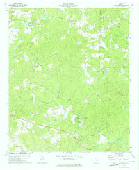 1973 Hulett1975 Print · USGSCarroll and Douglas Counties are captured in the early 1970s, showing a landscape of traditional creek-side industry and rural parish life. Genealogists and historians can trace family locations near Mars Hill Cem, Banning Mills, or along the Central of Georgia tracks.2 unique versions available
 - 1973 Map of Nebo, 1975 Print
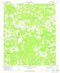 1973 Nebo1975 Print · USGSPaulding and Douglas Counties are captured here in the early 1970s, showing a rural landscape before the rapid expansion of the Atlanta metro area. Genealogists and local historians can locate several country churches and settlements, including Sudie, Brownsville, and the Callie Harbin Ch.3 unique versions available
 - 1973 Map of Villa Rica, 1975 Print
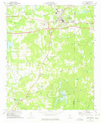 1973 Villa Rica1975 Print · USGSVilla Rica and its rural surroundings are captured here in the early seventies, showing a period of modern transit growth along the Southern rail line. Genealogists and local historians can trace family locations near Old Carrollton, Ithaca, and churches like Macedonia Ch and Ephesus Church.3 unique versions available
 - 1973 Map of Winston, 1975 Print
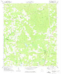
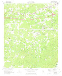 1973 Winston1975 Print · USGSDouglas County was undergoing significant change in the early seventies as the new interstate corridor was cut through the countryside. Researchers can trace family sites and community landmarks like Bill Arp, Fouts Mill, and several historic congregations including Old Mtn Top Ch.3 unique versions available
 - 1973 Map of New Georgia, 1975 Print
 1973 New Georgia1975 Print · USGSGeorgia's Piedmont region in the 1970s shows a landscape of growing rural communities and deep-rooted local history. Genealogists and researchers can trace family landmarks like Wesley Chapel, Pine Log Cem, and the settlement of New Georgia near the Little Tallapoosa River.2 unique versions available
End of results
Showing maps 1-5 of 5
Top cities of Douglas County
Frequently asked questions
- What are the different types of historical maps available for Douglas County?
- What is the oldest map of Douglas County?
- Where can I purchase historical maps of Douglas County for my home or office?
- Where can I download high-res historical maps of Douglas County?
- Are there historical topographic maps available for Douglas County?
- Is there historical aerial imagery available for Douglas County?
- Where are historical maps of Douglas County sourced from?