Old Maps of Effingham County, Georgia
Explore 138 old maps of Effingham County, spanning from 1918 to today. These high-resolution historic maps reveal how streets, neighborhoods, landmarks, and natural features evolved over time — perfect for genealogy, metal detecting, research, and local history exploration.
What you can do with these maps:
- See how Effingham County changed over time: Compare historical maps to modern-day views to trace roads, homesites, rail lines & more.
- View detailed metadata: Each map includes creators, publishers, year, scale, and archive source.
- Overlay maps with satellite & LiDAR: Visualize the past alongside modern tools to explore terrain & human change.
- Trusted historical sources: Maps sourced from the USGS, Library of Congress, and other archives.
- Access maps your way: View online, download high-res files, or order prints for personal or research use.
Start exploring old maps of Effingham County to uncover forgotten places, hidden landmarks, and the deep history beneath your feet.
Effingham County, GA maps
(138)- 1918 Map of Oliver, 1972 Print
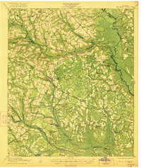
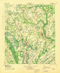
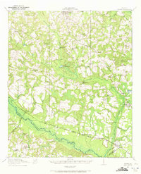 1918 Oliver1972 Print · USGSScreven County at the end of the Great War was a landscape defined by its river landings and intersecting railroads. Genealogists can trace family footprints at dozens of rural landmarks, from Lee Memorial Church and Jackson School to the depots in Oliver and Newington.
 - 1919 Map of Pineland
 1919 Pineland1919 Print · USGSThe Lowcountry landscape of Jasper and Hampton counties is captured here at the end of the post-war era, showing a transition between rail-centered towns and timber-rich wetlands. Genealogists can locate family ties at Highsmith's Sawmill, Good Hope Church, and the Pineland Club.3 unique versions available
 - 1919 Map of Shirley
 1919 Shirley1919 Print · USGSThe Savannah River borderlands in the years following the Great War reveal a landscape of active river landings, logging railroads, and tight-knit rural communities. You can trace early 20th-century family roots at Heavenly Rest Ch, Cypressvale School, and the busy Hudsons Ferry Landing.3 unique versions available
 - 1919 Map of Egypt
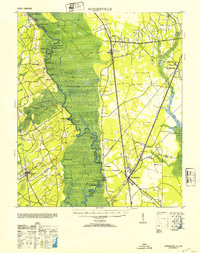
 1919 Egypt1919 Print · USGSEffingham County during the late teens was a thriving network of river landings and competing railroad lines. Genealogists can trace family names at local landmarks like Dasher School, Bethel Church, and riverside hubs like Joe Cone Landing.3 unique versions available
 - 1920 Map of Hardeeville
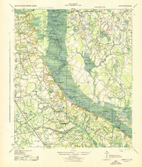
 1920 Hardeeville1920 Print · USGSThe Savannah River floodplain in the years following the Great War reveals a world of river landings and emerging rail towns. Genealogists and historians can trace the transition from water to rail through features like Becks Ferry, Hardeeville, and the Indian Mound.
 - 1920 Map of Meldrim
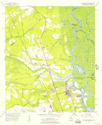
 1920 Meldrim1920 Print · USGSCoastal Georgia during the early post-war period is defined here by the winding Ogeechee River and a busy intersection of rail lines. Genealogists and researchers can trace family roots near Clyde or locate rural landmarks like Zion Church and Miller Chapel.
 - 1920 Map of Oliver
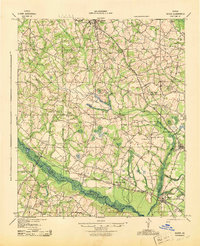
 1920 Oliver1920 Print · USGSScreven County agriculture and river commerce thrived in the years following the Great War. Genealogists can locate family landmarks across the Ogeechee basin, from Double Head Church and Middle Ground School to the bustling rail stops at Halcyondale and Oliver.2 unique versions available
 - 1921 Map of Brooklet
 1921 Brooklet1921 Print · USGSBulloch County's rural heartland is captured here during the 1920s, showing a landscape defined by small-town rail junctions and river fords. Genealogists can trace family footprints at vanished landmarks like Slabville School, Corinth Church, and Ebenezer Ford.2 unique versions available
 - 1939 Map of Egypt, 1957 Print
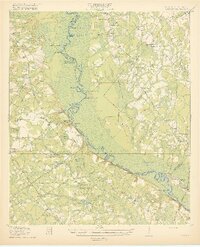
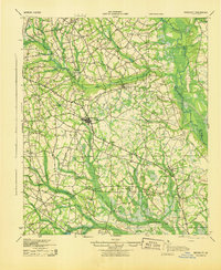
 1939 Egypt1957 Print · USGSEffingham County in the late thirties is a region defined by its river landings and a growing network of roads and rails. Genealogists can locate family landmarks such as Turkey Creek Church, Shiloh School, and the Georgia and Florida RR.
 - 1942 Map of Meldrim
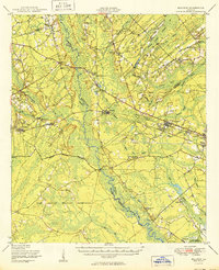
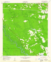
 1942 Meldrim1942 Print · USGSThe Ogeechee River corridor and its railway junctions are captured here in a series of surveys finalized just before the mid-century. Researchers can trace the layout of early settlements like Meldrim and Ellabel or locate ancestral sites at Miller Chapel and Zion Church.
 - 1942 Map of Savannah
 1942 Savannah1942 Print · USGSCoastal Georgia and the South Carolina borderlands come alive in this wartime survey of the Savannah riverfront. Genealogists and historians can trace industrial housing at Port Wentworth Colored Village, river landmarks like Fort Jackson, and the footprint of the Ogeechee Canal.
 - 1943 Map of Pineland
 1943 Pineland1943 Print · USGSCoastal South Carolina settlements between Hampton and Jasper counties are captured here in the early 1940s. Genealogists can trace family footprints through numerous rural landmarks like Highsmith Sawmill, Pineland Club, and Nixville Sch.2 unique versions available
 - 1943 Map of Brooklet
 1943 Brooklet1943 Print · USGSBulloch and Effingham Counties come alive in the early 1940s, showing a landscape of small farms and riverside landings. Genealogists can locate family landmarks like Knight Sch, Black Creek Ch, and the crossings along the Ogeechee River.
 - 1943 Map of Hardeeville
 1943 Hardeeville1943 Print · USGSCoastal South Carolina and Georgia meet along the river in the 1940s, showing a landscape shaped by tidewater swamps and early rail corridors. Researchers can trace historic river access at Becks Ferry or locate the Indian Mound near Purrysburg.
 - 1943 Map of Egypt
 1943 Egypt1943 Print · USGSEffingham County during the mid-forties shows a landscape shaped by river landings and the timber-hauling rail lines. Genealogists and historians can trace the positions of family-named landmarks like St Peters Bluff and rural institutions such as Laurel Hill Ch or Midway Sch.
 - 1943 Map of Shirley
 1943 Shirley1943 Print · USGSThe Savannah River valley during the early 1940s reveals a landscape of river landings and rail-side settlements. Genealogists can trace family roots through sites like Heavenly Rest Ch, Mizpah Sch, and the riverside Hudson Ferry Landing.
 - 1943 Map of Millen
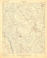
 1943 Millen1943 Print · USGSEastern Georgia during the early 1940s is shown here as a network of rail-side towns and river landings. Genealogists and local historians can locate many rural landmarks including Habersham Sch, Lovetts Cemetery, and the river crossing at Burtons Ferry.
 - 1943 Map of Oliver
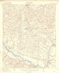
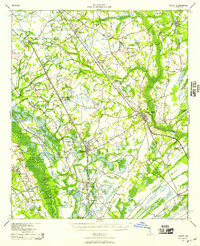
 1943 Oliver1943 Print · USGSScreven County is depicted during the early 1940s, showing a landscape defined by the Ogeechee River and bustling rail lines. Genealogists can locate family landmarks such as Jackson Sch, Lee Memorial Ch, and the community of Halcyondale.
 - 1947 Map of Savannah
 1947 Savannah1947 Print · USGSCoastal Georgia and South Carolina are captured here in the mid-forties, showing the rail-and-river networks of the Lowcountry. Genealogists and researchers can trace old crossroads and river towns from Statesboro to Beaufort, alongside military sites like Camp Stewart and Parris Island.
 - 1948 Map of Savannah
 1948 Savannah1948 Print · USGSThe Georgia and South Carolina Lowcountry comes alive in this post-war survey of the coast and its river-fed hinterlands. Genealogists and historians can trace rail lines like the Central of Georgia RR and find established settlements such as Isle of Hope and Sylvania.
 - 1950 Map of Meldrim
 1950 Meldrim1950 Print · USGSCoastal Georgia in the late forties is defined by the rail lines and river swamps that connect inland towns like Meldrim and Blitchton. Genealogists can trace family landmarks and rural life at the Scaffletown School, Bethesda Ch, and Blitch Cem.2 unique versions available
 - 1953 Map of Hardeeville
 1953 Hardeeville1953 Print · USGSThe riverfront and rail corridors of the South Carolina lowcountry are frozen in time just after the war. Researchers can trace the timber industry through sites like Ebenezer Log, locate the old Okatie Club, or find the Indian Mound near Purrysburg.
 - 1955 Map of Port Wentworth, 1957 Print
 1955 Port Wentworth1957 Print · USGSCoastal Georgia at the mid-century reveals a complex landscape of river commerce and expanding rail networks north of Savannah. Genealogists and historians can trace family-named sites like Meinhard, Cherokee Hill Cem, and the old Goshen Ch as they appeared before modern development.2 unique versions available
 - 1957 Map of Savannah, 1967 Print
 1957 Savannah1967 Print · USGSThe Lowcountry and Georgia coastal plain are shown here in the late fifties, prior to modern expansion. Researchers can trace the rail-and-river economy through the Central of Georgia lines and the Ogeechee River wetlands.4 unique versions available
 - 1958 Map of Meldrim SE, 1961 Print
 1958 Meldrim SE1961 Print · USGSThe Ogeechee River corridor is shown in the late fifties as rail lines like the Central of Georgia connect local towns. Researchers can trace family sites like Hopeton Plantation, Ennis Cem, and Spring Hill Ch.4 unique versions available
Showing maps 1-25 of 138
Top cities of Effingham County
Frequently asked questions
- What are the different types of historical maps available for Effingham County?
- What is the oldest map of Effingham County?
- Where can I purchase historical maps of Effingham County for my home or office?
- Where can I download high-res historical maps of Effingham County?
- Are there historical topographic maps available for Effingham County?
- Is there historical aerial imagery available for Effingham County?
- Where are historical maps of Effingham County sourced from?