1970s Maps of Effingham County, Georgia
Explore 10 historic maps of Effingham County from the 1970s. These maps offer a rare glimpse into what life looked like during the 1970s — showing old roads, neighborhoods, homes, and landmarks that have changed or disappeared over time.
Whether you're researching your family's past, planning a metal detecting trip, or studying how Effingham County's landscape evolved across the 1970s, these high-resolution maps are a powerful tool for exploring the history of this region.
- Focus on a specific era: All maps on this page are from the 1970s, giving you a focused view of this time period.
- See what’s changed: Compare century-old streets, trails, and buildings to today's modern landscape using overlays and satellite layers.
- Research with precision: Use these maps for genealogy, historical research, land use analysis, or educational projects.
- View, download, or print: Maps are fully viewable online in high resolution, and can be downloaded or printed for your own records.
Start exploring Effingham County's history through authentic maps from the 1970s. This is your window into the past.
Effingham County, GA maps
(10)- 1978 Map of Stilson
 1978 Stilson1978 Print · USGSSoutheast Bulloch County during the late seventies reveals a landscape of dispersed settlements and rural congregations. Trace the Old RR Grade through Stilson or locate family roots at Old Fellowship Ch and New Fellowship Ch.
 - 1978 Map of Springfield North
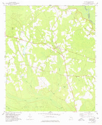
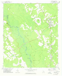
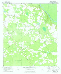
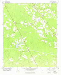
 1978 Springfield North1978 Print · USGSEffingham County during the late seventies is captured here at the intersection of rural life and regional rail networks. Genealogists and local historians can trace family locations near Clyo, Kieffer Cem, and several country churches like Turkey Branch Ch.
 - 1978 Map of Guyton
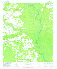
 1978 Guyton1978 Print · USGSEffingham and Bulloch counties are documented here in the late 1970s, as the Ogeechee River snakes past historic river landings. Genealogists and local historians can trace family-named sites like Ferguson Cem, St Peters Bluff, and the Old Railroad Grade connecting Pineora and Marlow.
 - 1978 Map of Oliver
 1978 Oliver1978 Print · USGSIn the late 1970s, the rural landscapes of Screven County remained tied to the Central of Georgia rail corridor. Researchers can trace the layout of small settlements like Oliver and Halcyondale or locate family sites near St Johns Ch and Cyphus Pond.
 - 1978 Map of Leefield
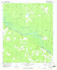
 1978 Leefield1978 Print · USGSBulloch and Effingham Counties in the late seventies remain deeply rooted in their agricultural and riverine origins. Genealogists and local historians can trace legacy paths along the Ogeechee River or locate family sites near Leefield and the Jerusalem Ch.
 - 1978 Map of Pineland
 1978 Pineland1978 Print · USGSThe Lowcountry landscape of Jasper County is documented here during the late 1970s, showcasing the intricate wetlands along the Savannah River. Genealogists can trace family footprints through historic sites like Black Swamp Cem and rural congregations including Antioch Ch and St Marys Ch.
 - 1978 Map of Kildare
 1978 Kildare1978 Print · USGSThe Savannah River borderlands in the late 1970s show a landscape of rail-side settlements and riverside landings. Genealogists can trace family names through the St Peters Cem and Mizpah Ch or locate old crossings at Hudson Ferry Landing.
 - 1978 Map of Brighton
 1978 Brighton1978 Print · USGSThe Savannah River floodplain at the South Carolina and Georgia border is documented here in the late seventies. Genealogists and local historians can trace rural river landings and community churches like Tuckasee King Landing, Taylor Ch, and the SEABOARD COAST LINE rail corridor.
 - 1978 Map of Egypt
 1978 Egypt1978 Print · USGSCoastal Georgia's rural interior comes into focus during the late seventies, centered on the railroad towns of Egypt and Tusculum. Genealogists and historians can trace family locations through sites like Egypt Cem, Thomas Chapel, and Elam Cem.
 - 1978 Map of Springfield South
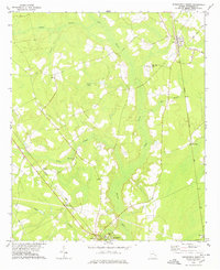
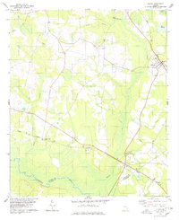
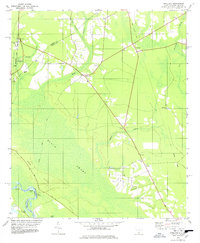
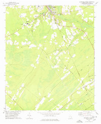 1978 Springfield South1978 Print · USGSEffingham County in the late seventies reveals a landscape of growing towns and established rail corridors. Genealogists can locate family landmarks such as Effingham Academy, Goodwill Ch, and several rural Cem sites tucked along Ebenezer Creek.
End of results
Showing maps 1-10 of 10
Top cities of Effingham County
Frequently asked questions
- What are the different types of historical maps available for Effingham County?
- What is the oldest map of Effingham County?
- Where can I purchase historical maps of Effingham County for my home or office?
- Where can I download high-res historical maps of Effingham County?
- Are there historical topographic maps available for Effingham County?
- Is there historical aerial imagery available for Effingham County?
- Where are historical maps of Effingham County sourced from?