Old Maps of Elbert County, Georgia for Hiking & Exploration
Hike through history with 111 historic maps of Elbert County. Explore old trails, ghost towns, and forgotten backroads — perfect for outdoor adventurers and local explorers.
- Rediscover forgotten places: Map out old mining camps, roads, and footpaths that no longer exist on modern maps.
- Layer with modern tools: Combine with LiDAR or satellite views to plan hikes through historical terrain.
- Made for exploration: Popular among hikers, overlanders, and local history lovers.
Use these maps to find adventure and explore the hidden past of Elbert County.
Elbert County, GA maps
(111)- 1891 Map of Carnesville
 1891 Carnesville1891 Print · USGSNortheast Georgia in the late nineteenth century is documented here as a landscape of small river settlements and emerging rail towns. Genealogists can trace family roots through locations like Jewellville, Fort Lamar, and the river crossing at Braggs Fy.6 unique versions available
 - 1893 Map of Elberton
 1893 Elberton1893 Print · USGSThe Georgia-South Carolina borderlands come alive in the 1890s, centering on the river-and-rail economy of the Savannah Valley. Genealogists can trace family names and early community hubs through Browns Ferry, Coldwater Church, and Ruckersville.5 unique versions available
 - 1906 Map of Crawfordville
 1906 Crawfordville1906 Print · USGSUpper Georgia and the South Carolina border come alive in this early century survey, showing a landscape defined by river ferries and mining sites. Genealogists can trace family roots through old post offices like Triplett P.O. or find historic crossings like Fishdam Ferry and the Columbia Mines.3 unique versions available
 - 1953 Map of Athens, 1966 Print
 1953 Athens1966 Print · USGSGeorgia's Piedmont and Savannah River borderlands come alive in this mid-century survey of the region surrounding Athens and Augusta. Trace the rail-and-river economy through the Georgia RR and landmarks like the Fort Gordon Military Reservation.3 unique versions available
 - 1954 Map of Greenville, 1965 Print
 1954 Greenville1965 Print · USGSThe Upstate and Northeast Georgia are captured here during a decade of massive transformation as new reservoirs reshaped the Piedmont. Genealogists and hikers can trace the Appalachian Trail over Brasstown Bald or locate old community centers like Demorest, Westminster, and Royston.3 unique versions available
 - 1955 Map of Broad, 1956 Print
 1955 Broad1956 Print · USGSWilkes and Elbert counties meet along the Broad River in the mid-1950s as the rising waters of Clark Hill Reservoir begin to transform the landscape. Family historians can trace rural congregations and early schools like Popes Chapel, Tabor Ch, and Pole Branch Sch.2 unique versions available
 - 1955 Map of Chennault, 1956 Print
 1955 Chennault1956 Print · USGSThe Georgia-South Carolina border was undergoing a massive transformation in the mid-fifties as the Clark Hill Reservoir filled. Researchers can trace rural life in settlements like Chennault and Graball or locate family landmarks like Mt Pleasant Ch and New Tabernacle Sch.3 unique versions available
 - 1958 Map of Greenville
 1958 Greenville1958 Print · USGSThe Piedmont and Blue Ridge foothills come alive in this mid-century survey of the Upstate and Northeast Georgia. Trace the regional rail-and-river economy through the Southern Railway corridors and early reservoir developments like Lake Sidney Lanier.
 - 1958 Map of Athens
 1958 Athens1958 Print · USGSNorth-central Georgia and the Savannah River valley are captured in the late fifties, showing the region as the new reservoirs were filling. Researchers can trace historic rail lines like the Georgia RR and locate rural landmarks such as Social Circle, Graves Mountain, and the Fort Gordon Military Reservation.
 - 1958 Map of Danielsville, 1959 Print
 1958 Danielsville1959 Print · USGSNortheast Georgia at the end of the fifties reveals a landscape defined by the Broad River and a dense network of rural parish life. Genealogists can trace family roots through numerous local landmarks like Harrison Sch, Masons Mill, and Vanna Chapel.
 - 1958 Map of Elberton, 1959 Print
 1958 Elberton1959 Print · USGSElbert County during the late fifties shows a landscape of deep-rooted rural communities and a thriving granite industry. Genealogists and local historians can locate dozens of country churches and schools like Liberty Ch and Downers Grove Sch, or trace the tracks of the Southern Railway.2 unique versions available
 - 1959 Map of Athens
 1959 Athens1959 Print · USGSNortheast Georgia and the South Carolina borderlands appear here in the mid-fifties, during a decade of infrastructure growth. Genealogists and historians can trace the rail-and-river geography of towns like Social Circle, the sprawl of Fort Gordon Military Reservation, and the newly formed Clark Hill Reservoir.
 - 1959 Map of Hartwell Dam, 1961 Print
 1959 Hartwell Dam1961 Print · USGSThe Savannah River borderlands are captured here during the late fifties as the new Hartwell Dam began to reshape the valley. Genealogists can locate numerous country churches like Cokesbury Ch and Sardis Ch, or trace the old roads around Montevideo.4 unique versions available
 - 1959 Map of Hartwell, 1961 Print
 1959 Hartwell1961 Print · USGSHart County was undergoing a significant transformation in the late fifties as the new reservoir began to fill the northern valleys. Genealogists and local historians can trace the foundations of this community through landmarks like Nancy Hart Sch, the Hartwell Railway, and numerous country churches including Bio Ch.2 unique versions available
 - 1963 Map of Athens
 1963 Athens1963 Print · USGSGeorgia's Piedmont and the Savannah River valley are captured in the early sixties as major reservoirs and military installations reshaped the landscape. Researchers can trace the development of Clark Hill Reservoir, locate the Fort Gordon Military Reservation, and find historic towns like Social Circle and Eatonton.
 - 1964 Map of Iva
 1964 Iva1964 Print · USGSUpper South Carolina in the mid-sixties reveals a landscape of railroad towns and country congregations along the Georgia border. Genealogists can trace family footprints through numerous rural landmarks like Goodhope Cem, Barnes Station, and Pleasant Grove Ch.3 unique versions available
 - 1964 Map of Lowndesville, 1965 Print
 1964 Lowndesville1965 Print · USGSThe South Carolina and Georgia borderlands near the Savannah River are captured here in the mid-1960s. Genealogists can trace family roots through numerous sites like Old McCalla Cemetery, Smyrna Church, and the Atlantic Coast Line rail corridor.3 unique versions available
 - 1964 Map of Calhoun Falls, 1965 Print
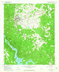 1964 Calhoun Falls1965 Print · USGSCalhoun Falls and the Savannah River valley are documented here in the mid-sixties as the reservoir transformed the landscape. Trace rail history and family roots via the Atlantic Coast Line, McAllister Chapel, and the Ellison Sch.3 unique versions available
 - 1964 Map of Heardmont, 1966 Print
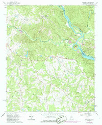 1964 Heardmont1966 Print · USGSElbert County, Georgia, and the South Carolina borderlands are captured here during a period of major infrastructure change in the mid-sixties. Genealogists and researchers can locate numerous country churches and schools like Hunters Chapel, Banks Sch, and New Hope Ch among the river shoals.3 unique versions available
 - 1970 Map of Jacksons Crossroads, 1973 Print
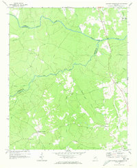 1970 Jacksons Crossroads1973 Print · USGSWilkes County and its neighbors come alive in the early 1970s as the Broad River winds through a landscape of historic small settlements. Researchers can trace the Old Railroad Grade and locate ancestral sites like Mallorysville, Clark Station Ch, and St Johns Cem.
 - 1971 Map of Vesta, 1973 Print
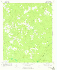 1971 Vesta1973 Print · USGSOglethorpe County in the early seventies was a landscape of granite extraction and rural congregations. Genealogists and historians can trace family locations near Saxon, Veribest, and numerous landmarks like Watkins Grove Ch or Fort Bethel Ch.2 unique versions available
 - 1972 Map of Bowman, 1974 Print
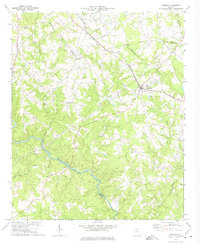 1972 Bowman1974 Print · USGSElbert and Madison counties meet along the Broad River during the early seventies, a landscape of rural communities and railroad stops. Genealogists can trace family footprints at Vanna, Harrison, and numerous local sites like Oak Grove Ch and Holly Springs Ch.
 - 1972 Map of Carlton, 1974 Print
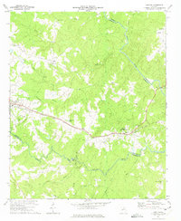 1972 Carlton1974 Print · USGSMadison and Elbert counties meet along the river in the early 1970s, as rural life centered on the SEABOARD COAST LINE rail corridor. Genealogists can trace family landmarks like Thankful Grove Ch, Old Fork Cem, and the historic WATSON MILL.
 - 1972 Map of Rock Branch, 1975 Print
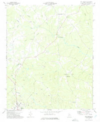 1972 Rock Branch1975 Print · USGSElbert County during the early seventies is revealed here as a landscape of rural communities and active industry. Researchers can trace family history through sites like New Bethel Ch, the settlement at Ruckersville, and the numerous Quarry labels marking the local economy.
 - 1973 Map of Elberton East, 1975 Print
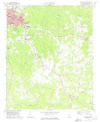 1973 Elberton East1975 Print · USGSElberton and its eastern granite country are captured here in the early seventies as the local textile and quarrying industries thrived. Researchers can locate vanished landmarks like the Drive-in Theater or trace family roots near Middleton and Fortsonia.2 unique versions available
Showing maps 1-25 of 111
Top cities of Elbert County
Frequently asked questions
- What are the different types of historical maps available for Elbert County?
- What is the oldest map of Elbert County?
- Where can I purchase historical maps of Elbert County for my home or office?
- Where can I download high-res historical maps of Elbert County?
- Are there historical topographic maps available for Elbert County?
- Is there historical aerial imagery available for Elbert County?
- Where are historical maps of Elbert County sourced from?