2020s Maps of McCaysville, Georgia
Explore 4 historic maps of McCaysville from the 2020s. These maps offer a rare glimpse into what life looked like during the 2020s — showing old roads, neighborhoods, homes, and landmarks that have changed or disappeared over time.
Whether you're researching your family's past, planning a metal detecting trip, or studying how McCaysville's landscape evolved across the 2020s, these high-resolution maps are a powerful tool for exploring the history of this region.
- Focus on a specific era: All maps on this page are from the 2020s, giving you a focused view of this time period.
- See what’s changed: Compare century-old streets, trails, and buildings to today's modern landscape using overlays and satellite layers.
- Research with precision: Use these maps for genealogy, historical research, land use analysis, or educational projects.
- View, download, or print: Maps are fully viewable online in high resolution, and can be downloaded or printed for your own records.
Start exploring McCaysville's history through authentic maps from the 2020s. This is your window into the past.
McCaysville, GA maps
(4)- 2020 Map of Epworth, 2020 Print
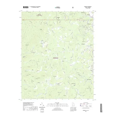 2020 Epworth2020 Print · USGSCovers McCaysville, including Copperhill, Lickskillet, and other nearby areas
 - 2020 Map of Mineral Bluff, 2020 Print
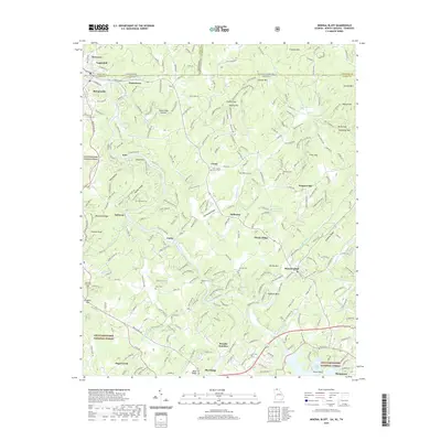 2020 Mineral Bluff2020 Print · USGSCovers McCaysville, including Blue Ridge, Copperhill, and other nearby areas
 - 2024 Map of Epworth, 2024 Print
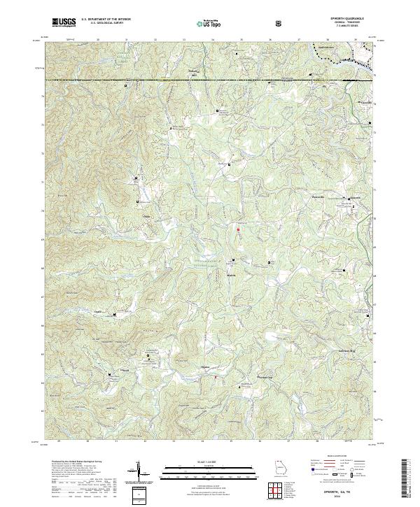 2024 Epworth2024 Print · USGSThe northern Georgia mountains meet the Tennessee border in the mid-2020s, showing the settled valleys between the national forests. Genealogists can trace family landmarks like the Patterson Family Cem, Hipps Chapel Methodist Church Cem, and the old Patterson Mill.
 - 2024 Map of Mineral Bluff, 2024 Print
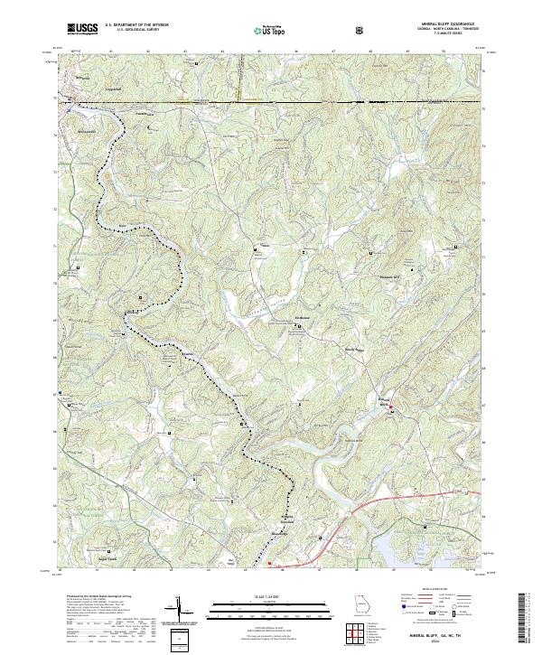 2024 Mineral Bluff2024 Print · USGSThe Tennessee-Georgia borderlands come into focus at this modern moment, where the Toccoa River and the L & N RR meet. Researchers can trace family lines through dozens of country landmarks like Union Cemetery, Bakers Ferry, and New River Baptist Church.
End of results
Showing maps 1-4 of 4
Top cities near McCaysville
- Blue Ridge historical maps
- Copperhill historical maps
- Ducktown historical maps
- Morganton historical maps
Top neighborhoods of McCaysville
Frequently asked questions
- What are the different types of historical maps available for McCaysville?
- What is the oldest map of McCaysville?
- Where can I purchase historical maps of McCaysville for my home or office?
- Where can I download high-res historical maps of McCaysville?
- Are there historical topographic maps available for McCaysville?
- Is there historical aerial imagery available for McCaysville?
- Where are historical maps of McCaysville sourced from?