1960s Maps of Franklin County, Georgia
Explore 8 historic maps of Franklin County from the 1960s. These maps offer a rare glimpse into what life looked like during the 1960s — showing old roads, neighborhoods, homes, and landmarks that have changed or disappeared over time.
Whether you're researching your family's past, planning a metal detecting trip, or studying how Franklin County's landscape evolved across the 1960s, these high-resolution maps are a powerful tool for exploring the history of this region.
- Focus on a specific era: All maps on this page are from the 1960s, giving you a focused view of this time period.
- See what’s changed: Compare century-old streets, trails, and buildings to today's modern landscape using overlays and satellite layers.
- Research with precision: Use these maps for genealogy, historical research, land use analysis, or educational projects.
- View, download, or print: Maps are fully viewable online in high resolution, and can be downloaded or printed for your own records.
Start exploring Franklin County's history through authentic maps from the 1960s. This is your window into the past.
Franklin County, GA maps
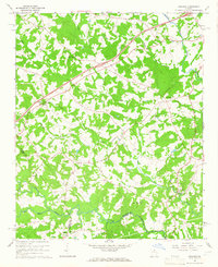
(8)- 1960 Map of Martin, 1962 Print
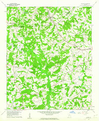 1960 Martin1962 Print · USGSThe Georgia Piedmont in the early sixties remains a landscape of rail-side towns and rural churches connected by the Southern railroad. Genealogists can trace family footprints near Line Academy, the Carnesville Trade Sch, and Zion Hill Cem Ch.3 unique versions available
 - 1963 Map of Oakway, 1964 Print
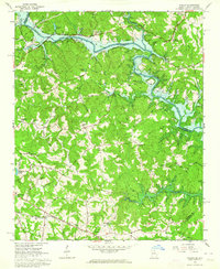
 1963 Oakway1964 Print · USGSThe Oconee County uplands meet the rising waters of the Savannah River basin in the early sixties. Researchers can trace rural lineages through landmarks like Old Retreat Ch, the Fair Play-Oakway Sch, and the shifting shoreline of the Hartwell Reservoir.3 unique versions available
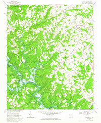
 - 1963 Map of Avalon, 1964 Print
 1963 Avalon1964 Print · USGSThe Tugaloo River valley meets the rising waters of the Hartwell Reservoir in the early sixties. Genealogists and historians can trace the rural communities of Avalon and Old Madison, alongside local landmarks like Tugaloo Ch and Museum Cem.3 unique versions available
 - 1964 Map of Ila, 1965 Print
 1964 Ila1965 Print · USGSIla and the surrounding Madison County countryside are captured here in the mid-1960s, a period of quiet rural character and traditional farmsteads. Family historians can locate several family-named landmarks and local institutions like Wesleys Chapel, the Hix-Williams Cem, and Fort Lamar.
 - 1964 Map of Ashland, 1965 Print
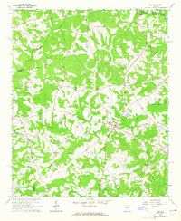
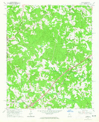
 1964 Ashland1965 Print · USGSFranklin County's rural landscape is captured here in the mid-1960s, showing a region defined by its creek-fed valleys and small communities. Researchers can locate family churches like Arnold Chapel and trace the road to the Covered Bridge near Cromers.2 unique versions available
 - 1964 Map of Lake Russell, 1965 Print
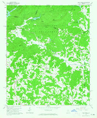 1964 Lake Russell1965 Print · USGSBanks County and the surrounding north Georgia highlands appear here in the mid-1960s as a landscape of timbered peaks and rural crossroads. Genealogists and local historians can locate family landmarks like Wofford Shoals Cem, Grady Sch, and Pinefield Crossroads.2 unique versions available
 - 1964 Map of Red Hill, 1965 Print
 1964 Red Hill1965 Print · USGSFranklin and Stephens counties in the mid-1960s were defined by small riverside settlements and rural parishes. Researchers can locate family burial sites at Stowe Cem and trace old road crossings like Akins Bridge or the community at Red Hill.
 - 1964 Map of Homer, 1965 Print
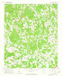
 1964 Homer1965 Print · USGSBanks and Franklin counties are shown in the mid-1960s, centered on the settlement of Homer. Genealogists can trace family roots through sites like Webb Creek Cem, Nells Grove Ch, and the old Covered Bridge.2 unique versions available
End of results
Showing maps 1-8 of 8
Top cities of Franklin County
Frequently asked questions
- What are the different types of historical maps available for Franklin County?
- What is the oldest map of Franklin County?
- Where can I purchase historical maps of Franklin County for my home or office?
- Where can I download high-res historical maps of Franklin County?
- Are there historical topographic maps available for Franklin County?
- Is there historical aerial imagery available for Franklin County?
- Where are historical maps of Franklin County sourced from?