Old Maps of Franklin County, Georgia for Metal Detecting
Plan your next treasure hunt with 82 historic maps of Franklin County. Find old homesites, ghost towns, trails, and gathering spots that may be lost to time — perfect for identifying promising metal detecting locations.
- Locate forgotten sites: Uncover places like long-lost settlements, abandoned rail lines, or gathering spots.
- Plan better hunts: Use map overlays combined with LiDAR or satellite views to narrow in on historically rich areas.
- Made for detectorists: Thousands of hobbyists use these maps to discover relics, coins, and hidden history.
Use these historic maps to boost your research and find new opportunities beneath the surface of Franklin County.
Franklin County, GA maps
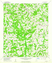
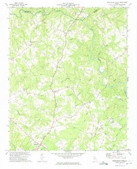
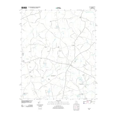
(82)- 1886 Map of Walhalla
 1886 Walhalla1886 Print · USGSThe foothills of the Blue Ridge come alive in this late nineteenth-century survey of the Georgia and South Carolina borderlands. Genealogists and historians can trace the early rail networks through Walhalla and Toccoa, or locate family landmarks like Batchelor's Retreat and Mosley's Mill.
 - 1891 Map of Carnesville
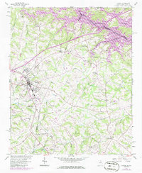
 1891 Carnesville1891 Print · USGSNortheast Georgia in the late nineteenth century is documented here as a landscape of small river settlements and emerging rail towns. Genealogists can trace family roots through locations like Jewellville, Fort Lamar, and the river crossing at Braggs Fy.6 unique versions available
 - 1892 Map of Walhalla
 1892 Walhalla1892 Print · USGSThe tri-state border region of Georgia and the Carolinas comes alive in this late nineteenth-century survey. Genealogists and historians can trace family-named landmarks like Young Davis's or locate river crossings like Jenkins's Ferry and the Bachelors Retreat P.O.7 unique versions available
 - 1896 Map of Walhalla
 1896 Walhalla1896 Print · USGSThe tri-state mountain country comes alive in this late 1800s survey of the Oconee and Habersham borderlands. Researchers can trace early river commerce and transit through Ramsey Ferry, the tracks of the Blue Ridge Railroad, and the industrial site of Mosley Mill.
 - 1954 Map of Greenville, 1965 Print
 1954 Greenville1965 Print · USGSThe Upstate and Northeast Georgia are captured here during a decade of massive transformation as new reservoirs reshaped the Piedmont. Genealogists and hikers can trace the Appalachian Trail over Brasstown Bald or locate old community centers like Demorest, Westminster, and Royston.3 unique versions available
 - 1958 Map of Greenville
 1958 Greenville1958 Print · USGSThe Piedmont and Blue Ridge foothills come alive in this mid-century survey of the Upstate and Northeast Georgia. Trace the regional rail-and-river economy through the Southern Railway corridors and early reservoir developments like Lake Sidney Lanier.
 - 1958 Map of Danielsville, 1959 Print
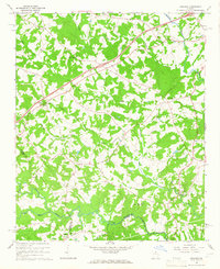
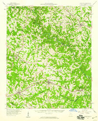 1958 Danielsville1959 Print · USGSNortheast Georgia at the end of the fifties reveals a landscape defined by the Broad River and a dense network of rural parish life. Genealogists can trace family roots through numerous local landmarks like Harrison Sch, Masons Mill, and Vanna Chapel.
 - 1959 Map of Carnesville, 1961 Print
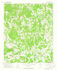
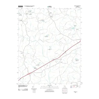
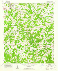 1959 Carnesville1961 Print · USGSFranklin County in the late fifties shows a rural landscape defined by its river forks and tight-knit communities. Genealogists and historians can trace family locations near Emmanuel College, Liberty Ch, and the crossroads at Sandy Cross.3 unique versions available
 - 1959 Map of Lavonia, 1961 Print
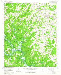
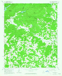
 1959 Lavonia1961 Print · USGSNortheast Georgia stands at the edge of a major geographic shift in the late fifties as the Tugaloo River valley prepares for inundation. Researchers can trace the original rail lines of the Southern Railway and locate local landmarks like Parkertown Mill and Willis Chapel before the waters of Hartwell Reservoir rose.2 unique versions available
 - 1959 Map of Royston, 1961 Print
 1959 Royston1961 Print · USGSNortheast Georgia in the late fifties is captured here at the meeting point of three counties during a time of steady rural growth. Researchers can trace family roots through numerous local landmarks, from Rose Hill Cem and Redwine Ch to the crossroads at Goldmine.2 unique versions available
 - 1960 Map of Martin, 1962 Print
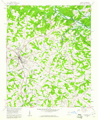
 1960 Martin1962 Print · USGSThe Georgia Piedmont in the early sixties remains a landscape of rail-side towns and rural churches connected by the Southern railroad. Genealogists can trace family footprints near Line Academy, the Carnesville Trade Sch, and Zion Hill Cem Ch.3 unique versions available
 - 1963 Map of Oakway, 1964 Print
 1963 Oakway1964 Print · USGSThe Oconee County uplands meet the rising waters of the Savannah River basin in the early sixties. Researchers can trace rural lineages through landmarks like Old Retreat Ch, the Fair Play-Oakway Sch, and the shifting shoreline of the Hartwell Reservoir.3 unique versions available
 - 1963 Map of Avalon, 1964 Print
 1963 Avalon1964 Print · USGSThe Tugaloo River valley meets the rising waters of the Hartwell Reservoir in the early sixties. Genealogists and historians can trace the rural communities of Avalon and Old Madison, alongside local landmarks like Tugaloo Ch and Museum Cem.3 unique versions available
 - 1964 Map of Ila, 1965 Print
 1964 Ila1965 Print · USGSIla and the surrounding Madison County countryside are captured here in the mid-1960s, a period of quiet rural character and traditional farmsteads. Family historians can locate several family-named landmarks and local institutions like Wesleys Chapel, the Hix-Williams Cem, and Fort Lamar.
 - 1964 Map of Ashland, 1965 Print
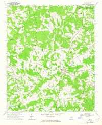
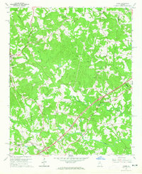
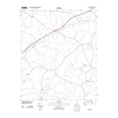
 1964 Ashland1965 Print · USGSFranklin County's rural landscape is captured here in the mid-1960s, showing a region defined by its creek-fed valleys and small communities. Researchers can locate family churches like Arnold Chapel and trace the road to the Covered Bridge near Cromers.2 unique versions available
 - 1964 Map of Lake Russell, 1965 Print
 1964 Lake Russell1965 Print · USGSBanks County and the surrounding north Georgia highlands appear here in the mid-1960s as a landscape of timbered peaks and rural crossroads. Genealogists and local historians can locate family landmarks like Wofford Shoals Cem, Grady Sch, and Pinefield Crossroads.2 unique versions available
 - 1964 Map of Red Hill, 1965 Print
 1964 Red Hill1965 Print · USGSFranklin and Stephens counties in the mid-1960s were defined by small riverside settlements and rural parishes. Researchers can locate family burial sites at Stowe Cem and trace old road crossings like Akins Bridge or the community at Red Hill.
 - 1964 Map of Homer, 1965 Print
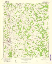
 1964 Homer1965 Print · USGSBanks and Franklin counties are shown in the mid-1960s, centered on the settlement of Homer. Genealogists can trace family roots through sites like Webb Creek Cem, Nells Grove Ch, and the old Covered Bridge.2 unique versions available
 - 1972 Map of Danielsville North, 1974 Print
 1972 Danielsville North1974 Print · USGSMadison County's rural character is preserved here in the early seventies, showing a landscape of river-fed valleys and quiet crossroads. Genealogists can trace family ties at Bethel Cem, Jones Chapel, and the historic county seat of Danielsville.2 unique versions available
 - 1979 Map of Commerce, 1980 Print
 1979 Commerce1980 Print · USGSThe Georgia and South Carolina Piedmont reached a period of significant regional growth in the late seventies. Genealogists and historians can trace family roots through locations like Blackberry Church, Old Pioneer Cem, and the Gillsville Sch.2 unique versions available
 - 1981 Map of Toccoa, 1982 Print
 1981 Toccoa1982 Print · USGSThe tri-state mountain region where Georgia meets the Carolinas is shown here in the early eighties. Genealogists and historians can trace family-named locations and settlements from Dahlonega to Tallulah Falls, along with the Southern rail corridor.2 unique versions available
 - 1985 Map of Lavonia, 1986 Print
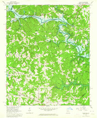
 1985 Lavonia1986 Print · USGSLavonia and the Georgia-South Carolina border are captured here in the mid-1980s as the rail-line economy met the rising waters of the Tugaloo. Researchers can trace family history through sites like Parkertown Mill, Pleasant Grove Cem, and Bowersville.
 - 2011 Map of Ashland, 2011 Print
 2011 Ashland2011 Print · USGSCovers Franklin County, including Carnesville, Hebron, and other nearby areas
 - 2011 Map of Martin, 2011 Print
 2011 Martin2011 Print · USGSCovers Franklin County, including Lavonia, Carnesville, and other nearby areas
 - 2011 Map of Ila, 2011 Print
 2011 Ila2011 Print · USGSCovers Franklin County, including Ila, Alvin, and other nearby areas
Showing maps 1-25 of 82
Top cities of Franklin County
Frequently asked questions
- What are the different types of historical maps available for Franklin County?
- What is the oldest map of Franklin County?
- Where can I purchase historical maps of Franklin County for my home or office?
- Where can I download high-res historical maps of Franklin County?
- Are there historical topographic maps available for Franklin County?
- Is there historical aerial imagery available for Franklin County?
- Where are historical maps of Franklin County sourced from?