Old Maps of Sandy Springs, Georgia for Metal Detecting
Plan your next treasure hunt with 44 historic maps of Sandy Springs. Find old homesites, ghost towns, trails, and gathering spots that may be lost to time — perfect for identifying promising metal detecting locations.
- Locate forgotten sites: Uncover places like long-lost settlements, abandoned rail lines, or gathering spots.
- Plan better hunts: Use map overlays combined with LiDAR or satellite views to narrow in on historically rich areas.
- Made for detectorists: Thousands of hobbyists use these maps to discover relics, coins, and hidden history.
Use these historic maps to boost your research and find new opportunities beneath the surface of Sandy Springs.
Sandy Springs, GA maps
(44)- 1888 Map of Atlanta, 1955 Print
 1888 Atlanta1955 Print · USGSAtlanta and its surrounding counties emerge as a booming rail hub in the years following the Civil War. Trace early settlements and infrastructure like Jett Ferry, Oakley Mill, and the massive granite profile of Stone Mountain before the era of modern sprawl.
 - 1890 Map of Suwanee
 1890 Suwanee1890 Print · USGSNorth Georgia in the 1890s was a landscape of river-powered commerce and gold prospecting. Genealogists and historians can trace family-named river crossings like Jones Ferry and Pirkle's Ferry or locate the historic Kin Mori Gold Mine.
 - 1890 Map of Atlanta
 1890 Atlanta1890 Print · USGSGeorgia's rail and river networks converge in the late nineteenth century as the capital city expands. Genealogists can trace family homesteads near Jetts Store, Howells Mills, and the various river crossings like Paces Ferry.
 - 1892 Map of Atlanta
 1892 Atlanta1892 Print · USGSAtlanta and its surrounding counties appear at a pivotal moment of post-war growth as the region's rail network reached maturity. Genealogists and historians can trace the foundations of modern DeKalb and Fulton counties through landmarks like Stone Mountain, Roswell Junction, and Paces Ferry.
 - 1894 Map of Suwanee
 1894 Suwanee1894 Print · USGSNorth Georgia in the late nineteenth century was a landscape of river ferries and rising industry, from marble quarries to gold mines. Genealogists can trace family landmarks like Fields Cross Roads, the Kin Mori Gold Mine, and Fort Buffington.6 unique versions available
 - 1895 Map of Atlanta
 1895 Atlanta1895 Print · USGSThe growing railroad hub of Atlanta is shown here in the late nineteenth century alongside its surrounding river ferries and emerging suburbs. Trace old family names and sites like Howell Mills, Vining Station, and Ft. McPherson.7 unique versions available
 - 1953 Map of Atlanta, 1965 Print
 1953 Atlanta1965 Print · USGSThe growing Atlanta metro and the industrial corridors of Eastern Alabama are captured here during the mid-century transition. Researchers can trace the rail-to-road shift through hubs like Anniston and La Grange or locate sites within Fort McClellan.2 unique versions available
 - 1954 Map of Chamblee, 1956 Print
 1954 Chamblee1956 Print · USGSDeKalb and Fulton counties are caught in a moment of rapid post-war growth during the mid-fifties, just as the expressway begins to reshape the landscape. Researchers can trace the footprints of the U S Naval Reservation Atlanta Air Station, Oglethorpe Univ, and old family landmarks like Winters Chapel Cem.5 unique versions available
 - 1955 Map of Rome
 1955 Rome1955 Print · USGSThe tri-state borderlands of Georgia, Alabama, and Tennessee appear in the mid-fifties as a landscape of ridge-and-valley industry and river navigation. Genealogists can trace family footprints near Chattanooga, the iron works of Gadsden, and textile towns like Trion or Summerville.
 - 1955 Map of Sandy Springs, 1957 Print
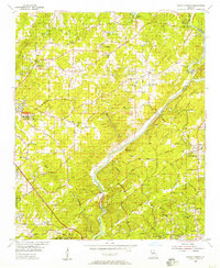 1955 Sandy Springs1957 Print · USGSThe northern edge of Atlanta and the banks of the Chattahoochee meet during a period of suburban transformation in the mid-fifties. Genealogists and local historians can trace family land via Heards Cem or locate community centers like the Powers Ferry Road Sch and Sardis Ch.6 unique versions available
 - 1956 Map of Mountain Park, 1957 Print
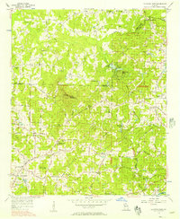 1956 Mountain Park1957 Print · USGSNorth Georgia in the mid-fifties remains a world of country churches and winding rural roads across the Cobb and Cherokee county lines. Trace family history through landmarks like Wesley Chapel, the Mountain View Sch, and the old crossing at Arnold Mill.6 unique versions available
 - 1956 Map of Roswell, 1957 Print
 1956 Roswell1957 Print · USGSNorthern Fulton County in the mid-fifties remains a world of quiet crossroads and rural parishes before the modern expansion. Researchers can trace ancestral locations at Crabapple, Newtown, and Lebanon Ch, or locate the County Prison Camp and Rock Quarry.5 unique versions available
 - 1957 Map of Atlanta
 1957 Atlanta1957 Print · USGSAtlanta and the Alabama borderlands appear here in the mid-fifties, capturing the region's post-war suburban and industrial transition. Trace the development of early transport hubs and military sites like Fort McPherson, Anniston, and the Kennesaw Mountain National Battlefield Park.
 - 1958 Map of Atlanta
 1958 Atlanta1958 Print · USGSMid-century Georgia and Alabama are shown in this regional study of the corridor between the Chattahoochee River and the Appalachian foothills. Local historians can trace the development of suburban Atlanta alongside vital landmarks like Stone Mountain, Dobbins AFB, and the Seaboard Air Line rail routes.
 - 1958 Map of Rome, 1966 Print
 1958 Rome1966 Print · USGSNorthwest Georgia and neighboring Tennessee and Alabama are captured here in the late fifties, showcasing a landscape of high ridges and river valleys. Researchers can trace historic rail lines like the Seaboard Air Line RR and explore the bounds of Cloudland Canyon State Park or Fort Oglethorpe.3 unique versions available
 - 1961 Map of Rome
 1961 Rome1961 Print · USGSNorthwest Georgia and neighboring Tennessee and Alabama are shown here at a moment of significant mid-century growth. Researchers can trace the rail networks of the Central of Georgia or locate landmarks within Chickamauga and Chattanooga Nat Military Park.
 - 1963 Map of Rome
 1963 Rome1963 Print · USGSThe tri-state corner of Georgia, Alabama, and Tennessee is captured here during a period of massive reservoir expansion and post-war growth. Genealogists and historians can trace the rail corridors of the Southern Ry or locate landmarks like Fort Oglethorpe and Cloudland Canyon State Park.
 - 1981 Map of Cartersville, 1982 Print
 1981 Cartersville1982 Print · USGSNorth Georgia at the start of the eighties shows a landscape defined by massive reservoirs and historic rail corridors. Researchers can trace the heritage of the Etowah Indian Mounds or locate old junctions along the Southern Railway and Seaboard Coast Line.2 unique versions available
 - 1981 Map of Atlanta, 1982 Print
 1981 Atlanta1982 Print · USGSThe Atlanta metro area is shown during its late-century boom, following the completion of the beltway and the rise of its major international airport. Trace the growth of suburbs from Mableton to Tucker and the footprints of Fort McPherson and Stone Mtn.
 - 1992 Map of Mountain Park
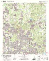 1992 Mountain Park1992 Print · USGSCobb and Cherokee Counties are seen during a period of rapid suburban growth in the early nineties. Genealogists can trace family names and local landmarks through Arnold Mill, Crossroad Church, and the Arnold Cem near the Fulton County line.2 unique versions available
 - 1992 Map of Roswell, 1993 Print
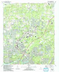 1992 Roswell1993 Print · USGSThe North Fulton corridor was evolving rapidly in the early nineties as residential growth began to bridge the gap between Alpharetta and Roswell. Genealogists and local historians can trace legacy landmarks including Old Newton School, Greenlawn Cemetery, and the community of Crabapple.2 unique versions available
 - 1993 Map of Sandy Springs, 1995 Print
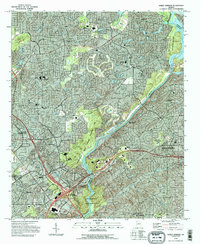 1993 Sandy Springs1995 Print · USGSSandy Springs and the northern Atlanta suburbs are shown here in the early nineties as modern infrastructure integrated with historic local landmarks. Researchers can trace the development of Marietta near Dobbins Air Force Base and locate community anchors like Mt Bethel Ch and Campground Cem.
 - 1993 Map of Chamblee, 1995 Print
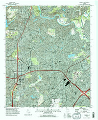 1993 Chamblee1995 Print · USGSSuburban Atlanta was reaching a peak of expansion in the early nineties, centered on the thriving DeKalb and Fulton county lines. Researchers can trace the development of local landmarks like Oglethorpe University, Perimeter Mall, and the De Kalb-Peachtree Airport.
 - 1997 Map of Sandy Springs, 1999 Print
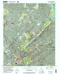 1997 Sandy Springs1999 Print · USGSThe northern Atlanta suburbs were undergoing significant expansion during the late nineties, as residential growth converged with the Chattahoochee River. Researchers can trace the development of Marietta and Sandy Springs through landmarks like Dobbins AFB and Cumberland Mall Shopping Center.
 - 2011 Map of Roswell, 2011 Print
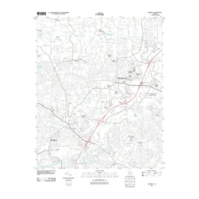 2011 Roswell2011 Print · USGSThe northern Atlanta suburbs show a period of rapid residential expansion and managed landscapes in the early twenty-first century. Researchers can locate numerous family burial sites like Maxwell Cemetery or trace the drainage of the Chattahoochee River and Big Creek.
Showing maps 1-25 of 44
Top cities near Sandy Springs
- Atlanta historical maps
- Roswell historical maps
- Johns Creek historical maps
- Alpharetta historical maps
- Marietta historical maps
- Smyrna historical maps
See more
Top neighborhoods of Sandy Springs
- Deerfield historical maps
- Forestdale Estates historical maps
- Hammond historical maps
- Ridgeview Forest historical maps
- River Bluff historical maps
- Rivergate historical maps
See more
Frequently asked questions
- What are the different types of historical maps available for Sandy Springs?
- What is the oldest map of Sandy Springs?
- Where can I purchase historical maps of Sandy Springs for my home or office?
- Where can I download high-res historical maps of Sandy Springs?
- Are there historical topographic maps available for Sandy Springs?
- Is there historical aerial imagery available for Sandy Springs?
- Where are historical maps of Sandy Springs sourced from?