2020s Maps of Duluth, Georgia
Explore 8 historic maps of Duluth from the 2020s. These maps offer a rare glimpse into what life looked like during the 2020s — showing old roads, neighborhoods, homes, and landmarks that have changed or disappeared over time.
Whether you're researching your family's past, planning a metal detecting trip, or studying how Duluth's landscape evolved across the 2020s, these high-resolution maps are a powerful tool for exploring the history of this region.
- Focus on a specific era: All maps on this page are from the 2020s, giving you a focused view of this time period.
- See what’s changed: Compare century-old streets, trails, and buildings to today's modern landscape using overlays and satellite layers.
- Research with precision: Use these maps for genealogy, historical research, land use analysis, or educational projects.
- View, download, or print: Maps are fully viewable online in high resolution, and can be downloaded or printed for your own records.
Start exploring Duluth's history through authentic maps from the 2020s. This is your window into the past.
Duluth, GA maps
(8)- 2020 Map of Luxomni, 2020 Print
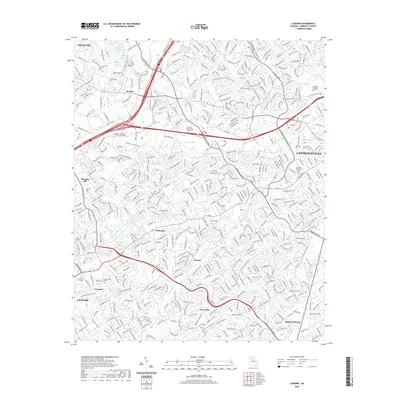 2020 Luxomni2020 Print · USGSCovers Duluth, including Lawrenceville, Snellville, and other nearby areas
 - 2020 Map of Norcross, 2020 Print
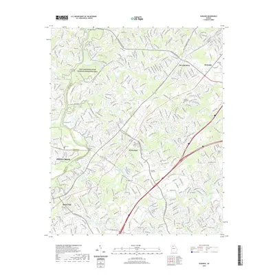
 2020 Norcross2020 Print · USGSCovers Duluth, including Johns Creek, Peachtree Corners, and other nearby areas
 - 2020 Map of Duluth, 2020 Print
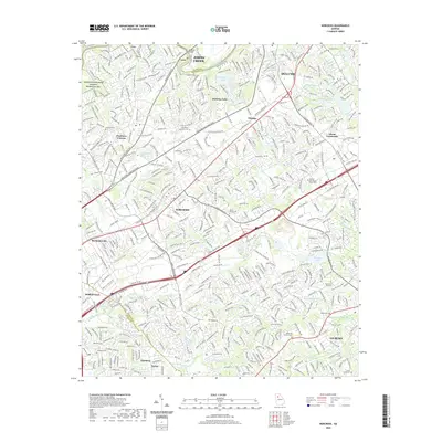
 2020 Duluth2020 Print · USGSCovers Duluth, including Johns Creek, Alpharetta, and other nearby areas
 - 2020 Map of Suwanee, 2020 Print
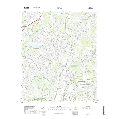
 2020 Suwanee2020 Print · USGSCovers Duluth, including Johns Creek, Sugar Hill, and other nearby areas
 - 2024 Map of Duluth, 2024 Print
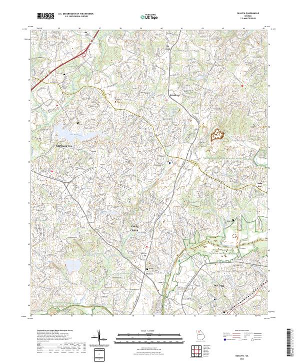 2024 Duluth2024 Print · USGSThe northern Atlanta suburbs meet the river in the twenty-first century, showing the dense residential growth of Duluth and Johns Creek. Researchers can locate several historical burial sites like Warsaw Cem and trace old river crossings at Rogers Ferry and Waters Ferry.
 - 2024 Map of Suwanee, 2024 Print
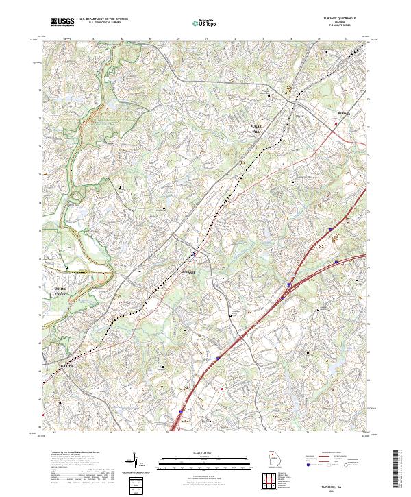 2024 Suwanee2024 Print · USGSNorthern Gwinnett County is shown here as a modern suburban corridor along the river. Genealogists can trace family heritage through numerous sites like Douglass Cem, Brandon Cem, and Gilberts Ferry.
 - 2024 Map of Norcross, 2024 Print
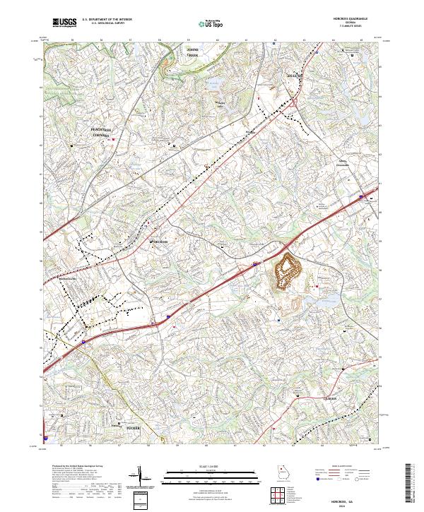 2024 Norcross2024 Print · USGSGwinnett County's suburban growth and historical landmarks are documented here in the early twenty-first century. Researchers can locate numerous family and community burial sites like Singleton Cem and Norcross Cem alongside the Chattahoochee River.
 - 2024 Map of Luxomni, 2024 Print
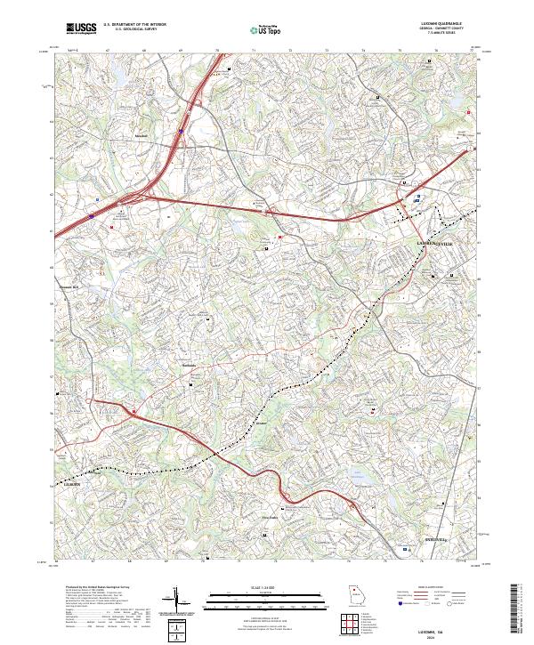 2024 Luxomni2024 Print · USGSGwinnett County's rapid suburban growth meets its historic roots in this modern survey of the area between Lilburn and Lawrenceville. Researchers can locate old family burial sites like Garner Pursell Cemetery and Ford Cemetery among the headwaters of the Yellow River.
End of results
Showing maps 1-8 of 8
Top cities near Duluth
- Atlanta historical maps
- Sandy Springs historical maps
- Roswell historical maps
- Johns Creek historical maps
- Alpharetta historical maps
- Brookhaven historical maps
See more
Top neighborhoods of Duluth
- Carriage Gate historical maps
- Chattawood historical maps
- Howell Wood historical maps
- Centurion Hills historical maps
- Forest Manor North historical maps
- GardenDale TownHomes historical maps
See more
Frequently asked questions
- What are the different types of historical maps available for Duluth?
- What is the oldest map of Duluth?
- Where can I purchase historical maps of Duluth for my home or office?
- Where can I download high-res historical maps of Duluth?
- Are there historical topographic maps available for Duluth?
- Is there historical aerial imagery available for Duluth?
- Where are historical maps of Duluth sourced from?