Old Maps of Madison Trace, Lawrenceville
Explore 31 old maps of Madison Trace, spanning from 1888 to today. These high-resolution historic maps reveal how streets, neighborhoods, landmarks, and natural features evolved over time — perfect for genealogy, metal detecting, research, and local history exploration.
What you can do with these maps:
- See how Madison Trace changed over time: Compare historical maps to modern-day views to trace roads, homesites, rail lines & more.
- View detailed metadata: Each map includes creators, publishers, year, scale, and archive source.
- Overlay maps with satellite & LiDAR: Visualize the past alongside modern tools to explore terrain & human change.
- Trusted historical sources: Maps sourced from the USGS, Library of Congress, and other archives.
- Access maps your way: View online, download high-res files, or order prints for personal or research use.
Start exploring old maps of Madison Trace to uncover forgotten places, hidden landmarks, and the deep history beneath your feet.
Madison Trace, Lawrenceville maps
(31)- 1888 Map of Atlanta, 1955 Print
 1888 Atlanta1955 Print · USGSAtlanta and its surrounding counties emerge as a booming rail hub in the years following the Civil War. Trace early settlements and infrastructure like Jett Ferry, Oakley Mill, and the massive granite profile of Stone Mountain before the era of modern sprawl.
 - 1890 Map of Atlanta
 1890 Atlanta1890 Print · USGSGeorgia's rail and river networks converge in the late nineteenth century as the capital city expands. Genealogists can trace family homesteads near Jetts Store, Howells Mills, and the various river crossings like Paces Ferry.
 - 1892 Map of Atlanta
 1892 Atlanta1892 Print · USGSAtlanta and its surrounding counties appear at a pivotal moment of post-war growth as the region's rail network reached maturity. Genealogists and historians can trace the foundations of modern DeKalb and Fulton counties through landmarks like Stone Mountain, Roswell Junction, and Paces Ferry.
 - 1895 Map of Atlanta
 1895 Atlanta1895 Print · USGSThe growing railroad hub of Atlanta is shown here in the late nineteenth century alongside its surrounding river ferries and emerging suburbs. Trace old family names and sites like Howell Mills, Vining Station, and Ft. McPherson.7 unique versions available
 - 1896 Map of Monroe
 1896 Monroe1896 Print · USGSNorth-central Georgia thrives during the late nineteenth century as a hub of river-powered industry and rail expansion. Genealogists and historians can trace family locations near Salem Camp Ground, the local commerce at Carithers Store, and several early crossings like Bells Bridge.5 unique versions available
 - 1953 Map of Atlanta, 1965 Print
 1953 Atlanta1965 Print · USGSThe growing Atlanta metro and the industrial corridors of Eastern Alabama are captured here during the mid-century transition. Researchers can trace the rail-to-road shift through hubs like Anniston and La Grange or locate sites within Fort McClellan.2 unique versions available
 - 1953 Map of Athens, 1966 Print
 1953 Athens1966 Print · USGSGeorgia's Piedmont and Savannah River borderlands come alive in this mid-century survey of the region surrounding Athens and Augusta. Trace the rail-and-river economy through the Georgia RR and landmarks like the Fort Gordon Military Reservation.3 unique versions available
 - 1957 Map of Atlanta
 1957 Atlanta1957 Print · USGSAtlanta and the Alabama borderlands appear here in the mid-fifties, capturing the region's post-war suburban and industrial transition. Trace the development of early transport hubs and military sites like Fort McPherson, Anniston, and the Kennesaw Mountain National Battlefield Park.
 - 1958 Map of Athens
 1958 Athens1958 Print · USGSNorth-central Georgia and the Savannah River valley are captured in the late fifties, showing the region as the new reservoirs were filling. Researchers can trace historic rail lines like the Georgia RR and locate rural landmarks such as Social Circle, Graves Mountain, and the Fort Gordon Military Reservation.
 - 1958 Map of Atlanta
 1958 Atlanta1958 Print · USGSMid-century Georgia and Alabama are shown in this regional study of the corridor between the Chattahoochee River and the Appalachian foothills. Local historians can trace the development of suburban Atlanta alongside vital landmarks like Stone Mountain, Dobbins AFB, and the Seaboard Air Line rail routes.
 - 1959 Map of Athens
 1959 Athens1959 Print · USGSNortheast Georgia and the South Carolina borderlands appear here in the mid-fifties, during a decade of infrastructure growth. Genealogists and historians can trace the rail-and-river geography of towns like Social Circle, the sprawl of Fort Gordon Military Reservation, and the newly formed Clark Hill Reservoir.
 - 1963 Map of Athens
 1963 Athens1963 Print · USGSGeorgia's Piedmont and the Savannah River valley are captured in the early sixties as major reservoirs and military installations reshaped the landscape. Researchers can trace the development of Clark Hill Reservoir, locate the Fort Gordon Military Reservation, and find historic towns like Social Circle and Eatonton.
 - 1963 Map of Luxomni, 1965 Print
 1963 Luxomni1965 Print · USGSGwinnett County during the early sixties shows a landscape of established rail towns and early interstate development. Genealogists and historians can trace the foundations of Luxomni, Gloster, and Bethesda, alongside rural landmarks like Lebanon Ch and Fairview Cem.4 unique versions available
 - 1964 Map of Lawrenceville, 1965 Print
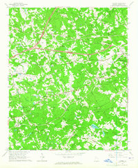
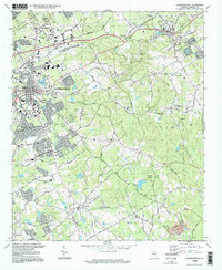
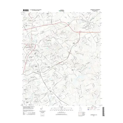
 1964 Lawrenceville1965 Print · USGSGwinnett County is captured in the mid-1960s as the town of Lawrenceville grows outward into a landscape of family farms and country churches. Genealogists and historians can locate Shadowlawn Cemetery, Tribble Mill, and the Lawrenceville Campground.2 unique versions available
 - 1980 Map of Athens, 1981 Print
 1980 Athens1981 Print · USGSNorth Georgia in the early eighties exhibits a landscape of growing university towns and deep-rooted rail hubs. Genealogists can trace family lands near Social Circle or Watkinsville while following the routes of the Central of Georgia and the Appalachee River.2 unique versions available
 - 1981 Map of Atlanta, 1982 Print
 1981 Atlanta1982 Print · USGSThe Atlanta metro area is shown during its late-century boom, following the completion of the beltway and the rise of its major international airport. Trace the growth of suburbs from Mableton to Tucker and the footprints of Fort McPherson and Stone Mtn.
 - 1988 Map of Athens
 1988 Athens1988 Print · USGSThe Georgia Piedmont and South Carolina borderlands appear in the late eighties as a landscape of vast reservoirs and growing towns. Researchers can trace the legacy of the Georgia RR connecting Athens and Augusta, or locate landmarks within Oconee National Forest.
 - 1992 Map of Lawrenceville
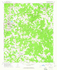
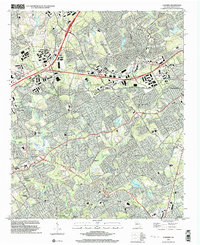
 1992 Lawrenceville1992 Print · USGSGwinnett County's rapid growth during the early nineties is documented here, showing the expansion of Lawrenceville and Dacula. Local historians can trace long-standing landmarks like the Lawrenceville Camp Ground and McMillan Cem alongside the modern Tribble Mill County Park.
 - 1992 Map of Luxomni, 1993 Print
 1992 Luxomni1993 Print · USGSGwinnett County's rapid suburbanization is documented here in the early nineties, showing how older crossroads communities adapted to new infrastructure. Genealogists and locals can trace family-named sites like McKendree Cem and Pharr School alongside the Seaboard System rail line.
 - 1998 Map of Lawrenceville, 1999 Print
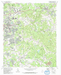
 1998 Lawrenceville1999 Print · USGSGwinnett County during the late nineties shows a landscape of growing suburban centers and preserved local history. Genealogists can trace family roots at Shadowlawn Cemetery and Ewings Cem, or explore older community hubs like New Hope and Grayson.
 - 1999 Map of Luxomni, 2003 Print
 1999 Luxomni2003 Print · USGSGwinnett County's suburban landscape emerges at the turn of the millennium as residential growth surrounds established community hubs. Researchers can trace family history through local sites like Ford Cemetery, Luxomni Church, and Pharr School.
 - 2011 Map of Lawrenceville, 2011 Print
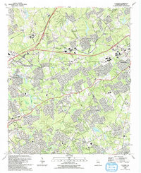
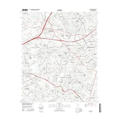
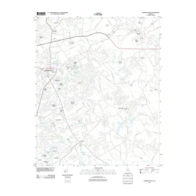 2011 Lawrenceville2011 Print · USGSCovers Madison Trace, including Lawrenceville, Snellville, and other nearby areas
 - 2011 Map of Luxomni, 2011 Print
 2011 Luxomni2011 Print · USGSCovers Madison Trace, including Lawrenceville, Duluth, and other nearby areas
 - 2014 Map of Lawrenceville, 2014 Print
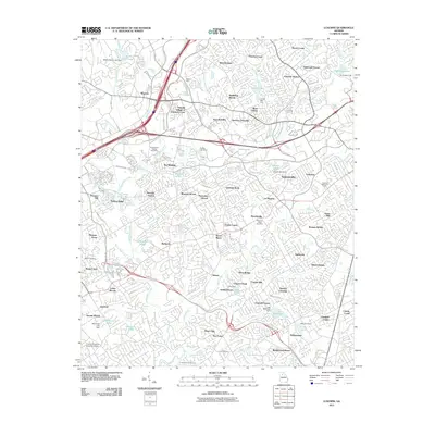
 2014 Lawrenceville2014 Print · USGSCovers Madison Trace, including Lawrenceville, Snellville, and other nearby areas
 - 2014 Map of Luxomni, 2014 Print
 2014 Luxomni2014 Print · USGSCovers Madison Trace, including Lawrenceville, Duluth, and other nearby areas
Showing maps 1-25 of 31
Frequently asked questions
- What are the different types of historical maps available for Madison Trace?
- What is the oldest map of Madison Trace?
- Where can I purchase historical maps of Madison Trace for my home or office?
- Where can I download high-res historical maps of Madison Trace?
- Are there historical topographic maps available for Madison Trace?
- Is there historical aerial imagery available for Madison Trace?
- Where are historical maps of Madison Trace sourced from?