Old Maps of Fortville, Georgia for Academic Research
Study the evolution of Fortville with 12 high-resolution historic maps. Whether you're teaching, researching, or modeling changes in land use, these maps provide essential visual documentation of urban, environmental, and geographic change.
- Analyze long-term change: Track patterns in development, transportation, and natural features.
- Ideal for environmental or urban studies: Support academic projects with primary historical map data.
- Use in the classroom or lab: Educators and researchers rely on these maps to bring historical context to life.
These maps are a powerful tool for teaching, research, and visualizing how Fortville has changed over the decades.
Fortville, GA maps
(12)- 1953 Map of Athens, 1966 Print
 1953 Athens1966 Print · USGSGeorgia's Piedmont and Savannah River borderlands come alive in this mid-century survey of the region surrounding Athens and Augusta. Trace the rail-and-river economy through the Georgia RR and landmarks like the Fort Gordon Military Reservation.3 unique versions available
 - 1958 Map of Athens
 1958 Athens1958 Print · USGSNorth-central Georgia and the Savannah River valley are captured in the late fifties, showing the region as the new reservoirs were filling. Researchers can trace historic rail lines like the Georgia RR and locate rural landmarks such as Social Circle, Graves Mountain, and the Fort Gordon Military Reservation.
 - 1959 Map of Athens
 1959 Athens1959 Print · USGSNortheast Georgia and the South Carolina borderlands appear here in the mid-fifties, during a decade of infrastructure growth. Genealogists and historians can trace the rail-and-river geography of towns like Social Circle, the sprawl of Fort Gordon Military Reservation, and the newly formed Clark Hill Reservoir.
 - 1963 Map of Athens
 1963 Athens1963 Print · USGSGeorgia's Piedmont and the Savannah River valley are captured in the early sixties as major reservoirs and military installations reshaped the landscape. Researchers can trace the development of Clark Hill Reservoir, locate the Fort Gordon Military Reservation, and find historic towns like Social Circle and Eatonton.
 - 1978 Map of Haddock
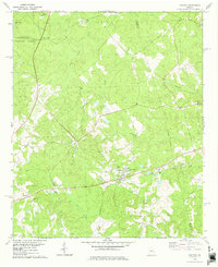 1978 Haddock1978 Print · USGSJones County's rural communities and small-town crossroads are captured here in the late seventies as the region balanced forestry and small-scale development. Genealogists and historians can locate family burial sites and country churches like Fortville Cem, Mt Zion Ch Cem, and Blountsville.
 - 1981 Map of Milledgeville
 1981 Milledgeville1981 Print · USGSMiddle Georgia in the early eighties shows a landscape shaped by major reservoirs and deep forests. Genealogists and historians can trace the rail networks of the Southern and Central of Georgia through towns like Monticello and Eatonton.2 unique versions available
 - 1988 Map of Athens
 1988 Athens1988 Print · USGSThe Georgia Piedmont and South Carolina borderlands appear in the late eighties as a landscape of vast reservoirs and growing towns. Researchers can trace the legacy of the Georgia RR connecting Athens and Augusta, or locate landmarks within Oconee National Forest.
 - 2011 Map of Haddock, 2011 Print
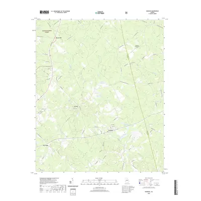
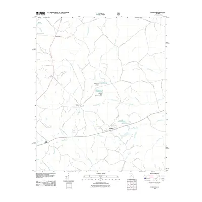 2011 Haddock2011 Print · USGSCovers Fortville, including Pine Ridge, Haddock, and other nearby areas
 - 2014 Map of Haddock, 2014 Print
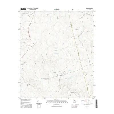 2014 Haddock2014 Print · USGSCovers Fortville, including Pine Ridge, Haddock, and other nearby areas
 - 2017 Map of Haddock, 2017 Print
 2017 Haddock2017 Print · USGSCovers Fortville, including Pine Ridge, Haddock, and other nearby areas
 - 2020 Map of Haddock, 2020 Print
 2020 Haddock2020 Print · USGSCovers Fortville, including Pine Ridge, Haddock, and other nearby areas
 - 2024 Map of Haddock, 2024 Print
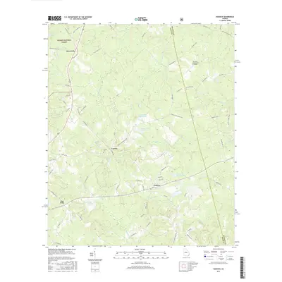
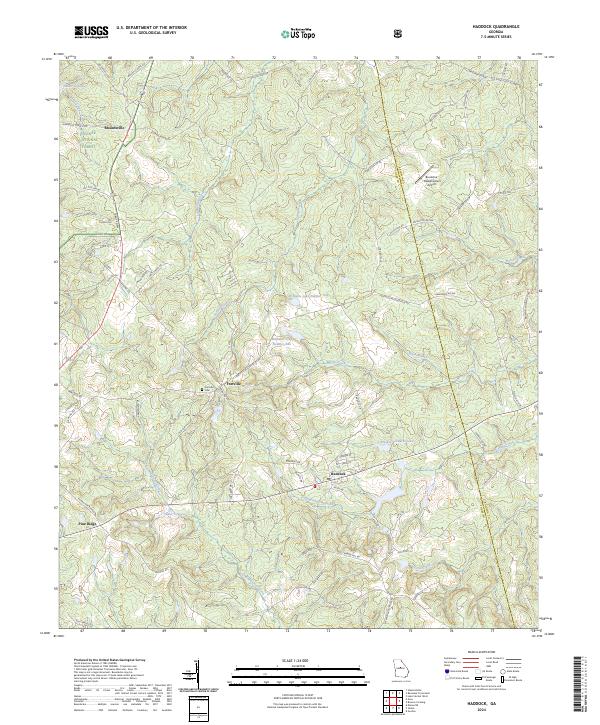 2024 Haddock2024 Print · USGSJones and Baldwin counties come together in this contemporary view of the Middle Georgia landscape, where timberlands meet small rural settlements. Family historians can trace the roads around Haddock, the grounds of Fortville Cem, and the reaches of Commissioner Creek.
End of results
Showing maps 1-12 of 12
Top cities near Fortville
- Macon historical maps
- Milledgeville historical maps
- Gray historical maps
- Gordon historical maps
- Ivey historical maps
- Crooked Creek historical maps
Frequently asked questions
- What are the different types of historical maps available for Fortville?
- What is the oldest map of Fortville?
- Where can I purchase historical maps of Fortville for my home or office?
- Where can I download high-res historical maps of Fortville?
- Are there historical topographic maps available for Fortville?
- Is there historical aerial imagery available for Fortville?
- Where are historical maps of Fortville sourced from?