Old Maps of Raccoon Bluff, Georgia for Academic Research
Study the evolution of Raccoon Bluff with 16 high-resolution historic maps. Whether you're teaching, researching, or modeling changes in land use, these maps provide essential visual documentation of urban, environmental, and geographic change.
- Analyze long-term change: Track patterns in development, transportation, and natural features.
- Ideal for environmental or urban studies: Support academic projects with primary historical map data.
- Use in the classroom or lab: Educators and researchers rely on these maps to bring historical context to life.
These maps are a powerful tool for teaching, research, and visualizing how Raccoon Bluff has changed over the decades.
Raccoon Bluff, GA maps
(16)- 1920 Map of Cabretta Island
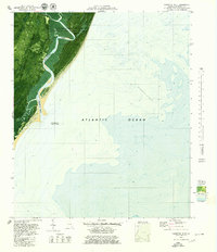
 1920 Cabretta Island1920 Print · USGSCoastal Georgia's barrier islands appear in this post-World War I military survey, showing the intricate marsh and beach terrain. Researchers can locate early triangulation points like Palm 1902 and land features including Sand Hill and Art Well.
 - 1944 Map of Cabretta Island
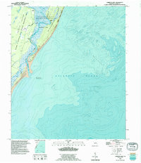
 1944 Cabretta Island1944 Print · USGSCoastal McIntosh County is captured here in the mid-1940s, showing the intricate barrier island geography before significant modern development. Genealogists and historians can trace family-named points and landmarks like Brinson, Lowe, and the Art Well along the shore of Sapelo Island.
 - 1946 Map of Brunswick, 1948 Print
 1946 Brunswick1948 Print · USGSCoastal Georgia in the mid-forties reveals a landscape defined by the Camp Stewart Military Reservation and the sprawling barrier islands. Genealogists and historians can trace the rail-and-river network through inland towns like Ludowici and Jesup, or locate coastal landmarks like the St Simon Light.
 - 1948 Map of Brunswick
 1948 Brunswick1948 Print · USGSCoastal Georgia in the late 1940s is defined here by its labyrinthine barrier islands and the massive footprint of Camp Stewart. Genealogists and historians can trace the rail-tied growth of Jesup and Hinesville or locate coastal landmarks like St Simon Light.
 - 1954 Map of Cabretta Inlet, 1959 Print
 1954 Cabretta Inlet1959 Print · USGSThe Georgia barrier islands and their tidal marshes are captured here in the mid-1950s, showing the early boundaries of conservation and local settlement. Researchers can trace the layout of Raccoon Bluff or examine the maritime reaches of Blackbeard Shoal and Cabretta Inlet.
 - 1956 Map of Brunswick, 1968 Print
 1956 Brunswick1968 Print · USGSThe Georgia coast in the mid-twentieth century is a wild expanse of barrier islands and massive river deltas. You can trace the development of the maritime economy and military presence at Brunswick, or locate historic sites like Fort Frederica National Monument and Harris Neck National Wildlife Refuge.2 unique versions available
 - 1961 Map of Brunswick
 1961 Brunswick1961 Print · USGSThe Georgia coast at the start of the 1960s was a landscape of deep tidal marshes and growing military installations. Genealogists and historians can trace rail-linked towns like Limerick Station or explore coastal landmarks from Fort Frederica National Monument to Sapelo Island.
 - 1978 Map of Brunswick
 1978 Brunswick1978 Print · USGSThe Georgia coast and its barrier islands are captured in the late 1970s, as I-95 and the rail lines shaped the growth of coastal towns. Genealogists and historians can trace family locations across the islands or locate sites near Fort Stewart, Darien, and Ludowici.2 unique versions available
 - 1979 Map of Cabretta Inlet
 1979 Cabretta Inlet1979 Print · USGSGeorgia's barrier islands appear in the late seventies as a protected wilderness where the tide reshapes the shore. Genealogists and historians can trace the locations of Raccoon Bluff, King Savannah, and the coastal site of Salt Boiler.
 - 1981 Map of Brunswick, 1982 Print
 1981 Brunswick1982 Print · USGSThe Georgia coast at the start of the eighties reveals a complex landscape of tidal estuaries, deep-water sounds, and growing island communities. Trace local history through the protected grounds of Fort Frederica National Monument and the old rail stops at Thalmann and Nahunta.3 unique versions available
 - 1993 Map of Cabretta Inlet, 1995 Print
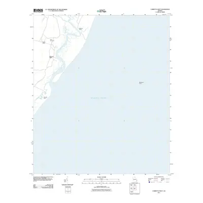
 1993 Cabretta Inlet1995 Print · USGSThe Georgia coastline near McIntosh County remains a wild landscape of shifting sands and protected marshes in the 1990s. Researchers can locate remote landmarks like Raccoon Bluff, identify local ruins, and trace the dynamic shoreline near Cabretta Inlet.
 - 2011 Map of Cabretta Inlet, 2011 Print
 2011 Cabretta Inlet2011 Print · USGSCovers Raccoon Bluff, including McIntosh County, United States, and other nearby areas
 - 2014 Map of Cabretta Inlet, 2014 Print
 2014 Cabretta Inlet2014 Print · USGSCovers Raccoon Bluff, including McIntosh County, United States, and other nearby areas
 - 2017 Map of Cabretta Inlet, 2017 Print
 2017 Cabretta Inlet2017 Print · USGSCovers Raccoon Bluff, including McIntosh County, United States, and other nearby areas
 - 2020 Map of Cabretta Inlet, 2020 Print
 2020 Cabretta Inlet2020 Print · USGSCovers Raccoon Bluff, including McIntosh County, United States, and other nearby areas
 - 2024 Map of Cabretta Inlet, 2024 Print
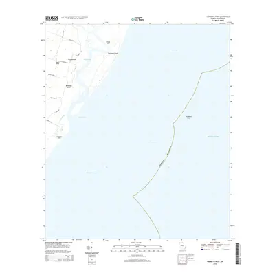
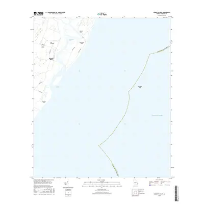
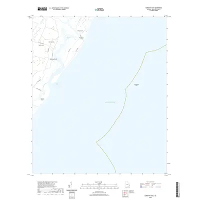
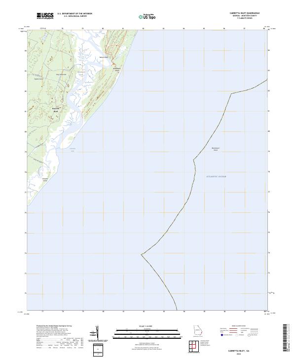 2024 Cabretta Inlet2024 Print · USGSThe Georgia barrier islands are captured in this recent survey, showcasing the tidal geography of McIntosh County. Researchers can trace the roads around Raccoon Bluff or explore the protected reaches of the Blackbeard Island Wilderness.
End of results
Showing maps 1-16 of 16
Top cities near Raccoon Bluff
Frequently asked questions
- What are the different types of historical maps available for Raccoon Bluff?
- What is the oldest map of Raccoon Bluff?
- Where can I purchase historical maps of Raccoon Bluff for my home or office?
- Where can I download high-res historical maps of Raccoon Bluff?
- Are there historical topographic maps available for Raccoon Bluff?
- Is there historical aerial imagery available for Raccoon Bluff?
- Where are historical maps of Raccoon Bluff sourced from?