Old Maps of Cherokee Park, Columbus for Metal Detecting
Plan your next treasure hunt with 16 historic maps of Cherokee Park. Find old homesites, ghost towns, trails, and gathering spots that may be lost to time — perfect for identifying promising metal detecting locations.
- Locate forgotten sites: Uncover places like long-lost settlements, abandoned rail lines, or gathering spots.
- Plan better hunts: Use map overlays combined with LiDAR or satellite views to narrow in on historically rich areas.
- Made for detectorists: Thousands of hobbyists use these maps to discover relics, coins, and hidden history.
Use these historic maps to boost your research and find new opportunities beneath the surface of Cherokee Park.
Cherokee Park, Columbus maps
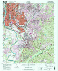
(16)- 1908 Map of Columbus
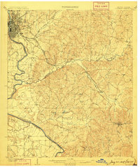 1908 Columbus1908 Print · USGSThe Chattahoochee riverfront at the dawn of the century shows the thriving river-and-rail economy of the Georgia-Alabama border. Genealogists and historians can trace early landings like BRADLEY LDG, rural congregations at Goodhope Church, and the operations at Cooks Mill.8 unique versions available
 - 1929 Map of Columbus
 1929 Columbus1929 Print · USGSThe Georgia-Alabama borderlands come alive in this late 1920s survey of the bustling military and rail hub around Columbus. Genealogists and historians can trace the transition from rural farmsteads to military grounds at Fort Benning, identifying family landmarks like Greenwood Hill and Holliday Hill.
 - 1947 Map of Columbus, 1954 Print
 1947 Columbus1954 Print · USGSPostwar Georgia and Alabama meet along the Chattahoochee River in this detailed study of military expansion and urban growth. Genealogists and historians can trace family-named landmarks across Fort Benning and locate sites like Riverdale Cem, Midway Ch, and Baker Village.2 unique versions available
 - 1949 Map of Columbus
 1949 Columbus1949 Print · USGSColumbus and Phenix City flank the Chattahoochee River during a period of massive military growth following the war. Genealogists can trace family footprints through Linwood Cem and neighborhood schools like St Elmo School or Jordan High School.2 unique versions available
 - 1955 Map of Columbus, 1959 Print
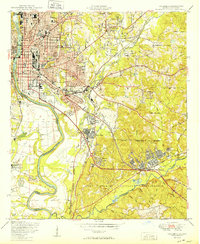
 1955 Columbus1959 Print · USGSMid-century Columbus and Phenix City thrive along the river at the height of their industrial and military significance. Genealogists and local historians can locate many vanished city schools, the sprawling Rose Hill Cemetery, and the early layout of the Fort Benning Military Reservation.5 unique versions available
 - 1955 Map of Columbus, 1961 Print
 1955 Columbus1961 Print · USGSColumbus and the neighboring military lands at Fort Benning are shown here during a period of significant post-war growth. Researchers can trace family sites among the many named hills and local landmarks like Montgomery Mill, St Peters Ch, and the Central of Georgia rail lines.
 - 1955 Map of Phenix City, 1964 Print
 1955 Phenix City1964 Print · USGSPost-war Alabama and Georgia meet along the Chattahoochee River as industry and military installations expand. Trace the rail lines of the Central of Georgia through towns like Opelika, Tuskegee, and Alexander City.3 unique versions available
 - 1957 Map of Phenix City
 1957 Phenix City1957 Print · USGSThe Alabama-Georgia borderlands are captured here in the mid-fifties, centered on the bustling river crossing at Phenix City and Columbus. Researchers can trace the mid-century footprint of the Fort Benning Military Reservation or locate smaller textile and railroad towns like Langdale and Camp Hill.
 - 1958 Map of Phenix City
 1958 Phenix City1958 Print · USGSThe Alabama-Georgia borderlands thrive during the late fifties, anchored by the river-driven industry of Columbus and Phenix City. Researchers can trace the mid-century footprints of Fort Benning, Auburn, and the textile towns of Fairfax and Lanett.
 - 1981 Map of Americus, 1982 Print
 1981 Americus1982 Print · USGSWest Georgia and East Alabama appear here during the early 1980s, showcasing the transition from military reservation to agricultural heartland. Researchers can trace the Central of Georgia rail lines through towns like Plains, Ellaville, and the historic site of Andersonville.
 - 1999 Map of Columbus, 2001 Print
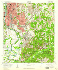
 1999 Columbus2001 Print · USGSColumbus at the close of the twentieth century shows a city shaped by the Chattahoochee River and the expanding Fort Benning Military Reservation. Genealogists can locate family plots at Linwood Cemetery or trace old rail lines like the Central of Georgia.
 - 2011 Map of Columbus, 2011 Print
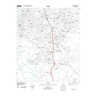 2011 Columbus2011 Print · USGSCovers Cherokee Park, including Columbus, Phenix City, and other nearby areas
 - 2014 Map of Columbus, 2014 Print
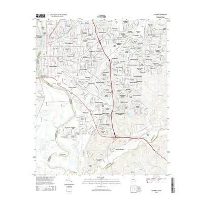 2014 Columbus2014 Print · USGSCovers Cherokee Park, including Columbus, Phenix City, and other nearby areas
 - 2017 Map of Columbus, 2017 Print
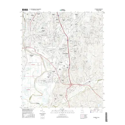 2017 Columbus2017 Print · USGSCovers Cherokee Park, including Columbus, Phenix City, and other nearby areas
 - 2020 Map of Columbus, 2020 Print
 2020 Columbus2020 Print · USGSCovers Cherokee Park, including Columbus, Phenix City, and other nearby areas
 - 2024 Map of Columbus, 2024 Print
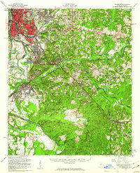
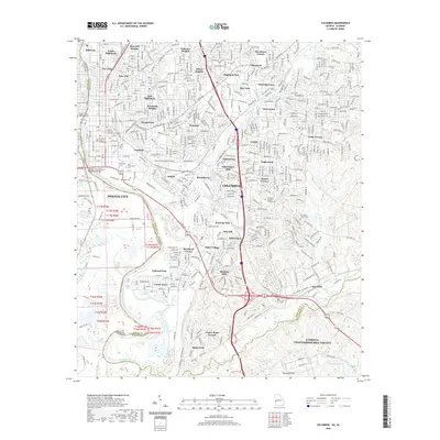
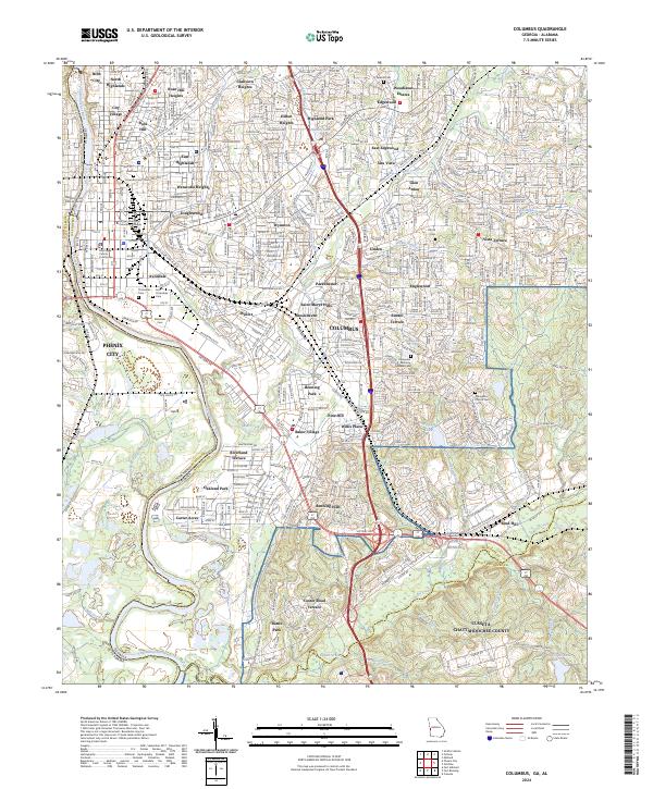 2024 Columbus2024 Print · USGSColumbus and the Chattahoochee River valley appear in high detail during this contemporary era. Genealogists can trace family records across Linwood Cem and Evergreen Memory Gardens Cem near Fort Benning.
End of results
Showing maps 1-16 of 16
Frequently asked questions
- What are the different types of historical maps available for Cherokee Park?
- What is the oldest map of Cherokee Park?
- Where can I purchase historical maps of Cherokee Park for my home or office?
- Where can I download high-res historical maps of Cherokee Park?
- Are there historical topographic maps available for Cherokee Park?
- Is there historical aerial imagery available for Cherokee Park?
- Where are historical maps of Cherokee Park sourced from?