Old Maps of Newton County, Georgia for Academic Research
Study the evolution of Newton County with 91 high-resolution historic maps. Whether you're teaching, researching, or modeling changes in land use, these maps provide essential visual documentation of urban, environmental, and geographic change.
- Analyze long-term change: Track patterns in development, transportation, and natural features.
- Ideal for environmental or urban studies: Support academic projects with primary historical map data.
- Use in the classroom or lab: Educators and researchers rely on these maps to bring historical context to life.
These maps are a powerful tool for teaching, research, and visualizing how Newton County has changed over the decades.
Newton County, GA maps
(91)- 1888 Map of Atlanta, 1955 Print
 1888 Atlanta1955 Print · USGSAtlanta and its surrounding counties emerge as a booming rail hub in the years following the Civil War. Trace early settlements and infrastructure like Jett Ferry, Oakley Mill, and the massive granite profile of Stone Mountain before the era of modern sprawl.
 - 1890 Map of Atlanta
 1890 Atlanta1890 Print · USGSGeorgia's rail and river networks converge in the late nineteenth century as the capital city expands. Genealogists can trace family homesteads near Jetts Store, Howells Mills, and the various river crossings like Paces Ferry.
 - 1892 Map of Atlanta
 1892 Atlanta1892 Print · USGSAtlanta and its surrounding counties appear at a pivotal moment of post-war growth as the region's rail network reached maturity. Genealogists and historians can trace the foundations of modern DeKalb and Fulton counties through landmarks like Stone Mountain, Roswell Junction, and Paces Ferry.
 - 1895 Map of Atlanta
 1895 Atlanta1895 Print · USGSThe growing railroad hub of Atlanta is shown here in the late nineteenth century alongside its surrounding river ferries and emerging suburbs. Trace old family names and sites like Howell Mills, Vining Station, and Ft. McPherson.7 unique versions available
 - 1896 Map of Monroe
 1896 Monroe1896 Print · USGSNorth-central Georgia thrives during the late nineteenth century as a hub of river-powered industry and rail expansion. Genealogists and historians can trace family locations near Salem Camp Ground, the local commerce at Carithers Store, and several early crossings like Bells Bridge.5 unique versions available
 - 1953 Map of Atlanta, 1965 Print
 1953 Atlanta1965 Print · USGSThe growing Atlanta metro and the industrial corridors of Eastern Alabama are captured here during the mid-century transition. Researchers can trace the rail-to-road shift through hubs like Anniston and La Grange or locate sites within Fort McClellan.2 unique versions available
 - 1953 Map of Athens, 1966 Print
 1953 Athens1966 Print · USGSGeorgia's Piedmont and Savannah River borderlands come alive in this mid-century survey of the region surrounding Athens and Augusta. Trace the rail-and-river economy through the Georgia RR and landmarks like the Fort Gordon Military Reservation.3 unique versions available
 - 1957 Map of Atlanta
 1957 Atlanta1957 Print · USGSAtlanta and the Alabama borderlands appear here in the mid-fifties, capturing the region's post-war suburban and industrial transition. Trace the development of early transport hubs and military sites like Fort McPherson, Anniston, and the Kennesaw Mountain National Battlefield Park.
 - 1958 Map of Athens
 1958 Athens1958 Print · USGSNorth-central Georgia and the Savannah River valley are captured in the late fifties, showing the region as the new reservoirs were filling. Researchers can trace historic rail lines like the Georgia RR and locate rural landmarks such as Social Circle, Graves Mountain, and the Fort Gordon Military Reservation.
 - 1958 Map of Atlanta
 1958 Atlanta1958 Print · USGSMid-century Georgia and Alabama are shown in this regional study of the corridor between the Chattahoochee River and the Appalachian foothills. Local historians can trace the development of suburban Atlanta alongside vital landmarks like Stone Mountain, Dobbins AFB, and the Seaboard Air Line rail routes.
 - 1959 Map of Athens
 1959 Athens1959 Print · USGSNortheast Georgia and the South Carolina borderlands appear here in the mid-fifties, during a decade of infrastructure growth. Genealogists and historians can trace the rail-and-river geography of towns like Social Circle, the sprawl of Fort Gordon Military Reservation, and the newly formed Clark Hill Reservoir.
 - 1963 Map of Athens
 1963 Athens1963 Print · USGSGeorgia's Piedmont and the Savannah River valley are captured in the early sixties as major reservoirs and military installations reshaped the landscape. Researchers can trace the development of Clark Hill Reservoir, locate the Fort Gordon Military Reservation, and find historic towns like Social Circle and Eatonton.
 - 1964 Map of Lloyd Shoals Dam, 1965 Print
 1964 Lloyd Shoals Dam1965 Print · USGSThe convergence of the South and Alcovy Rivers into Jackson Lake defines this rural Georgia landscape in the early sixties. Genealogists can trace family names and landmarks like Leverette Cem, Bethel Grove Ch, and the settlement of Bethel.3 unique versions available
 - 1964 Map of Ola, 1965 Print
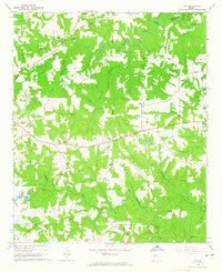 1964 Ola1965 Print · USGSHenry County remains a pastoral landscape of family farms and creek-side settlements in the mid-1960s. Genealogists can trace family roots through numerous sites like Old Mt Bethel Cem, Humphrey Cem, and the community hub at Ola.3 unique versions available
 - 1964 Map of Stewart, 1965 Print
 1964 Stewart1965 Print · USGSThe convergence of the Alcovy and Yellow Rivers into Jackson Lake highlights this Georgia landscape in the 1960s. Researchers can trace family history through sites like Newton Factory and the Heard-Mixon Sch or find old burial sites such as Fincher Cem.3 unique versions available
 - 1964 Map of Worthville, 1965 Print
 1964 Worthville1965 Print · USGSThe tri-county border of Newton, Henry, and Butts comes alive in the 1960s as a landscape of rural river settlements and country churches. Genealogists can trace family roots through Rock Springs Ch, Worthville, and the Fairview Cem.2 unique versions available
 - 1964 Map of Porterdale, 1966 Print
 1964 Porterdale1966 Print · USGSNewton County's river-driven industry and rural crossroads are captured here in the mid-1960s as the suburbs of Atlanta began to reach eastward. Researchers can trace family roots at Salem Campground, Richards Chapel, and the now-familiar streets of Porterdale.4 unique versions available
 - 1964 Map of Kelleytown, 1966 Print
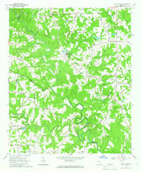 1964 Kelleytown1966 Print · USGSRockdale and Henry counties appear in the mid-1960s as a landscape of rural family farms and quiet crossroads. Researchers can locate legacy family sites and landmarks including Kelleytown, the Monastery of the Holy Ghost, and the Whitaker Cem.3 unique versions available
 - 1964 Map of Covington, 1966 Print
 1964 Covington1966 Print · USGSCovington and the surrounding Newton County countryside are shown here in the mid-sixties as the area evolved from its agricultural roots. Genealogists and local historians can locate early institutions like Emory Jr College, Starrsville Ch, and the Rakestraw Cems.3 unique versions available
 - 1964 Map of Milstead, 1966 Print
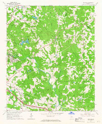 1964 Milstead1966 Print · USGSThe Yellow River valley of northern Georgia is shown in the mid-1960s, a period when rural church communities and historic mill sites still defined the landscape. Genealogists and historians can trace family locations near Milstead, Philadelphia Ch, and Costley Millpond.4 unique versions available
 - 1964 Map of Jersey, 1966 Print
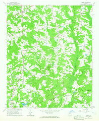 1964 Jersey1966 Print · USGSWalton and Newton counties are captured in the mid-1960s as rural crossroads and family homesteads defined the landscape. Genealogists can trace family landmarks like Carter Cem and Brodnax Cem alongside local centers like Jersey and Walnut Grove.3 unique versions available
 - 1971 Map of Social Circle, 1974 Print
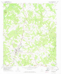 1971 Social Circle1974 Print · USGSSocial Circle and its neighboring rural communities are captured here in the early seventies, centered on the Georgia Railroad corridor. Researchers can locate family landmarks like Annie Mary Ch, Circle View Cem, and the small settlement of Herndonville.3 unique versions available
 - 1972 Map of Farrar, 1974 Print
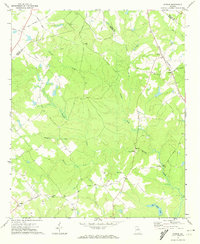 1972 Farrar1974 Print · USGSJasper and Newton counties are captured here in the early 1970s, showing a rural landscape of winding creeks and country crossroads. Genealogists can trace family landmarks like Pitts Chapel, Shiloh Ch, and the small community of Farrar along the Central of Georgia rail line.2 unique versions available
 - 1972 Map of Mansfield, 1974 Print
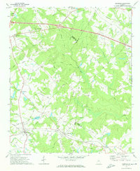 1972 Mansfield1974 Print · USGSNewton County in the early seventies remains a landscape of rail-connected towns and country churches. Genealogists can trace family names and old landmarks across the Central of Georgia line between Mansfield and the historic Brick Store settlement.2 unique versions available
 - 1979 Map of Griffin, 1980 Print
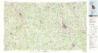 1979 Griffin1980 Print · USGSWest-central Georgia at the close of the seventies reveals a landscape of historic rail towns and growing suburbs between the major river systems. Trace the rail lines and early road networks connecting Griffin, Peachtree City, and Newnan, or locate smaller settlements like Senoia and Experiment.3 unique versions available
Showing maps 1-25 of 91
Top cities of Newton County
- Covington historical maps
- Oxford historical maps
- Porterdale historical maps
- Newborn historical maps
- Mansfield historical maps
Frequently asked questions
- What are the different types of historical maps available for Newton County?
- What is the oldest map of Newton County?
- Where can I purchase historical maps of Newton County for my home or office?
- Where can I download high-res historical maps of Newton County?
- Are there historical topographic maps available for Newton County?
- Is there historical aerial imagery available for Newton County?
- Where are historical maps of Newton County sourced from?