1970s Maps of Putnam County, Georgia
Explore 10 historic maps of Putnam County from the 1970s. These maps offer a rare glimpse into what life looked like during the 1970s — showing old roads, neighborhoods, homes, and landmarks that have changed or disappeared over time.
Whether you're researching your family's past, planning a metal detecting trip, or studying how Putnam County's landscape evolved across the 1970s, these high-resolution maps are a powerful tool for exploring the history of this region.
- Focus on a specific era: All maps on this page are from the 1970s, giving you a focused view of this time period.
- See what’s changed: Compare century-old streets, trails, and buildings to today's modern landscape using overlays and satellite layers.
- Research with precision: Use these maps for genealogy, historical research, land use analysis, or educational projects.
- View, download, or print: Maps are fully viewable online in high resolution, and can be downloaded or printed for your own records.
Start exploring Putnam County's history through authentic maps from the 1970s. This is your window into the past.
Putnam County, GA maps
(10)- 1972 Map of Liberty, 1974 Print
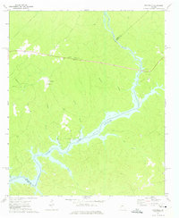
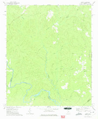 1972 Liberty1974 Print · USGSGreene County is depicted in the early seventies as a landscape of deep river bends and rural church communities. Genealogists and historians can trace the paths of Richland Creek and locate family landmarks such as Liberty Chapel, Flat Rock Ch, and Lawrence Center.2 unique versions available
 - 1972 Map of Meda, 1974 Print
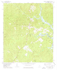
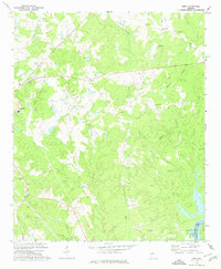 1972 Meda1974 Print · USGSPutnam County in the early seventies was a landscape of small settlements and rural congregations connected by the Central of Georgia railroad. Genealogists can locate family landmarks such as Philadelphia Ch, Wesley Chapel, and the Lookout Tower near Meda.
 - 1972 Map of Eatonton, 1974 Print
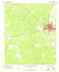 1972 Eatonton1974 Print · USGSEatonton and the surrounding Putnam County countryside are captured here in the early 1970s, as the railroad still influenced the local economy. Genealogists can locate family landmarks like Hunts Chapel Cem, Mount Gilead Ch, and the small settlement of Imperial.2 unique versions available
 - 1972 Map of Shady Dale, 1974 Print
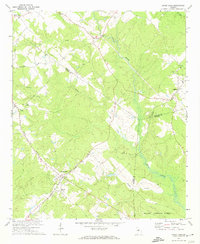 1972 Shady Dale1974 Print · USGSJasper and Morgan County crossroads are preserved here during the early seventies, centered on the rail-based growth of Shady Dale and Machen. Researchers can trace old family sites and local landmarks like Pleasant Grove Ch and the Central of Georgia rail line.2 unique versions available
 - 1972 Map of Smithboro, 1974 Print
 1972 Smithboro1974 Print · USGSThe rural landscape of Jasper and Putnam Counties in the 1970s is defined by the dense woods of the Oconee National Forest. Researchers can trace old transportation routes and local landmarks including Reids Chapel, the Central of Georgia rail line, and the namesake settlement of Smithboro.2 unique versions available
 - 1972 Map of Harmony, 1974 Print
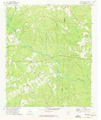
 1972 Harmony1974 Print · USGSThe Putnam County Piedmont is captured here in the early seventies, as the Oconee National Forest and Oconee River frame rural life. Genealogists can trace family roots at Lone Oak Ch, Ward Chapel, and several scattered cemeteries.3 unique versions available
 - 1972 Map of Rock Eagle Lake, 1974 Print
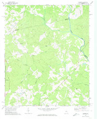
 1972 Rock Eagle Lake1974 Print · USGSPutnam and Morgan counties in the early seventies reveal a mix of public forest and deep-rooted rural communities. Researchers can trace land tracts near Reids Crossroads, locate the Rock Eagle Monument, and find rural churches like Springfield Ch.
 - 1972 Map of Lake Sinclair West, 1975 Print
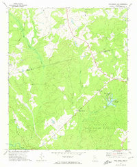
 1972 Lake Sinclair West1975 Print · USGSThe confluence of the Oconee and Little Rivers in the early seventies shows a landscape transformed by power generation and lakeside growth. Researchers can locate rural landmarks like Rooty Creek Ch, the Central of Georgia rail line, and the John Milledge Academy.
 - 1972 Map of Rockville, 1975 Print
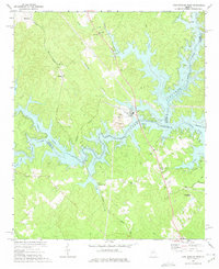
 1972 Rockville1975 Print · USGSPutnam County's rural character is on full display in the early seventies as the waters of Lake Sinclair reach into the wooded hills. Genealogists can trace family roots through several local landmarks like St Pauls Ch, Jenkins Grove Chapel, and the Rockville settlement.2 unique versions available
 - 1978 Map of Resseaus Crossroads
 1978 Resseaus Crossroads1978 Print · USGSPutnam and Jones counties appear here in the late seventies as the recreation-driven economy of the reservoir began to shape the landscape. Researchers can trace old family sites near Resseaus Crossroads, Pierce Chapel Ch, and the shores of Lake Sinclair.3 unique versions available
End of results
Showing maps 1-10 of 10
Top cities of Putnam County
Frequently asked questions
- What are the different types of historical maps available for Putnam County?
- What is the oldest map of Putnam County?
- Where can I purchase historical maps of Putnam County for my home or office?
- Where can I download high-res historical maps of Putnam County?
- Are there historical topographic maps available for Putnam County?
- Is there historical aerial imagery available for Putnam County?
- Where are historical maps of Putnam County sourced from?