
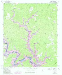
1972 Map of Liberty
USGS Topo · Published 1974About this map
The Oconee River defines the southern portion of this landscape, meandering through a series of dramatic bends where the borders of Putnam and Greene counties converge. The terrain is deeply carved by an extensive drainage network, with the substantial Richland Creek flowing south to meet the river, joined by tributaries such as Beaverdam Creek, Stewarts Creek, and Sandy Creek. These watercourses dictate the placement of local landmarks and transit routes across the rural countryside.
Find a feature on this map
22 named features on this map. Tap any name to fly to it.
Don’t see what you’re looking for? This feature index may not catch every label — zoom into the map to look around manually.
Map Details
Editions of this 1972 Liberty Map
2 editions found
Other maps of this area

1953 · Athens
USGS Topo · 1:250,000

1958 · Athens
USGS Topo · 1:250,000

1959 · Athens
USGS Topo · 1:250,000

1963 · Athens
USGS Topo · 1:250,000

1965 · Union Point
USGS Topo · 1:24,000

1972 · Shoulderbone
USGS Topo · 1:24,000

1972 · Meda
USGS Topo · 1:24,000

1972 · Buckhead
USGS Topo · 1:24,000

1972 · Harmony
USGS Topo · 1:24,000
1972 · Greensboro
USGS Topo · 1:24,000