
1972 Map of Buckhead
USGS Topo · Published 1974About this map
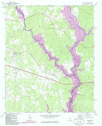
The Apalachee River and Oconee River converge in the eastern portion of this map, marking the boundary between Morgan and Greene counties in the early 1970s. This rural landscape is heavily wooded, dominated by the Oconee National Forest and characterized by the intersection of the Georgia railroad line and state highways. Small settlements and local landmarks dot the terrain, including Buckhead, Swords, and Carey, along with several country churches like Mt Zion Ch and Greenville Ch.
Find a feature on this map
26 named features on this map. Tap any name to fly to it.
Don’t see what you’re looking for? This feature index may not catch every label — zoom into the map to look around manually.
Map Details
Editions of this 1972 Buckhead Map
2 editions found
Other maps of this area

1953 · Athens
USGS Topo · 1:250,000

1958 · Athens
USGS Topo · 1:250,000

1959 · Athens
USGS Topo · 1:250,000

1963 · Athens
USGS Topo · 1:250,000

1972 · Penfield
USGS Topo · 1:24,000

1972 · Liberty
USGS Topo · 1:24,000

1972 · Apalachee
USGS Topo · 1:24,000

1972 · Harmony
USGS Topo · 1:24,000

1972 · Rock Eagle Lake
USGS Topo · 1:24,000
1972 · Greshamville
USGS Topo · 1:24,000