
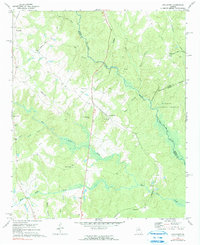
1972 Map of Apalachee
USGS Topo · Published 1974About this map
The Apalachee River flows through the heart of this landscape, forming a natural boundary between Morgan, Oconee, and Greene counties. In the early 1970s, the rural character of this region was defined by small settlements like Bostwick, Salem, and Apalachee, where the Central of Georgia railroad line parallels the highway. This survey documents a deeply rooted community infrastructure, featuring numerous country churches such as First St Pauls Ch, Second St Pauls Ch, and Holland Spring Ch, many of which are accompanied by small cemeteries.
Find a feature on this map
38 named features on this map. Tap any name to fly to it.
Don’t see what you’re looking for? This feature index may not catch every label — zoom into the map to look around manually.
Map Details
Editions of this 1972 Apalachee Map
2 editions found
Other maps of this area

1896 · Monroe
USGS Topo · 1:125,000

1953 · Athens
USGS Topo · 1:250,000

1958 · Athens
USGS Topo · 1:250,000

1959 · Athens
USGS Topo · 1:250,000

1963 · Athens
USGS Topo · 1:250,000

1964 · Barnett Shoals
USGS Topo · 1:24,000

1964 · High Shoals
USGS Topo · 1:24,000

1964 · Watkinsville
USGS Topo · 1:24,000

1971 · Rutledge North
USGS Topo · 1:24,000

1972 · Buckhead
USGS Topo · 1:24,000