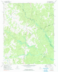
1972 Map of Apalachee
USGS Topo · Published 1991About this map
The Apalachee River flows through the center of this rural Georgia landscape, marking the borders between Morgan, Oconee, and Greene counties. During the early 1970s, the Central of Georgia railroad corridor anchored the small settlements of Apalachee and Bostwick, while the eastern portion of the map is defined by the protected acreage of the Oconee National Forest. This survey captures a series of local landmarks and congregational hubs, including First St Pauls Ch and Second St Pauls Ch, alongside numerous small family or community cemeteries. The terrain is characterized by a dense network of watercourses like Big Sandy Creek and Hard Labor Creek, which carve through the wooded hills. Distinctive features such as Balance Rock and a strategically placed Lookout Tower reflect a mix of natural geology and forest management typical of the Piedmont region.
Find a feature on this map
37 named features on this map. Tap any name to fly to it.
Don’t see what you’re looking for? This feature index may not catch every label — zoom into the map to look around manually.
Map Details
Editions of this 1972 Apalachee Map
2 editions found

Other maps of this area

1896 · Monroe
USGS Topo · 1:125,000

1953 · Athens
USGS Topo · 1:250,000

1958 · Athens
USGS Topo · 1:250,000

1959 · Athens
USGS Topo · 1:250,000

1963 · Athens
USGS Topo · 1:250,000

1964 · Barnett Shoals
USGS Topo · 1:24,000

1964 · High Shoals
USGS Topo · 1:24,000

1964 · Watkinsville
USGS Topo · 1:24,000

1971 · Rutledge North
USGS Topo · 1:24,000

1972 · Buckhead
USGS Topo · 1:24,000