
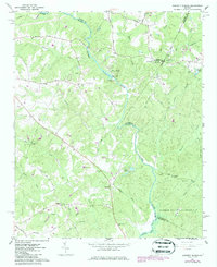
1964 Map of Barnett Shoals
USGS Topo · Published 1965About this map
The Oconee River meanders through this landscape, marking the borders of Clarke, Oconee, Oglethorpe, and Greene counties. At the heart of the terrain lies Barnett Shoals, where a powerplant and the Barnett Shoals Dam harness the river's energy near a sharp bend. The surrounding countryside is defined by a dense network of family-named cemeteries and rural congregations, reflecting the deep-rooted community structure of the mid-1960s.
Find a feature on this map
59 named features on this map. Tap any name to fly to it.
Don’t see what you’re looking for? This feature index may not catch every label — zoom into the map to look around manually.
Map Details
Editions of this 1964 Barnett Shoals Map
2 editions found
Other maps of this area

1953 · Athens
USGS Topo · 1:250,000

1958 · Athens
USGS Topo · 1:250,000

1959 · Athens
USGS Topo · 1:250,000

1963 · Athens
USGS Topo · 1:250,000

1964 · Athens West
USGS Topo · 1:24,000

1964 · Watkinsville
USGS Topo · 1:24,000
1964 · Athens East
USGS Topo · 1:24,000
1971 · Crawford
USGS Topo · 1:24,000

1971 · Maxeys
USGS Topo · 1:24,000

1972 · Penfield
USGS Topo · 1:24,000