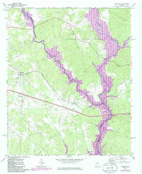
1972 Map of Buckhead
USGS Topo · Published 1986About this map
Lake Oconee dominates the southeastern quadrant of this region, where the water spills across the borders of Morgan and Greene Counties. The landscape is a mix of agricultural clearings and dense woodland, much of which is protected within the Oconee National Forest. This 1970s-era survey captures the area at a point of significant environmental change, with revisions from 1981 showing the expansion of the lake's reach along the Apalachee River and Sugar Creek.
Find a feature on this map
23 named features on this map. Tap any name to fly to it.
Don’t see what you’re looking for? This feature index may not catch every label — zoom into the map to look around manually.
Map Details
Editions of this 1972 Buckhead Map
2 editions found
Other maps of this area

1953 · Athens
USGS Topo · 1:250,000

1958 · Athens
USGS Topo · 1:250,000

1959 · Athens
USGS Topo · 1:250,000

1963 · Athens
USGS Topo · 1:250,000

1972 · Penfield
USGS Topo · 1:24,000

1972 · Liberty
USGS Topo · 1:24,000

1972 · Buckhead
USGS Topo · 1:24,000

1972 · Apalachee
USGS Topo · 1:24,000

1972 · Harmony
USGS Topo · 1:24,000

1972 · Rock Eagle Lake
USGS Topo · 1:24,000