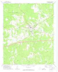
1972 Map of Greensboro
USGS Topo · Published 1974About this map
The Georgia city of Greensboro stands as the central hub of this early 1970s landscape, where the rural character of Greene County meets the southern reaches of the Oconee National Forest. This era shows a community defined by its institutional anchors and expanding infrastructure, from Boswell Hospital and Corry Jr High Sch to the modern passage of Georgia 20 and Georgia 15. The town's connection to the land is marked by small bodies of water like Phelps Lake and Greensboro Lake, surrounded by the dense hydrology of Richland Creek and Town Creek.
Find a feature on this map
33 named features on this map. Tap any name to fly to it.
Don’t see what you’re looking for? This feature index may not catch every label — zoom into the map to look around manually.
Map Details
Editions of this 1972 Greensboro Map
2 editions found
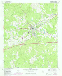
Other maps of this area

1953 · Athens
USGS Topo · 1:250,000

1958 · Athens
USGS Topo · 1:250,000

1959 · Athens
USGS Topo · 1:250,000

1963 · Athens
USGS Topo · 1:250,000

1965 · Woodville
USGS Topo · 1:24,000

1965 · Union Point
USGS Topo · 1:24,000

1972 · Penfield
USGS Topo · 1:24,000

1972 · Liberty
USGS Topo · 1:24,000

1972 · Buckhead
USGS Topo · 1:24,000

1972 · Harmony
USGS Topo · 1:24,000