
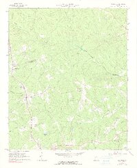
1965 Map of Woodville
USGS Topo · Published 1966About this map
The Oglethorpe County and Greene County border bisects this mid-1960s landscape, where small agricultural and railway settlements dot the rural interior of Georgia. The town of Woodville serves as a primary hub along Georgia 77, supported by community landmarks such as St Pauls Ch and a central Water Tank. To the north, Bairdstown sits near the county line, while smaller hamlets like Temperance Bell, Durham Town, and Jacksonville are connected by a network of unimproved roads and small creek crossings. The topography is defined by the drainage systems of the North Fork Little River and its numerous tributaries, including Tuggle Creek and Calloway Creek. Significant infrastructure of the era is evident in the Lookout Tower and Radio Tower located south of Woodville, overlooking the waters of Stewarts Lake.
Find a feature on this map
29 named features on this map. Tap any name to fly to it.
Don’t see what you’re looking for? This feature index may not catch every label — zoom into the map to look around manually.
Map Details
Editions of this 1965 Woodville Map
2 editions found
Other maps of this area

1906 · Crawfordville
USGS Topo · 1:125,000

1953 · Athens
USGS Topo · 1:250,000

1958 · Athens
USGS Topo · 1:250,000

1959 · Athens
USGS Topo · 1:250,000

1963 · Athens
USGS Topo · 1:250,000

1965 · Union Point
USGS Topo · 1:24,000

1966 · Philomath
USGS Topo · 1:24,000

1966 · Crawfordville
USGS Topo · 1:24,000

1971 · Maxeys
USGS Topo · 1:24,000
1971 · Lexington
USGS Topo · 1:24,000