Old Maps of Riverturn, Georgia for Academic Research
Study the evolution of Riverturn with 13 high-resolution historic maps. Whether you're teaching, researching, or modeling changes in land use, these maps provide essential visual documentation of urban, environmental, and geographic change.
- Analyze long-term change: Track patterns in development, transportation, and natural features.
- Ideal for environmental or urban studies: Support academic projects with primary historical map data.
- Use in the classroom or lab: Educators and researchers rely on these maps to bring historical context to life.
These maps are a powerful tool for teaching, research, and visualizing how Riverturn has changed over the decades.
Riverturn, GA maps
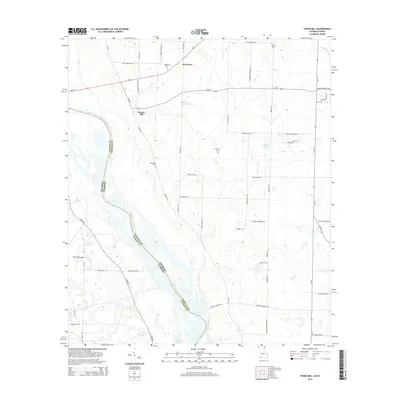
(13)- 1954 Map of Steam Mill, 1955 Print
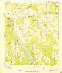 1954 Steam Mill1955 Print · USGSThe borderlands of Georgia and Florida are captured here during the mid-century development of the Jim Woodruff Reservoir. Genealogists and local historians can trace rural life through sites like Lela Courthouse, Griselda Sch, and the Williams Cem.2 unique versions available
 - 1954 Map of Tallahassee, 1967 Print
 1954 Tallahassee1967 Print · USGSThe Florida Panhandle and South Georgia are captured here during a period of mid-century growth and military expansion. Researchers can trace the development of Panama City, the footprint of Tyndall Air Force Base, and the rail lines of the Atlantic Coast Line.4 unique versions available
 - 1959 Map of Tallahassee
 1959 Tallahassee1959 Print · USGSFlorida's Panhandle and the Big Bend region appear here in the mid-fifties, showing a landscape defined by its great river systems and developing coast. Trace the early layout of Panama City, the expansive Apalachicola National Forest, and the coastal St Marks Lighthouse.
 - 1960 Map of Tallahassee
 1960 Tallahassee1960 Print · USGSThe Florida Panhandle and southern Georgia are captured here in the mid-twentieth century, showing a region defined by its rivers and military installations. Genealogists and historians can trace the growth of Tallahassee or locate coastal landmarks like the St Marks Lighthouse and Tyndall Air Force Base.
 - 1978 Map of Bainbridge, 1980 Print
 1978 Bainbridge1980 Print · USGSIn the late seventies, this Georgia-Florida borderland was defined by the confluence of the Flint and Chattahoochee rivers. Trace the region's infrastructure via the Seaboard Coast Line Railroad and find sites like Bainbridge State Hospital.
 - 1982 Map of Steam Mill, 1983 Print
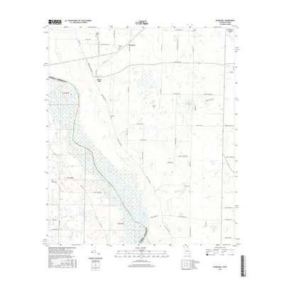
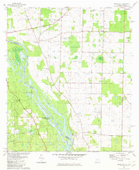 1982 Steam Mill1983 Print · USGSThe Florida-Georgia borderland along the Chattahoochee River is captured here in the early eighties as Lake Seminole reaches into the Seminole County countryside. Researchers can trace family history through numerous sites like Williams Cem, Lela Courthouse, and the settlement at Steam Mill.
 - 1988 Map of Tallahassee
 1988 Tallahassee1988 Print · USGSThe Florida Panhandle and South Georgia are captured here in the late eighties, showing the expansion of the regional highway network and coastal growth. Genealogists and historians can trace rail lines like the Seaboard System Railroad or locate family roots in Blountstown, Graceville, or Crawfordville.2 unique versions available
 - 1994 Map of Steam Mill, 1998 Print
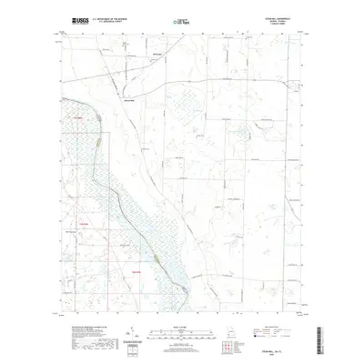
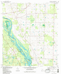 1994 Steam Mill1998 Print · USGSThe Georgia and Florida borderlands are captured here in the mid-nineties as the river economy gave way to conservation and lake life. Genealogists can trace family footprints at Lela Courthouse and numerous burial sites like Brunson Cem or Williams Cem.
 - 2011 Map of Steam Mill, 2011 Print
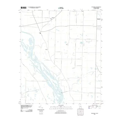 2011 Steam Mill2011 Print · USGSCovers Riverturn, including Green Acres Subdivision, Steam Mill, and other nearby areas
 - 2014 Map of Steam Mill, 2014 Print
 2014 Steam Mill2014 Print · USGSCovers Riverturn, including Green Acres Subdivision, Steam Mill, and other nearby areas
 - 2017 Map of Steam Mill, 2017 Print
 2017 Steam Mill2017 Print · USGSCovers Riverturn, including Green Acres Subdivision, Steam Mill, and other nearby areas
 - 2020 Map of Steam Mill, 2020 Print
 2020 Steam Mill2020 Print · USGSCovers Riverturn, including Green Acres Subdivision, Steam Mill, and other nearby areas
 - 2024 Map of Steam Mill, 2024 Print
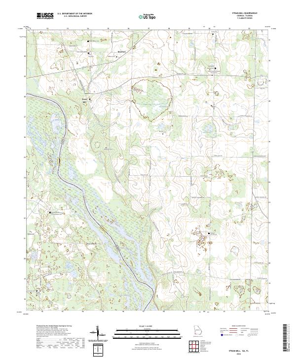 2024 Steam Mill2024 Print · USGSThe Georgia-Florida borderlands near the Chattahoochee River are captured here in the contemporary era, showing a landscape defined by water and woods. Genealogists can trace a remarkable number of family burial sites and country congregations, from Circle Hill Cem to the Macedonia Missionary Baptist Church Cem.
End of results
Showing maps 1-13 of 13
Top cities near Riverturn
- Marianna historical maps
- Donalsonville historical maps
- Malone historical maps
- Colquitt historical maps
- Greenwood historical maps
- Iron City historical maps
See more
Frequently asked questions
- What are the different types of historical maps available for Riverturn?
- What is the oldest map of Riverturn?
- Where can I purchase historical maps of Riverturn for my home or office?
- Where can I download high-res historical maps of Riverturn?
- Are there historical topographic maps available for Riverturn?
- Is there historical aerial imagery available for Riverturn?
- Where are historical maps of Riverturn sourced from?