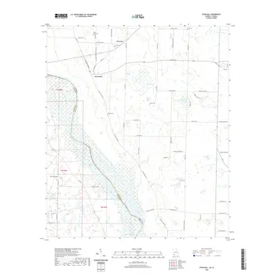
2020 Map of Steam Mill
USGS Topo · Published 2020About this map
The Chattahoochee River defines the border between Georgia and Florida, winding through a landscape of wetlands and low-lying plains. The southeastern portion of the map is dominated by the waters of Lake Seminole, where landings like Buena Vista Lndg and Desser Landing Rd provide access to the expansive shoreline. Local history is deeply rooted in the small communities and rural tracts of Seminole County, as evidenced by the distribution of family and community burial grounds, including Green Willow Cem, Williams Cem, and Dickenson Cem.
Find a feature on this map
57 named features on this map. Tap any name to fly to it.
Don’t see what you’re looking for? This feature index may not catch every label — zoom into the map to look around manually.
Map Details
Editions of this 2020 Steam Mill Map
This is the sole edition of this map. No revisions or reprints were ever made.
Other maps of this area

1952 · Dellwood
USGS Topo · 1:24,000

1952 · Bascom
USGS Topo · 1:24,000

1953 · Dothan
USGS Topo · 1:250,000

1954 · Dothan
USGS Topo · 1:250,000

1954 · Steam Mill
USGS Topo · 1:24,000

1954 · Desser
USGS Topo · 1:24,000

1954 · Tallahassee
USGS Topo · 1:250,000

1955 · Dothan
USGS Topo · 1:250,000

1955 · Fairchild
USGS Topo · 1:24,000

1955 · Reynoldsville
USGS Topo · 1:24,000