
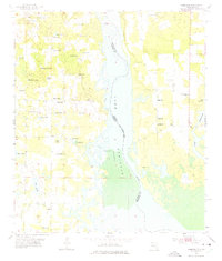
1955 Map of Fairchild
USGS Topo · Published 1956About this map
The Jim Woodruff Reservoir dominates the eastern half of this 1950s landscape, illustrating the transformation of the Chattahoochee River valley where Florida and Georgia meet. The map documents the rural infrastructure of Seminole Co and Jackson Co before modern development, marking numerous family and community landmarks such as Drakes Still and Parramore. On the western side of the reservoir, a high density of small water bodies like Charley Pond, Boram Lake, and Half Moon Pond dot the low-lying terrain. Genealogy researchers will find significant value in the distribution of community centers, including Sylvania Sch, Little Zion Sch, and rural churches like Galilee Ch and Tabernacle Ch. Several burial grounds, notably Wooten Cem and Whiddon Cem, are clearly delineated, providing spatial context for local family histories during this mid-century period.
Find a feature on this map
45 named features on this map. Tap any name to fly to it.
Don’t see what you’re looking for? This feature index may not catch every label — zoom into the map to look around manually.
Map Details
Editions of this 1955 Fairchild Map
2 editions found
Other maps of this area

1952 · Cypress
USGS Topo · 1:24,000

1952 · Dellwood
USGS Topo · 1:24,000

1952 · Bascom
USGS Topo · 1:24,000

1954 · Steam Mill
USGS Topo · 1:24,000

1954 · Sneads
USGS Topo · 1:24,000

1954 · Desser
USGS Topo · 1:24,000

1954 · Tallahassee
USGS Topo · 1:250,000

1955 · Reynoldsville
USGS Topo · 1:24,000

1955 · Chattahoochee
USGS Topo · 1:24,000

1959 · Tallahassee
USGS Topo · 1:250,000